


<< Text Pages >> Huambacho - Ancient Village or Settlement in Peru
Submitted by bat400 on Wednesday, 10 October 2018 Page Views: 636
Multi-periodSite Name: HuambachoCountry: Peru
NOTE: This site is 8.332 km away from the location you searched for.
Type: Ancient Village or Settlement
Nearest Village: Huambacho
Latitude: 9.26797S Longitude: 78.419W
Condition:
| 5 | Perfect |
| 4 | Almost Perfect |
| 3 | Reasonable but with some damage |
| 2 | Ruined but still recognisable as an ancient site |
| 1 | Pretty much destroyed, possibly visible as crop marks |
| 0 | No data. |
| -1 | Completely destroyed |
| 5 | Superb |
| 4 | Good |
| 3 | Ordinary |
| 2 | Not Good |
| 1 | Awful |
| 0 | No data. |
| 5 | Can be driven to, probably with disabled access |
| 4 | Short walk on a footpath |
| 3 | Requiring a bit more of a walk |
| 2 | A long walk |
| 1 | In the middle of nowhere, a nightmare to find |
| 0 | No data. |
| 5 | co-ordinates taken by GPS or official recorded co-ordinates |
| 4 | co-ordinates scaled from a detailed map |
| 3 | co-ordinates scaled from a bad map |
| 2 | co-ordinates of the nearest village |
| 1 | co-ordinates of the nearest town |
| 0 | no data |
Be the first person to rate this site - see the 'Contribute!' box in the right hand menu.
Internal Links:
External Links:
Ancient Temple - Political center in Peru.
This complex of enclosures, plazas, halls and patios are thought to have been a place for ceremonies and gatherings associated with communal feasting. It was not a village or residence.
You may be viewing yesterday's version of this page. To see the most up to date information please register for a free account.
Do not use the above information on other web sites or publications without permission of the contributor.
Nearby Images from Flickr

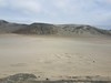
The above images may not be of the site on this page, but were taken nearby. They are loaded from Flickr so please click on them for image credits.
Click here to see more info for this site
Nearby sites
Click here to view sites on an interactive map of the areaKey: Red: member's photo, Blue: 3rd party photo, Yellow: other image, Green: no photo - please go there and take one, Grey: site destroyed
Download sites to:
KML (Google Earth)
GPX (GPS waypoints)
CSV (Garmin/Navman)
CSV (Excel)
To unlock full downloads you need to sign up as a Contributory Member. Otherwise downloads are limited to 50 sites.
Turn off the page maps and other distractions
Nearby sites listing. In the following links * = Image available
27.6km SE 142° Sechin Bajo Ancient Palace
27.9km SE 139° Taukachi-Konkan Ancient Village or Settlement
29.2km ESE 113° Huerequeque Ancient Village or Settlement
29.3km SE 139° Sechin Alto Ancient Village or Settlement
29.5km SE 143° Cerro Sechin* Ancient Temple
31.4km ENE 57° Siete Huaca* Ancient Village or Settlement
33.9km SE 140° Pampa de Las Llamas - Moxeque Ancient Village or Settlement
35.3km SSE 147° La Cantina Ancient Village or Settlement
37.9km SSE 148° Chankillo Fortress* Ancient Temple
38.8km SSE 147° Chankillo - 13 Towers* Ancient Temple
50.0km SSE 164° Las Aldas Ancient Village or Settlement
55.4km ESE 123° Pallka Ancient Village or Settlement
71.1km ENE 69° Tumshukayko* Ancient Village or Settlement
78.2km E 85° Guitarrero Cave* Cave or Rock Shelter
93.2km NNE 18° La Galgada Pyramid / Mastaba
93.9km SSE 160° El Castillo de Huarmey* Pyramid / Mastaba
101.9km ESE 107° Museo Regional de Áncash Museum
102.4km ESE 104° Willkawain* Chambered Tomb
103.0km ESE 104° Ichik Willkawain* Chambered Tomb
140.2km NNW 333° Museo Huacas de Moche Museum
140.8km NNW 333° Huaca de la Luna* Ancient Temple
140.8km ESE 105° Chavín de Huantar* Ancient Village or Settlement
141.3km NNW 333° Huaca del Sol* Pyramid / Mastaba
143.8km NNW 338° Caballo Muerto Ancient Village or Settlement
146.5km NNW 332° Huaca Esmeralda* Pyramid / Mastaba
View more nearby sites and additional images


 We would like to know more about this location. Please feel free to add a brief description and any relevant information in your own language.
 Wir möchten mehr über diese Stätte erfahren. Bitte zögern Sie nicht, eine kurze Beschreibung und relevante Informationen in Deutsch hinzuzufügen.
 Nous aimerions en savoir encore un peu sur les lieux. S'il vous plaît n'hesitez pas à ajouter une courte description et tous les renseignements pertinents dans votre propre langue.
 Quisieramos informarnos un poco más de las lugares. No dude en añadir una breve descripción y otros datos relevantes en su propio idioma.