


<< Other Photo Pages >> Petroglyphs Provincial Park (Ontario) - Rock Art in Canada
Submitted by MartinJEley on Friday, 25 July 2014 Page Views: 4598
Rock ArtSite Name: Petroglyphs Provincial Park (Ontario)Country: Canada Type: Rock Art
Nearest Town: Lakefield, Ontario Nearest Village: Burleigh Falls, Ontario
Latitude: 44.594433N Longitude: 78.0393W
Condition:
| 5 | Perfect |
| 4 | Almost Perfect |
| 3 | Reasonable but with some damage |
| 2 | Ruined but still recognisable as an ancient site |
| 1 | Pretty much destroyed, possibly visible as crop marks |
| 0 | No data. |
| -1 | Completely destroyed |
| 5 | Superb |
| 4 | Good |
| 3 | Ordinary |
| 2 | Not Good |
| 1 | Awful |
| 0 | No data. |
| 5 | Can be driven to, probably with disabled access |
| 4 | Short walk on a footpath |
| 3 | Requiring a bit more of a walk |
| 2 | A long walk |
| 1 | In the middle of nowhere, a nightmare to find |
| 0 | No data. |
| 5 | co-ordinates taken by GPS or official recorded co-ordinates |
| 4 | co-ordinates scaled from a detailed map |
| 3 | co-ordinates scaled from a bad map |
| 2 | co-ordinates of the nearest village |
| 1 | co-ordinates of the nearest town |
| 0 | no data |
Internal Links:
External Links:
I have visited· I would like to visit
eirrac5 would like to visit
MartinJEley visited on 22nd Jul 2014 - their rating: Cond: 4 Amb: 5 Access: 3 An inspiring site, well worth the visit.
X-Ice visited on 1st Mar 1986 - their rating: Amb: 2 Access: 4 The petroglyphs were inside a locked building. We could see only a little through the windows.
Average ratings for this site from all visit loggers: Ambience: 3.5 Access: 3.5
 (PID:121649)")
The carvings, some 900 of them, are protected under a modern purpose built shelter. Commonly known as the "rocks that that teach" they are the largest known single concentration of Aboriginal rock art in Canada. Thought to have been the work of an Algonquin speaking group the origins are uncertain although they are thought to predate the arrival of Europeans in North America.
The spiritual nature of the art means that photography of the petroglyphs is prohibited, hence the reason for no pictures being attached to this description.
There is an interpretation centre to explain the beliefs of the Aboriginal peoples before visiting the petroglyphs. The site is both informative and peaceful, in keeping with the aboriginal beliefs.
The site is in a day use only Provincial Park, with the published co-ordinates being for the park entrance. There is an entrance fee, $14 for two adults in a car. The hours are 10-5 during the week and can be checked at this link, along with other information: www.ontarioparks.com.
You may be viewing yesterday's version of this page. To see the most up to date information please register for a free account.
 (PID:158562)")
 (PID:158561)")
Do not use the above information on other web sites or publications without permission of the contributor.
Nearby Images from Flickr
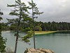
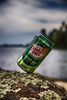
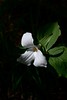
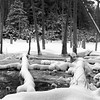
The above images may not be of the site on this page, but were taken nearby. They are loaded from Flickr so please click on them for image credits.
Click here to see more info for this site
Nearby sites
Click here to view sites on an interactive map of the areaKey: Red: member's photo, Blue: 3rd party photo, Yellow: other image, Green: no photo - please go there and take one, Grey: site destroyed
Download sites to:
KML (Google Earth)
GPX (GPS waypoints)
CSV (Garmin/Navman)
CSV (Excel)
To unlock full downloads you need to sign up as a Contributory Member. Otherwise downloads are limited to 50 sites.
Turn off the page maps and other distractions
Nearby sites listing. In the following links * = Image available
36.7km WSW 249° Jacob's Island Mound Barrow Cemetery
44.0km SSW 192° Serpent Mound, Keene* Misc. Earthwork
92.5km WNW 287° Lewiston Mound State Park* Artificial Mound
178.5km ESE 106° Perch Lake mounds* Artificial Mound
192.1km E 88° Maitland Tower* Modern Stone Circle etc
205.4km ENE 62° Canadian Museum of History* Museum
288.7km S 187° Stone of Rock City Park Natural Stone / Erratic / Other Natural Feature
313.2km SSE 157° Spanish Hill* Artificial Mound
317.1km E 84° Earthwood new stone circle Modern Stone Circle etc
343.8km WSW 245° Davidson Ancient Village or Settlement
350.0km W 269° Alpena-Amberley Ridge Game Drives* Ancient Mine, Quarry or other Industry
351.4km E 85° Earthwood Modern Stone Circle Modern Stone Circle etc
366.4km ENE 72° Charles De Gaulle Obelisk* Modern Stone Circle etc
390.9km SSW 202° Indian God Rock Rock Art
393.5km WSW 245° Mound at Head of St Clair River* Artificial Mound
411.1km WSW 257° Sanilac Petroglyphs Historic State Park* Rock Art
431.5km W 267° Ottawa Point Mound* Artificial Mound
435.0km E 89° Elmore Balancing Rock* Natural Stone / Erratic / Other Natural Feature
439.2km SE 130° The King Stones Stone Circle
440.2km E 84° Balancing Stone Westfield Natural Stone / Erratic / Other Natural Feature
440.6km WSW 242° Riviere Au Vase Artificial Mound
448.6km ESE 119° Balance Stone Lanesborough Natural Stone / Erratic / Other Natural Feature
449.2km ESE 120° EarthGate Circle Modern Stone Circle etc
452.2km SSE 150° Scotrun* Round Cairn
454.4km ESE 103° Calendar II* Artificial Mound
View more nearby sites and additional images


 We would like to know more about this location. Please feel free to add a brief description and any relevant information in your own language.
 Wir möchten mehr über diese Stätte erfahren. Bitte zögern Sie nicht, eine kurze Beschreibung und relevante Informationen in Deutsch hinzuzufügen.
 Nous aimerions en savoir encore un peu sur les lieux. S'il vous plaît n'hesitez pas à ajouter une courte description et tous les renseignements pertinents dans votre propre langue.
 Quisieramos informarnos un poco más de las lugares. No dude en añadir una breve descripción y otros datos relevantes en su propio idioma.