 with our Megalithic Portal iPhone app")


<< Our Photo Pages >> El Tablon (Tierradentro) - Sculptured Stone in Colombia
Submitted by SolarMegalith on Saturday, 14 April 2012 Page Views: 3082
Multi-periodSite Name: El Tablon (Tierradentro)Country: Colombia
NOTE: This site is 44.69 km away from the location you searched for.
Type: Sculptured Stone
Nearest Village: San Andres de Pisimbala
Latitude: 2.583122N Longitude: 76.033375W
Condition:
| 5 | Perfect |
| 4 | Almost Perfect |
| 3 | Reasonable but with some damage |
| 2 | Ruined but still recognisable as an ancient site |
| 1 | Pretty much destroyed, possibly visible as crop marks |
| 0 | No data. |
| -1 | Completely destroyed |
| 5 | Superb |
| 4 | Good |
| 3 | Ordinary |
| 2 | Not Good |
| 1 | Awful |
| 0 | No data. |
| 5 | Can be driven to, probably with disabled access |
| 4 | Short walk on a footpath |
| 3 | Requiring a bit more of a walk |
| 2 | A long walk |
| 1 | In the middle of nowhere, a nightmare to find |
| 0 | No data. |
| 5 | co-ordinates taken by GPS or official recorded co-ordinates |
| 4 | co-ordinates scaled from a detailed map |
| 3 | co-ordinates scaled from a bad map |
| 2 | co-ordinates of the nearest village |
| 1 | co-ordinates of the nearest town |
| 0 | no data |
Internal Links:
External Links:
 (PID:88257)")
El Tablon is the only significant site in Tierradentro Archaeoogical Park which includes the sculptures of Tierradentro culture. The statues show similarities with the ones from San Agustin, they are carved from the volcanic rocks. The masculine representations are distinguishable through their head-dresses.
The site includes 6 sculptures in total.
You may be viewing yesterday's version of this page. To see the most up to date information please register for a free account.
 (PID:88258)")
 (PID:88256)")
Do not use the above information on other web sites or publications without permission of the contributor.
Nearby Images from Flickr
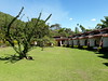
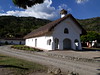
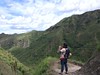
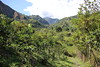
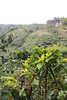
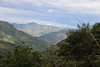
The above images may not be of the site on this page, but were taken nearby. They are loaded from Flickr so please click on them for image credits.
Click here to see more info for this site
Nearby sites
Click here to view sites on an interactive map of the areaKey: Red: member's photo, Blue: 3rd party photo, Yellow: other image, Green: no photo - please go there and take one, Grey: site destroyed
Download sites to:
KML (Google Earth)
GPX (GPS waypoints)
CSV (Garmin/Navman)
CSV (Excel)
To unlock full downloads you need to sign up as a Contributory Member. Otherwise downloads are limited to 50 sites.
Turn off the page maps and other distractions
Nearby sites listing. In the following links * = Image available
1.1km S 175° Alto de Segovia* Rock Cut Tomb
2.2km SSW 207° El Aguacate* Rock Cut Tomb
77.5km SSW 202° Obando* Rock Cut Tomb
77.7km SSW 197° Alto de los Idolos* Artificial Mound
79.2km SSW 202° Petroglifos del Estrecho* Rock Art
79.2km SSW 197° Alto de las Guacas* Burial Chamber or Dolmen
80.0km SSW 201° La Pelota* Sculptured Stone
80.0km SSW 199° La Chaquira* Rock Art
80.0km SSW 201° El Purutal* Burial Chamber or Dolmen
80.6km SSW 196° Alto del Tigre* Rock Art
80.6km SSW 200° El Tablon (San Agustin)* Sculptured Stone
81.4km SSW 200° San Agustin Parque Arqueologico* Sculptured Stone
112.2km NNW 332° Deportivo Cali Tombs Barrow Cemetery
312.7km NE 44° Museo del Oro (Bogota)* Museum
342.2km SW 223° Inca-Caranqui* Ancient Village or Settlement
348.8km SW 221° Pyramids of Zuleta Pyramid / Mastaba
349.7km E 90° Angosturas II Rock Art
351.9km E 91° Cerro Azul Rock Art
364.7km E 92° Nuevo Tolima Rock Art
377.9km SW 222° Cochasqui Ancient Village or Settlement
390.8km SW 223° Rumicucho Pucara Hillfort
391.7km SW 223° Catequilla* Stone Circle
437.5km NE 39° El Infiernito* Standing Stones
484.8km SW 221° Malqui-Machay* Ancient Village or Settlement
539.0km SSW 201° Cueva de los Tayos Cave or Rock Shelter
View more nearby sites and additional images


 We would like to know more about this location. Please feel free to add a brief description and any relevant information in your own language.
 Wir möchten mehr über diese Stätte erfahren. Bitte zögern Sie nicht, eine kurze Beschreibung und relevante Informationen in Deutsch hinzuzufügen.
 Nous aimerions en savoir encore un peu sur les lieux. S'il vous plaît n'hesitez pas à ajouter une courte description et tous les renseignements pertinents dans votre propre langue.
 Quisieramos informarnos un poco más de las lugares. No dude en añadir una breve descripción y otros datos relevantes en su propio idioma.