

<< Text Pages >> Sumbay - Rock Art in Peru
Submitted by davidmorgan on Sunday, 29 April 2018 Page Views: 1561
Rock ArtSite Name: Sumbay Alternative Name: Pinturas Rupestres de SumbayCountry: Peru
NOTE: This site is 46.339 km away from the location you searched for.
Type: Rock Art
Nearest Town: Arequipa
Latitude: 15.97585S Longitude: 71.34932W
Condition:
| 5 | Perfect |
| 4 | Almost Perfect |
| 3 | Reasonable but with some damage |
| 2 | Ruined but still recognisable as an ancient site |
| 1 | Pretty much destroyed, possibly visible as crop marks |
| 0 | No data. |
| -1 | Completely destroyed |
| 5 | Superb |
| 4 | Good |
| 3 | Ordinary |
| 2 | Not Good |
| 1 | Awful |
| 0 | No data. |
| 5 | Can be driven to, probably with disabled access |
| 4 | Short walk on a footpath |
| 3 | Requiring a bit more of a walk |
| 2 | A long walk |
| 1 | In the middle of nowhere, a nightmare to find |
| 0 | No data. |
| 5 | co-ordinates taken by GPS or official recorded co-ordinates |
| 4 | co-ordinates scaled from a detailed map |
| 3 | co-ordinates scaled from a bad map |
| 2 | co-ordinates of the nearest village |
| 1 | co-ordinates of the nearest town |
| 0 | no data |
Be the first person to rate this site - see the 'Contribute!' box in the right hand menu.
Internal Links:
External Links:
Rock Art in Arequipa Region, Peru
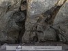
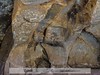
About 500 figures of animals and some humans painted in a series of rock-shelters in the gorge of a tributary of the Rio Sumbay.
More information (in Spanish) at Rupestre Web.
You may be viewing yesterday's version of this page. To see the most up to date information please register for a free account.
Do not use the above information on other web sites or publications without permission of the contributor.
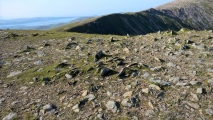
Nearby Images from Flickr
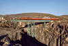

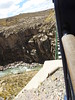
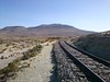
The above images may not be of the site on this page, but were taken nearby. They are loaded from Flickr so please click on them for image credits.
Click here to see more info for this site
Nearby sites
Click here to view sites on an interactive map of the areaKey: Red: member's photo, Blue: 3rd party photo, Yellow: other image, Green: no photo - please go there and take one, Grey: site destroyed
Download sites to:
KML (Google Earth)
GPX (GPS waypoints)
CSV (Garmin/Navman)
CSV (Excel)
To unlock full downloads you need to sign up as a Contributory Member. Otherwise downloads are limited to 50 sites.
Turn off the page maps and other distractions
Nearby sites listing. In the following links * = Image available
126.2km WSW 257° Toro Muerto Petroglyphs* Rock Art
130.5km ENE 78° Sillustani necropolis* Ancient Temple
133.7km ENE 74° Lake Titicaca Raised Fields Ancient Village or Settlement
136.7km SSE 158° Cerro Baul Ancient Village or Settlement
152.0km W 280° Tompullo 2* Ancient Village or Settlement
156.4km E 87° Puno Fertility Sanctuary* Ancient Temple
170.0km E 99° Jiskairumoko Ancient Village or Settlement
183.4km S 177° Museo Chiribaya Museum
184.0km S 178° Chiribaya Alta Ancient Village or Settlement
194.4km E 97° Aramu Muru* Sculptured Stone
200.3km N 359° Raqchi* Ancient Temple
221.2km ESE 108° Cuncaicha Natural Stone / Erratic / Other Natural Feature
235.6km E 92° La Fuente del Inca* Holy Well or Sacred Spring
242.8km E 95° Copacabana Ceremonial Center Ancient Temple
261.1km NNW 345° Maucallacta Ancient Village or Settlement
264.6km N 352° Rumiqullqa Ancient Mine, Quarry or other Industry
265.6km N 351° Pikillaqta Ancient Village or Settlement
266.6km N 351° Chokepukio Ancient Village or Settlement
271.5km N 350° Tipon* Ancient Village or Settlement
278.6km E 98° Suriki Island* Ancient Mine, Quarry or other Industry
280.9km NNW 346° Qhataqasapatallaqta Barrow Cemetery
281.3km NNW 346° Cusco - Qorikancha* Ancient Temple
281.6km NNW 346° The Cusco Machu Picchu Museum* Museum
281.7km NNW 346° Cusco* Ancient Village or Settlement
281.9km NNW 346° Museo de Arte Precolombino* Museum
View more nearby sites and additional images


 We would like to know more about this location. Please feel free to add a brief description and any relevant information in your own language.
 Wir möchten mehr über diese Stätte erfahren. Bitte zögern Sie nicht, eine kurze Beschreibung und relevante Informationen in Deutsch hinzuzufügen.
 Nous aimerions en savoir encore un peu sur les lieux. S'il vous plaît n'hesitez pas à ajouter une courte description et tous les renseignements pertinents dans votre propre langue.
 Quisieramos informarnos un poco más de las lugares. No dude en añadir una breve descripción y otros datos relevantes en su propio idioma.