

<< Text Pages >> Rumiqullqa - Ancient Mine, Quarry or other Industry in Peru
Submitted by davidmorgan on Thursday, 26 January 2017 Page Views: 1032
Multi-periodSite Name: Rumiqullqa Alternative Name: RumicolcaCountry: Peru
NOTE: This site is 33.143 km away from the location you searched for.
Type: Ancient Mine, Quarry or other Industry
Nearest Town: Cusco Nearest Village: Huarcapay
Latitude: 13.621633S Longitude: 71.707414W
Condition:
| 5 | Perfect |
| 4 | Almost Perfect |
| 3 | Reasonable but with some damage |
| 2 | Ruined but still recognisable as an ancient site |
| 1 | Pretty much destroyed, possibly visible as crop marks |
| 0 | No data. |
| -1 | Completely destroyed |
| 5 | Superb |
| 4 | Good |
| 3 | Ordinary |
| 2 | Not Good |
| 1 | Awful |
| 0 | No data. |
| 5 | Can be driven to, probably with disabled access |
| 4 | Short walk on a footpath |
| 3 | Requiring a bit more of a walk |
| 2 | A long walk |
| 1 | In the middle of nowhere, a nightmare to find |
| 0 | No data. |
| 5 | co-ordinates taken by GPS or official recorded co-ordinates |
| 4 | co-ordinates scaled from a detailed map |
| 3 | co-ordinates scaled from a bad map |
| 2 | co-ordinates of the nearest village |
| 1 | co-ordinates of the nearest town |
| 0 | no data |
Internal Links:
External Links:
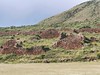
Ancient Structure in Quispicanchi Province, Peru
Possibly an aqueduct or gateway erected by the Wari with later Inca additions.
You may be viewing yesterday's version of this page. To see the most up to date information please register for a free account.
Do not use the above information on other web sites or publications without permission of the contributor.
Nearby Images from Flickr
![Pikillacta - [P�rou]](https://farm66.static.flickr.com/65535/53333296970_2404cdf79e_t.jpg)
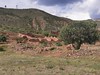
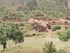
The above images may not be of the site on this page, but were taken nearby. They are loaded from Flickr so please click on them for image credits.
Click here to see more info for this site
Nearby sites
Click here to view sites on an interactive map of the areaKey: Red: member's photo, Blue: 3rd party photo, Yellow: other image, Green: no photo - please go there and take one, Grey: site destroyed
Download sites to:
KML (Google Earth)
GPX (GPS waypoints)
CSV (Garmin/Navman)
CSV (Excel)
To unlock full downloads you need to sign up as a Contributory Member. Otherwise downloads are limited to 50 sites.
Turn off the page maps and other distractions
Nearby sites listing. In the following links * = Image available
1.4km NW 307° Pikillaqta Ancient Village or Settlement
3.3km WNW 299° Chokepukio Ancient Village or Settlement
10.1km NW 304° Tipon* Ancient Village or Settlement
27.1km NNE 20° Ninamarca Chambered Tomb
27.4km NNW 327° Pisac Ruins* Ancient Village or Settlement
29.3km NE 38° Watoqto Ancient Village or Settlement
29.6km WSW 252° Maucallacta Ancient Village or Settlement
29.6km WNW 296° Inkil Tambo* Ancient Temple
30.6km WNW 295° Lacco Carving
30.6km WNW 294° Kusilluchayoc Carving
31.1km WNW 294° Qenko* Ancient Temple
31.2km WNW 291° Cusco - Qorikancha* Ancient Temple
31.4km WNW 292° The Cusco Machu Picchu Museum* Museum
31.5km WNW 292° Museo de Arte Precolombino* Museum
31.5km WNW 299° Puca Pucara* Stone Fort or Dun
31.6km WNW 292° Cusco* Ancient Village or Settlement
31.7km WNW 290° Qhataqasapatallaqta Barrow Cemetery
31.9km WNW 296° Lanlakuyok Carving
32.2km WNW 293° Sacsayhuaman* Hillfort
32.3km WNW 299° Tambomachay* Ancient Village or Settlement
38.3km NW 318° Huchuy Qosqo Ancient Village or Settlement
44.7km NW 305° Puma Temple* Ancient Temple
44.8km NW 305° Chinchero* Ancient Village or Settlement
60.2km NW 306° Las Salinas* Ancient Mine, Quarry or other Industry
62.0km WNW 302° Moray Terraces* Misc. Earthwork
View more nearby sites and additional images


 We would like to know more about this location. Please feel free to add a brief description and any relevant information in your own language.
 Wir möchten mehr über diese Stätte erfahren. Bitte zögern Sie nicht, eine kurze Beschreibung und relevante Informationen in Deutsch hinzuzufügen.
 Nous aimerions en savoir encore un peu sur les lieux. S'il vous plaît n'hesitez pas à ajouter une courte description et tous les renseignements pertinents dans votre propre langue.
 Quisieramos informarnos un poco más de las lugares. No dude en añadir una breve descripción y otros datos relevantes en su propio idioma.