


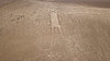
<< Other Photo Pages >> Atacama Giant - Hill Figure or Geoglyph in Chile
Submitted by bat400 on Sunday, 18 October 2009 Page Views: 10112
Multi-periodSite Name: Atacama GiantCountry: Chile
NOTE: This site is 61.54 km away from the location you searched for.
Type: Hill Figure or Geoglyph
Nearest Town: Iquique Nearest Village: Huara
Latitude: 19.94905S Longitude: 69.63324W
Condition:
| 5 | Perfect |
| 4 | Almost Perfect |
| 3 | Reasonable but with some damage |
| 2 | Ruined but still recognisable as an ancient site |
| 1 | Pretty much destroyed, possibly visible as crop marks |
| 0 | No data. |
| -1 | Completely destroyed |
| 5 | Superb |
| 4 | Good |
| 3 | Ordinary |
| 2 | Not Good |
| 1 | Awful |
| 0 | No data. |
| 5 | Can be driven to, probably with disabled access |
| 4 | Short walk on a footpath |
| 3 | Requiring a bit more of a walk |
| 2 | A long walk |
| 1 | In the middle of nowhere, a nightmare to find |
| 0 | No data. |
| 5 | co-ordinates taken by GPS or official recorded co-ordinates |
| 4 | co-ordinates scaled from a detailed map |
| 3 | co-ordinates scaled from a bad map |
| 2 | co-ordinates of the nearest village |
| 1 | co-ordinates of the nearest town |
| 0 | no data |
Internal Links:
External Links:
")
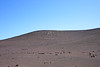
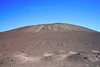
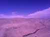
Easily seen using the Google Earth link. Scan the rest of the hill side for additional geometric figures.
You may be viewing yesterday's version of this page. To see the most up to date information please register for a free account.
Do not use the above information on other web sites or publications without permission of the contributor.
Nearby Images from Flickr
The above images may not be of the site on this page, but were taken nearby. They are loaded from Flickr so please click on them for image credits.
Click here to see more info for this site
Nearby sites
Click here to view sites on an interactive map of the areaKey: Red: member's photo, Blue: 3rd party photo, Yellow: other image, Green: no photo - please go there and take one, Grey: site destroyed
Download sites to:
KML (Google Earth)
GPX (GPS waypoints)
CSV (Garmin/Navman)
CSV (Excel)
To unlock full downloads you need to sign up as a Contributory Member. Otherwise downloads are limited to 50 sites.
Turn off the page maps and other distractions
Nearby sites listing. In the following links * = Image available
14.1km ENE 71° Tarapacá geoglyphs Hill Figure or Geoglyph
56.7km NW 322° Tiliviche Geoglyphs* Hill Figure or Geoglyph
75.4km S 182° Cerro Pintados* Hill Figure or Geoglyph
91.6km NNW 335° Chiza Geoglyphs* Hill Figure or Geoglyph
163.8km NNW 341° Azapa Valley Geoglyphs* Hill Figure or Geoglyph
169.3km NNW 340° San Miguel de Azapa Archaeological Museum* Museum
170.0km NNW 338° Cerro Sagrado Geoglyphs Hill Figure or Geoglyph
172.4km NNW 338° La Tropilla Geoglyphs* Hill Figure or Geoglyph
181.1km NNW 339° Lluta Valley Geoglyphs* Hill Figure or Geoglyph
254.6km S 169° Chug Chug Geoglyphs* Hill Figure or Geoglyph
310.7km NW 326° Museo Chiribaya Museum
311.3km NW 326° Chiribaya Alta Ancient Village or Settlement
336.0km SSE 155° Petroglifos Yerbas Buenas* Rock Art
340.9km NNW 338° Cerro Baul Ancient Village or Settlement
359.4km SSE 156° Pucara de Quitor* Stone Fort or Dun
360.8km SSE 156° R. P. Gustavo Le Paige Archaeological Museum* Museum
365.3km SSE 157° Tulor Ancient Village or Settlement
375.4km N 4° Cuncaicha Natural Stone / Erratic / Other Natural Feature
389.9km NNE 15° Pumapunku* Ancient Temple
390.7km NNE 15° Tiwanaku - Akapana Pyramid* Pyramid / Mastaba
390.8km NNE 15° Tiwanaku* Ancient Village or Settlement
405.4km E 83° Tarapaya* Natural Stone / Erratic / Other Natural Feature
408.0km E 85° Cerro Rico* Ancient Mine, Quarry or other Industry
415.6km NNE 13° Suriki Island* Ancient Mine, Quarry or other Industry
415.8km N 358° Jiskairumoko Ancient Village or Settlement
View more nearby sites and additional images


 We would like to know more about this location. Please feel free to add a brief description and any relevant information in your own language.
 Wir möchten mehr über diese Stätte erfahren. Bitte zögern Sie nicht, eine kurze Beschreibung und relevante Informationen in Deutsch hinzuzufügen.
 Nous aimerions en savoir encore un peu sur les lieux. S'il vous plaît n'hesitez pas à ajouter une courte description et tous les renseignements pertinents dans votre propre langue.
 Quisieramos informarnos un poco más de las lugares. No dude en añadir una breve descripción y otros datos relevantes en su propio idioma.