


<< Text Pages >> Castro das Quenllas do Forno - Castro or Chafurdão in Spain in Galicia
Submitted by TheCaptain on Wednesday, 08 September 2010 Page Views: 2391
Iron Age and Later PrehistorySite Name: Castro das Quenllas do FornoCountry: Spain
NOTE: This site is 7.183 km away from the location you searched for.
Region: Galicia Type: Castro or Chafurdão
Nearest Town: Lugo Nearest Village: Guitiriz
Latitude: 43.182000N Longitude: 7.895W
Condition:
| 5 | Perfect |
| 4 | Almost Perfect |
| 3 | Reasonable but with some damage |
| 2 | Ruined but still recognisable as an ancient site |
| 1 | Pretty much destroyed, possibly visible as crop marks |
| 0 | No data. |
| -1 | Completely destroyed |
| 5 | Superb |
| 4 | Good |
| 3 | Ordinary |
| 2 | Not Good |
| 1 | Awful |
| 0 | No data. |
| 5 | Can be driven to, probably with disabled access |
| 4 | Short walk on a footpath |
| 3 | Requiring a bit more of a walk |
| 2 | A long walk |
| 1 | In the middle of nowhere, a nightmare to find |
| 0 | No data. |
| 5 | co-ordinates taken by GPS or official recorded co-ordinates |
| 4 | co-ordinates scaled from a detailed map |
| 3 | co-ordinates scaled from a bad map |
| 2 | co-ordinates of the nearest village |
| 1 | co-ordinates of the nearest town |
| 0 | no data |
Be the first person to rate this site - see the 'Contribute!' box in the right hand menu.
Internal Links:
External Links:
Castro in Galicia
Castro das Quenllas do Forno is a Castro in the community of Guitiriz, Province of Lugo, region of Galicia
You may be viewing yesterday's version of this page. To see the most up to date information please register for a free account.
Do not use the above information on other web sites or publications without permission of the contributor.
Nearby Images from Flickr
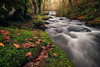
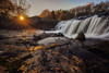
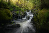

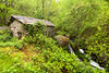
The above images may not be of the site on this page, but were taken nearby. They are loaded from Flickr so please click on them for image credits.
Click here to see more info for this site
Nearby sites
Click here to view sites on an interactive map of the areaKey: Red: member's photo, Blue: 3rd party photo, Yellow: other image, Green: no photo - please go there and take one, Grey: site destroyed
Download sites to:
KML (Google Earth)
GPX (GPS waypoints)
CSV (Garmin/Navman)
CSV (Excel)
To unlock full downloads you need to sign up as a Contributory Member. Otherwise downloads are limited to 50 sites.
Turn off the page maps and other distractions
Nearby sites listing. In the following links * = Image available
5.1km SSE 158° Pena Xiboi* Cave or Rock Shelter
6.9km ENE 60° Castro de Locencia Castro or Chafurdão
11.8km SE 138° Castro de A Picheta Castro or Chafurdão
13.6km E 95° Castro de San Martiño de Pacios Castro or Chafurdão
14.6km SSE 165° Castro de Gundín Castro or Chafurdão
15.1km ESE 123° Chao Mazós Dolmen Burial Chamber or Dolmen
15.3km SE 146° Castro de Narla Castro or Chafurdão
15.6km ENE 57° Roza das Modias* Burial Chamber or Dolmen
15.9km NE 49° Castro de Belesar Castro or Chafurdão
16.2km NNE 25° Mollafariña Dolmen* Burial Chamber or Dolmen
16.2km SW 228° Campamento Romano Ciadella Ancient Village or Settlement
16.3km NE 47° Castro de Belesar Castro or Chafurdão
16.3km NNE 28° Mámoa de Medorra de Mollafariña Round Barrow(s)
16.6km W 279° Castro das Cotorras Castro or Chafurdão
16.9km SSW 202° Castro das Lagoas Castro or Chafurdão
17.0km SW 215° Castro de Cumbraos Castro or Chafurdão
17.0km W 274° Montes do Gato Dolmen Burial Chamber or Dolmen
17.2km WNW 300° Tumbas antropomórficas de San Martiño de Churío Barrow Cemetery
17.6km NNE 18° Mámoa de Medorra do Caldeirón Round Barrow(s)
18.0km NE 50° Castro de Gondaísque Castro or Chafurdão
18.0km ESE 108° Castro de Donalbai Castro or Chafurdão
18.3km WNW 291° Petroglifo e Mámoa das Lombas Rock Art
18.5km ENE 67° Castro de Aguiar Castro or Chafurdão
18.6km SSW 201° Castro do Seixo Castro or Chafurdão
18.6km ENE 58° Castro de Vixil Castro or Chafurdão
View more nearby sites and additional images


 We would like to know more about this location. Please feel free to add a brief description and any relevant information in your own language.
 Wir möchten mehr über diese Stätte erfahren. Bitte zögern Sie nicht, eine kurze Beschreibung und relevante Informationen in Deutsch hinzuzufügen.
 Nous aimerions en savoir encore un peu sur les lieux. S'il vous plaît n'hesitez pas à ajouter une courte description et tous les renseignements pertinents dans votre propre langue.
 Quisieramos informarnos un poco más de las lugares. No dude en añadir una breve descripción y otros datos relevantes en su propio idioma.