


<< Our Photo Pages >> Mámoa das Chousas do Acedo - Burial Chamber or Dolmen in Spain in Galicia
Submitted by holger_rix on Wednesday, 16 December 2015 Page Views: 781
Neolithic and Bronze AgeSite Name: Mámoa das Chousas do AcedoCountry: Spain
NOTE: This site is 4.511 km away from the location you searched for.
Region: Galicia Type: Burial Chamber or Dolmen
Latitude: 42.813572N Longitude: 8.002167W
Condition:
| 5 | Perfect |
| 4 | Almost Perfect |
| 3 | Reasonable but with some damage |
| 2 | Ruined but still recognisable as an ancient site |
| 1 | Pretty much destroyed, possibly visible as crop marks |
| 0 | No data. |
| -1 | Completely destroyed |
| 5 | Superb |
| 4 | Good |
| 3 | Ordinary |
| 2 | Not Good |
| 1 | Awful |
| 0 | No data. |
| 5 | Can be driven to, probably with disabled access |
| 4 | Short walk on a footpath |
| 3 | Requiring a bit more of a walk |
| 2 | A long walk |
| 1 | In the middle of nowhere, a nightmare to find |
| 0 | No data. |
| 5 | co-ordinates taken by GPS or official recorded co-ordinates |
| 4 | co-ordinates scaled from a detailed map |
| 3 | co-ordinates scaled from a bad map |
| 2 | co-ordinates of the nearest village |
| 1 | co-ordinates of the nearest town |
| 0 | no data |
Be the first person to rate this site - see the 'Contribute!' box in the right hand menu.
Internal Links:
External Links:
I have visited· I would like to visit
Xandlinathry visited on 20th Apr 2016 - their rating: Cond: 2 Amb: 2 Access: 1
")
You may be viewing yesterday's version of this page. To see the most up to date information please register for a free account.
")
Do not use the above information on other web sites or publications without permission of the contributor.
Nearby Images from Flickr

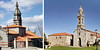
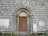
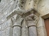
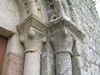
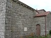
The above images may not be of the site on this page, but were taken nearby. They are loaded from Flickr so please click on them for image credits.
Click here to see more info for this site
Nearby sites
Click here to view sites on an interactive map of the areaKey: Red: member's photo, Blue: 3rd party photo, Yellow: other image, Green: no photo - please go there and take one, Grey: site destroyed
Download sites to:
KML (Google Earth)
GPX (GPS waypoints)
CSV (Garmin/Navman)
CSV (Excel)
To unlock full downloads you need to sign up as a Contributory Member. Otherwise downloads are limited to 50 sites.
Turn off the page maps and other distractions
Nearby sites listing. In the following links * = Image available
3.2km SSW 199° Petróglifos da Ermida Rock Art
4.2km SW 217° Castro de Merlín Castro or Chafurdão
5.9km SSW 194° Castro Marcelín Castro or Chafurdão
9.3km S 180° Petróglifos de Ventosa* Rock Art
9.7km SE 140° Petróglifos Laxe Ferrada Rock Art
10.0km NNW 341° Pedra do Casal* Standing Stone (Menhir)
10.9km NNE 14° Pena do Raposo Dolmen Burial Chamber or Dolmen
11.0km S 178° Mámoa de Coto Cornellal* Burial Chamber or Dolmen
11.1km S 178° Petróglifo do Monte Cornellal* Rock Art
11.2km SSW 193° Mámoa da Cruz 1* Burial Chamber or Dolmen
11.3km S 175° Mámoa da Cima da Costa Burial Chamber or Dolmen
11.3km SSW 193° Mámoa da Cruz 2* Burial Chamber or Dolmen
11.3km SSW 193° Mámoa da Cruz 3* Burial Chamber or Dolmen
11.4km S 178° Petróglifos do Coto da Aspra* Rock Art
11.7km S 180° Dolmen de Namelas 3* Burial Chamber or Dolmen
11.9km S 181° Dolmen de Namelas 2* Burial Chamber or Dolmen
12.4km ENE 65° Castro de Marzá Castro or Chafurdão
12.7km SE 142° Dolmen Couto dos Mouros* Burial Chamber or Dolmen
13.7km E 100° Castro de Penedo Castro or Chafurdão
14.6km N 7° Castro de Piñeiro (Toques) Castro or Chafurdão
14.7km N 2° Castro de Abeancos Castro or Chafurdão
14.7km WSW 245° Necrópole Megalítica do Marco do Camballón* Barrow Cemetery
15.7km NNE 22° Castro de Vilouriz Castro or Chafurdão
17.0km N 4° Castro de Brañas Castro or Chafurdão
17.0km NNW 343° Castro de Donide Castro or Chafurdão
View more nearby sites and additional images


 We would like to know more about this location. Please feel free to add a brief description and any relevant information in your own language.
 Wir möchten mehr über diese Stätte erfahren. Bitte zögern Sie nicht, eine kurze Beschreibung und relevante Informationen in Deutsch hinzuzufügen.
 Nous aimerions en savoir encore un peu sur les lieux. S'il vous plaît n'hesitez pas à ajouter une courte description et tous les renseignements pertinents dans votre propre langue.
 Quisieramos informarnos un poco más de las lugares. No dude en añadir una breve descripción y otros datos relevantes en su propio idioma.