


<< Text Pages >> Castro Castroeiro - Castro or Chafurdão in Portugal in Vila Real
Submitted by TheCaptain on Wednesday, 08 September 2010 Page Views: 2392
Iron Age and Later PrehistorySite Name: Castro Castroeiro Alternative Name: Castro de CrastoeiroCountry: Portugal
NOTE: This site is 4.862 km away from the location you searched for.
Distrito: Vila Real Type: Castro or Chafurdão
Nearest Town: Mondim de Basto Nearest Village: Campos
Latitude: 41.414680N Longitude: 7.92945W
Condition:
| 5 | Perfect |
| 4 | Almost Perfect |
| 3 | Reasonable but with some damage |
| 2 | Ruined but still recognisable as an ancient site |
| 1 | Pretty much destroyed, possibly visible as crop marks |
| 0 | No data. |
| -1 | Completely destroyed |
| 5 | Superb |
| 4 | Good |
| 3 | Ordinary |
| 2 | Not Good |
| 1 | Awful |
| 0 | No data. |
| 5 | Can be driven to, probably with disabled access |
| 4 | Short walk on a footpath |
| 3 | Requiring a bit more of a walk |
| 2 | A long walk |
| 1 | In the middle of nowhere, a nightmare to find |
| 0 | No data. |
| 5 | co-ordinates taken by GPS or official recorded co-ordinates |
| 4 | co-ordinates scaled from a detailed map |
| 3 | co-ordinates scaled from a bad map |
| 2 | co-ordinates of the nearest village |
| 1 | co-ordinates of the nearest town |
| 0 | no data |
Be the first person to rate this site - see the 'Contribute!' box in the right hand menu.
Internal Links:
External Links:
Castro Castroeiro is a Castro in the community of Mondim de Basto near the town of Mondim de Basto, District of Vila Rea, in North Portugal.
l
More information at IGESPAR.
You may be viewing yesterday's version of this page. To see the most up to date information please register for a free account.
Do not use the above information on other web sites or publications without permission of the contributor.
Nearby Images from Flickr


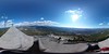
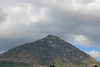
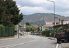
The above images may not be of the site on this page, but were taken nearby. They are loaded from Flickr so please click on them for image credits.
Click here to see more info for this site
Nearby sites
Click here to view sites on an interactive map of the areaKey: Red: member's photo, Blue: 3rd party photo, Yellow: other image, Green: no photo - please go there and take one, Grey: site destroyed
Download sites to:
KML (Google Earth)
GPX (GPS waypoints)
CSV (Garmin/Navman)
CSV (Excel)
To unlock full downloads you need to sign up as a Contributory Member. Otherwise downloads are limited to 50 sites.
Turn off the page maps and other distractions
Nearby sites listing. In the following links * = Image available
11.5km ENE 64° Castro da Cerva Castro or Chafurdão
18.4km ESE 108° Gravuras Rupestres do Alto da Mão do Homem Rock Art
19.8km ENE 62° Mamoa do Alto do Cotorino Round Barrow(s)
20.0km E 84° Veiga dos Fornos* Rock Art
20.3km SE 130° Museu de Arqueologia e Numismática de Vila Real* Museum
20.4km SE 131° Museu da Vila Velha* Museum
21.0km ESE 102° São Bento (Vila Real)* Castro or Chafurdão
21.7km WNW 282° Castro de Santo Ovídio Castro or Chafurdão
23.5km NW 324° Monte do Castelo Castro or Chafurdão
24.4km SSW 196° Anta da Aboboreira* Burial Chamber or Dolmen
24.9km NNE 17° Castro da Giestosa Castro or Chafurdão
25.0km SSW 198° Meninas do Crasto 3* Burial Chamber or Dolmen
25.3km SE 125° Santuário de Panóias* Barrow Cemetery
26.3km SSW 200° Dólmen de Outeiro de Ante 1* Burial Chamber or Dolmen
26.4km SSW 200° Dólmen de Outeiro de Ante 3* Burial Chamber or Dolmen
26.8km E 92° Ponte Romana de Arco* Rock Art
27.0km SSW 200° Dólmen de Outeiro de Gregos 2* Burial Chamber or Dolmen
27.1km SSW 200° Dólmen de Outeiro de Gregos 3* Burial Chamber or Dolmen
27.2km SSE 165° Castro de Cidadelhe Castro or Chafurdão
29.5km NNW 327° Monte do Castelo Castro or Chafurdão
29.5km NNE 30° Castro Outeiro Lesenho* Castro or Chafurdão
29.6km ESE 116° Mamoa de Madorras* Burial Chamber or Dolmen
30.8km W 276° Museu Martins Sarmento* Museum
31.4km NNE 30° Castro de Lesenho Castro or Chafurdão
33.4km SE 145° Fonte do Milho* Ancient Village or Settlement
View more nearby sites and additional images


 We would like to know more about this location. Please feel free to add a brief description and any relevant information in your own language.
 Wir möchten mehr über diese Stätte erfahren. Bitte zögern Sie nicht, eine kurze Beschreibung und relevante Informationen in Deutsch hinzuzufügen.
 Nous aimerions en savoir encore un peu sur les lieux. S'il vous plaît n'hesitez pas à ajouter une courte description et tous les renseignements pertinents dans votre propre langue.
 Quisieramos informarnos un poco más de las lugares. No dude en añadir una breve descripción y otros datos relevantes en su propio idioma.