


<< Our Photo Pages >> Núcleo Museológico da Villa Romana de Milreu - Ancient Village or Settlement in Portugal in Faro
Submitted by holger_rix on Monday, 07 December 2015 Page Views: 1921
Multi-periodSite Name: Núcleo Museológico da Villa Romana de MilreuCountry: Portugal
NOTE: This site is 3.745 km away from the location you searched for.
Distrito: Faro Type: Ancient Village or Settlement
Latitude: 37.095240N Longitude: 7.90395W
Condition:
| 5 | Perfect |
| 4 | Almost Perfect |
| 3 | Reasonable but with some damage |
| 2 | Ruined but still recognisable as an ancient site |
| 1 | Pretty much destroyed, possibly visible as crop marks |
| 0 | No data. |
| -1 | Completely destroyed |
| 5 | Superb |
| 4 | Good |
| 3 | Ordinary |
| 2 | Not Good |
| 1 | Awful |
| 0 | No data. |
| 5 | Can be driven to, probably with disabled access |
| 4 | Short walk on a footpath |
| 3 | Requiring a bit more of a walk |
| 2 | A long walk |
| 1 | In the middle of nowhere, a nightmare to find |
| 0 | No data. |
| 5 | co-ordinates taken by GPS or official recorded co-ordinates |
| 4 | co-ordinates scaled from a detailed map |
| 3 | co-ordinates scaled from a bad map |
| 2 | co-ordinates of the nearest village |
| 1 | co-ordinates of the nearest town |
| 0 | no data |
Be the first person to rate this site - see the 'Contribute!' box in the right hand menu.
Internal Links:
External Links:
")
You may be viewing yesterday's version of this page. To see the most up to date information please register for a free account.
")
")
")
")
Do not use the above information on other web sites or publications without permission of the contributor.
Nearby Images from Flickr

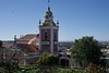
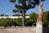
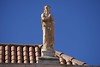
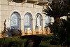

The above images may not be of the site on this page, but were taken nearby. They are loaded from Flickr so please click on them for image credits.
Click here to see more info for this site
Nearby sites
Click here to view sites on an interactive map of the areaKey: Red: member's photo, Blue: 3rd party photo, Yellow: other image, Green: no photo - please go there and take one, Grey: site destroyed
Download sites to:
KML (Google Earth)
GPX (GPS waypoints)
CSV (Garmin/Navman)
CSV (Excel)
To unlock full downloads you need to sign up as a Contributory Member. Otherwise downloads are limited to 50 sites.
Turn off the page maps and other distractions
Nearby sites listing. In the following links * = Image available
10.6km SE 131° Centro de Educacão Ambiental de Marim* Museum
10.6km SE 130° Quinta de Marim 1* Ancient Village or Settlement
11.3km E 83° Caminho do Cerro da Cabeça* Ancient Mine, Quarry or other Industry
11.7km WNW 295° Al-Ulyá* Museum
11.9km SW 229° Tanques romanos de salga de peixe* Ancient Mine, Quarry or other Industry
18.4km W 261° Quarteira 6000 years* Museum
19.2km W 265° Cerro da Vila* Ancient Village or Settlement
20.7km NW 322° Salir Museum* Museum
22.6km E 81° Castelo de Tavira* Castro or Chafurdão
27.8km N 357° Anta do Beringel* Burial Chamber or Dolmen
29.3km N 5° Cerro das Pedras Altas* Burial Chamber or Dolmen
29.8km N 353° Pedra do Alagar* Burial Chamber or Dolmen
29.9km N 6° Aldeia dos Palheiros* Ancient Village or Settlement
31.3km ENE 72° Túmulo Megalítico Santa Rita 2* Burial Chamber or Dolmen
31.4km ENE 72° Tumulo de Santa Rita Chambered Tomb
31.6km N 6° Anta da Masmorra* Burial Chamber or Dolmen
31.9km N 8° Anta do Curral da Castelhana* Burial Chamber or Dolmen
32.8km N 6° Tholos do Cerro do Malhanito* Burial Chamber or Dolmen
38.0km NNE 26° Parque Mineiro Cova dos Mouros* Ancient Mine, Quarry or other Industry
38.7km ENE 73° Cachopo Palheiros* Ancient Village or Settlement
39.5km NNE 17° Cista do Cerro do Malhão* Cist
40.4km NNE 26° Cerro do Castelo de Santa Justa* Ancient Village or Settlement
42.1km WNW 294° Menir da Vilarinha 1* Standing Stone (Menhir)
42.2km WNW 294° Sepultura da Pedreirinha* Rock Cut Tomb
42.2km WNW 294° Necrópole da Pedreirinha* Rock Cut Tomb
View more nearby sites and additional images


 We would like to know more about this location. Please feel free to add a brief description and any relevant information in your own language.
 Wir möchten mehr über diese Stätte erfahren. Bitte zögern Sie nicht, eine kurze Beschreibung und relevante Informationen in Deutsch hinzuzufügen.
 Nous aimerions en savoir encore un peu sur les lieux. S'il vous plaît n'hesitez pas à ajouter une courte description et tous les renseignements pertinents dans votre propre langue.
 Quisieramos informarnos un poco más de las lugares. No dude en añadir una breve descripción y otros datos relevantes en su propio idioma.