

<< Text Pages >> Castro de Ribadeume - Castro or Chafurdão in Spain in Galicia
Submitted by holger_rix on Saturday, 12 December 2015 Page Views: 414
Iron Age and Later PrehistorySite Name: Castro de RibadeumeCountry: Spain
NOTE: This site is 0.248 km away from the location you searched for.
Region: Galicia Type: Castro or Chafurdão
Nearest Town: Coruña Nearest Village: Pontes de Garcia Rodriguez
Latitude: 43.426089N Longitude: 7.890866W
Condition:
| 5 | Perfect |
| 4 | Almost Perfect |
| 3 | Reasonable but with some damage |
| 2 | Ruined but still recognisable as an ancient site |
| 1 | Pretty much destroyed, possibly visible as crop marks |
| 0 | No data. |
| -1 | Completely destroyed |
| 5 | Superb |
| 4 | Good |
| 3 | Ordinary |
| 2 | Not Good |
| 1 | Awful |
| 0 | No data. |
| 5 | Can be driven to, probably with disabled access |
| 4 | Short walk on a footpath |
| 3 | Requiring a bit more of a walk |
| 2 | A long walk |
| 1 | In the middle of nowhere, a nightmare to find |
| 0 | No data. |
| 5 | co-ordinates taken by GPS or official recorded co-ordinates |
| 4 | co-ordinates scaled from a detailed map |
| 3 | co-ordinates scaled from a bad map |
| 2 | co-ordinates of the nearest village |
| 1 | co-ordinates of the nearest town |
| 0 | no data |
Be the first person to rate this site - see the 'Contribute!' box in the right hand menu.
Internal Links:
External Links:
Castro in Galicia
You may be viewing yesterday's version of this page. To see the most up to date information please register for a free account.
Do not use the above information on other web sites or publications without permission of the contributor.
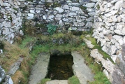
Nearby Images from Flickr
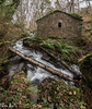
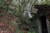
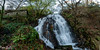
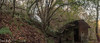

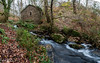
The above images may not be of the site on this page, but were taken nearby. They are loaded from Flickr so please click on them for image credits.
Click here to see more info for this site
Nearby sites
Click here to view sites on an interactive map of the areaKey: Red: member's photo, Blue: 3rd party photo, Yellow: other image, Green: no photo - please go there and take one, Grey: site destroyed
Download sites to:
KML (Google Earth)
GPX (GPS waypoints)
CSV (Garmin/Navman)
CSV (Excel)
To unlock full downloads you need to sign up as a Contributory Member. Otherwise downloads are limited to 50 sites.
Turn off the page maps and other distractions
Nearby sites listing. In the following links * = Image available
3.9km ENE 57° Castro das Pontes Castro or Chafurdão
4.0km WSW 240° Castro de Rebardille Castro or Chafurdão
6.4km NNW 330° Castro de Espiñaredo Castro or Chafurdão
7.8km E 89° Castro de Sucastro Castro or Chafurdão
8.3km SSE 148° Castro da Igrexa de Cazán Castro or Chafurdão
8.7km NW 310° Castro de Seoane Castro or Chafurdão
8.9km E 82° Castro de Castrillón (Roupar) Castro or Chafurdão
11.6km SSE 154° Mámoa de Medorra do Caldeirón Round Barrow(s)
13.2km ENE 64° Castro da Casavella (Muras) Castro or Chafurdão
13.8km N 359° Mámoa de Marbán Round Barrow(s)
14.1km SSE 152° Mollafariña Dolmen* Burial Chamber or Dolmen
14.7km SSE 150° Mámoa de Medorra de Mollafariña Round Barrow(s)
14.8km SE 130° Pedra Chantada Menhir* Standing Stone (Menhir)
14.8km N 358° Castro de Marván Castro or Chafurdão
15.0km NNW 341° Castro de Santa Cruz de Moeche Castro or Chafurdão
15.4km SE 138° Castro de Codesido Castro or Chafurdão
15.7km WSW 257° Castro de Vilafaíl Castro or Chafurdão
16.4km WSW 240° Castro de A Louseira Castro or Chafurdão
16.7km WSW 251° Castro de As Croas Castro or Chafurdão
17.0km NNW 335° Castro de Labacengos Castro or Chafurdão
17.3km NW 315° Castro das Croas (San Sadurniño) Castro or Chafurdão
17.6km SE 128° Castro de Santaballa e Trastoi Castro or Chafurdão
17.9km NNW 328° Castro de Casablanca Castro or Chafurdão
18.1km NNE 25° Forno dos Mouros Dolmen (Mañón)* Burial Chamber or Dolmen
18.8km ESE 117° Castro da Regueira Castro or Chafurdão
View more nearby sites and additional images


 We would like to know more about this location. Please feel free to add a brief description and any relevant information in your own language.
 Wir möchten mehr über diese Stätte erfahren. Bitte zögern Sie nicht, eine kurze Beschreibung und relevante Informationen in Deutsch hinzuzufügen.
 Nous aimerions en savoir encore un peu sur les lieux. S'il vous plaît n'hesitez pas à ajouter une courte description et tous les renseignements pertinents dans votre propre langue.
 Quisieramos informarnos un poco más de las lugares. No dude en añadir una breve descripción y otros datos relevantes en su propio idioma.