

<< Text Pages >> Castro das Seixas - Castro or Chafurdão in Spain in Galicia
Submitted by johnstone on Monday, 27 January 2020 Page Views: 268
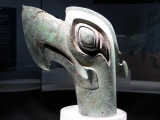
Iron Age and Later PrehistorySite Name: Castro das SeixasCountry: Spain
NOTE: This site is 5.607 km away from the location you searched for.
Region: Galicia Type: Castro or Chafurdão
Nearest Town: Lugo Nearest Village: Mosteiro
Latitude: 42.949937N Longitude: 7.879144W
Condition:
| 5 | Perfect |
| 4 | Almost Perfect |
| 3 | Reasonable but with some damage |
| 2 | Ruined but still recognisable as an ancient site |
| 1 | Pretty much destroyed, possibly visible as crop marks |
| 0 | No data. |
| -1 | Completely destroyed |
| 5 | Superb |
| 4 | Good |
| 3 | Ordinary |
| 2 | Not Good |
| 1 | Awful |
| 0 | No data. |
| 5 | Can be driven to, probably with disabled access |
| 4 | Short walk on a footpath |
| 3 | Requiring a bit more of a walk |
| 2 | A long walk |
| 1 | In the middle of nowhere, a nightmare to find |
| 0 | No data. |
| 5 | co-ordinates taken by GPS or official recorded co-ordinates |
| 4 | co-ordinates scaled from a detailed map |
| 3 | co-ordinates scaled from a bad map |
| 2 | co-ordinates of the nearest village |
| 1 | co-ordinates of the nearest town |
| 0 | no data |
Be the first person to rate this site - see the 'Contribute!' box in the right hand menu.
Internal Links:
External Links:
Castro in Galicia
Can you send us a photo or more information about this site?
You may be viewing yesterday's version of this page. To see the most up to date information please register for a free account.
Do not use the above information on other web sites or publications without permission of the contributor.
Nearby Images from Flickr
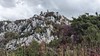
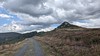
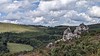
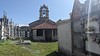
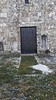
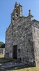
The above images may not be of the site on this page, but were taken nearby. They are loaded from Flickr so please click on them for image credits.
Click here to see more info for this site
Nearby sites
Click here to view sites on an interactive map of the areaKey: Red: member's photo, Blue: 3rd party photo, Yellow: other image, Green: no photo - please go there and take one, Grey: site destroyed
Download sites to:
KML (Google Earth)
GPX (GPS waypoints)
CSV (Garmin/Navman)
CSV (Excel)
To unlock full downloads you need to sign up as a Contributory Member. Otherwise downloads are limited to 50 sites.
Turn off the page maps and other distractions
Nearby sites listing. In the following links * = Image available
4.2km W 261° Castro de Vilouriz Castro or Chafurdão
5.5km WNW 288° Castro de Mangoeiro Castro or Chafurdão
6.7km WNW 302° Castro de Paradela Castro or Chafurdão
8.0km WNW 288° Castro da Graña* Castro or Chafurdão
8.3km W 266° Castro de Piñeiro (Toques) Castro or Chafurdão
8.7km WSW 238° Pena do Raposo Dolmen Burial Chamber or Dolmen
9.0km WNW 281° Castro de Brañas Castro or Chafurdão
9.1km WNW 282° Castro de Codesal Castro or Chafurdão
9.1km WNW 283° Castro de Lobos Castro or Chafurdão
9.2km WNW 283° Castro de San Xiao do Monte Castro or Chafurdão
9.5km W 267° Castro de Abeancos Castro or Chafurdão
10.0km S 173° Castro de Marzá Castro or Chafurdão
10.5km NW 311° Forno dos Mouros Dolmen (Toques)* Burial Chamber or Dolmen
10.9km NW 308° Pena Moura Rock Outcrop
11.0km NE 53° Castro de Lobengos Castro or Chafurdão
11.6km NW 317° Castro do Seixo Castro or Chafurdão
11.9km NNE 12° Castro de Gundín Castro or Chafurdão
12.4km ENE 59° Castro de Casa do Castro Castro or Chafurdão
12.7km NW 323° Castro das Lagoas Castro or Chafurdão
13.1km W 280° Castro de Pedrouzos Castro or Chafurdão
13.9km ENE 57° A Pedra das Cazolas Standing Stone (Menhir)
14.5km WSW 247° Pedra do Casal* Standing Stone (Menhir)
15.0km NNE 29° Castro de Narla Castro or Chafurdão
15.0km W 274° Castro de Donide Castro or Chafurdão
15.8km ESE 104° Pedrafita da Goia Standing Stone (Menhir)
View more nearby sites and additional images


 We would like to know more about this location. Please feel free to add a brief description and any relevant information in your own language.
 Wir möchten mehr über diese Stätte erfahren. Bitte zögern Sie nicht, eine kurze Beschreibung und relevante Informationen in Deutsch hinzuzufügen.
 Nous aimerions en savoir encore un peu sur les lieux. S'il vous plaît n'hesitez pas à ajouter une courte description et tous les renseignements pertinents dans votre propre langue.
 Quisieramos informarnos un poco más de las lugares. No dude en añadir una breve descripción y otros datos relevantes en su propio idioma.