


<< Other Photo Pages >> Chãs d’Égua - Museum in Portugal in Coimbra
Submitted by davidmorgan on Tuesday, 11 February 2014 Page Views: 1644
MuseumsSite Name: Chãs d’ÉguaCountry: Portugal
NOTE: This site is 6.674 km away from the location you searched for.
Distrito: Coimbra Type: Museum
Nearest Town: Santa Ovaia Nearest Village: Chãs d'Égua
Latitude: 40.236076N Longitude: 7.80249W
Condition:
| 5 | Perfect |
| 4 | Almost Perfect |
| 3 | Reasonable but with some damage |
| 2 | Ruined but still recognisable as an ancient site |
| 1 | Pretty much destroyed, possibly visible as crop marks |
| 0 | No data. |
| -1 | Completely destroyed |
| 5 | Superb |
| 4 | Good |
| 3 | Ordinary |
| 2 | Not Good |
| 1 | Awful |
| 0 | No data. |
| 5 | Can be driven to, probably with disabled access |
| 4 | Short walk on a footpath |
| 3 | Requiring a bit more of a walk |
| 2 | A long walk |
| 1 | In the middle of nowhere, a nightmare to find |
| 0 | No data. |
| 5 | co-ordinates taken by GPS or official recorded co-ordinates |
| 4 | co-ordinates scaled from a detailed map |
| 3 | co-ordinates scaled from a bad map |
| 2 | co-ordinates of the nearest village |
| 1 | co-ordinates of the nearest town |
| 0 | no data |
Internal Links:
External Links:
Museum in Central Portugal
An interpretative centre for the rock art in the area.
Website
You may be viewing yesterday's version of this page. To see the most up to date information please register for a free account.
Do not use the above information on other web sites or publications without permission of the contributor.
davidmorgan has found this location on Google Street View:
Nearby Images from Flickr
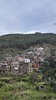
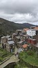
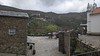
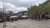
The above images may not be of the site on this page, but were taken nearby. They are loaded from Flickr so please click on them for image credits.
Click here to see more info for this site
Nearby sites
Click here to view sites on an interactive map of the areaKey: Red: member's photo, Blue: 3rd party photo, Yellow: other image, Green: no photo - please go there and take one, Grey: site destroyed
Download sites to:
KML (Google Earth)
GPX (GPS waypoints)
CSV (Garmin/Navman)
CSV (Excel)
To unlock full downloads you need to sign up as a Contributory Member. Otherwise downloads are limited to 50 sites.
Turn off the page maps and other distractions
Nearby sites listing. In the following links * = Image available
15.4km SSE 154° Barroca Rock Art Rock Art
16.0km NNW 336° Anta do Pinheiro dos Abraços* Burial Chamber or Dolmen
19.6km W 272° Castro da Lomba do Canho Castro or Chafurdão
19.9km ENE 60° Serra de Estrela* Rock Outcrop
22.4km NNW 333° Anta da Cavada* Burial Chamber or Dolmen
22.9km NNE 33° Sabugueiro Cross I* Early Christian Sculptured Stone
23.5km N 351° Anta de Arcaínha* Burial Chamber or Dolmen
24.0km N 359° Anta de Curral dos Mouros* Burial Chamber or Dolmen
24.9km NE 45° Vale do Rossim* Rock Outcrop
25.0km NE 38° Sabugueiro Cross II* Early Christian Sculptured Stone
25.3km NNW 332° Orquinha da Víbora* Burial Chamber or Dolmen
25.6km NNW 332° Complexos Rupestres do Ameal* Rock Art
25.8km NNW 334° Abrigo da Orca* Cave or Rock Shelter
25.8km NNW 332° Orca 2 do Ameal* Burial Chamber or Dolmen
25.8km NNW 334° Dólmen da Orca* Burial Chamber or Dolmen
25.9km NNW 333° Orca 1 do Ameal* Burial Chamber or Dolmen
26.3km NNW 332° Orca da Palheira* Burial Chamber or Dolmen
26.3km NNW 335° Orca do Santo* Burial Chamber or Dolmen
27.3km NNW 338° Orca do Outeiro do rato* Burial Chamber or Dolmen
28.3km N 359° Antas de Paranhos* Burial Chamber or Dolmen
29.8km N 353° Orca do Folhadal* Burial Chamber or Dolmen
30.2km NW 325° Orca do sto. Tisco* Burial Chamber or Dolmen
31.9km NNE 23° Anta da Pedra da Orca* Burial Chamber or Dolmen
32.0km NNW 337° Gravuras da Póvoa da Pegada* Rock Art
32.2km NNW 337° Sepulturas antropomórficas de Chãs* Rock Cut Tomb
View more nearby sites and additional images


 We would like to know more about this location. Please feel free to add a brief description and any relevant information in your own language.
 Wir möchten mehr über diese Stätte erfahren. Bitte zögern Sie nicht, eine kurze Beschreibung und relevante Informationen in Deutsch hinzuzufügen.
 Nous aimerions en savoir encore un peu sur les lieux. S'il vous plaît n'hesitez pas à ajouter une courte description et tous les renseignements pertinents dans votre propre langue.
 Quisieramos informarnos un poco más de las lugares. No dude en añadir una breve descripción y otros datos relevantes en su propio idioma.