 with our Megalithic Portal iPhone app")


<< Our Photo Pages >> Castro de Castromaior - Castro or Chafurdão in Spain in Galicia
Submitted by TheCaptain on Wednesday, 08 September 2010 Page Views: 2768
Iron Age and Later PrehistorySite Name: Castro de CastromaiorCountry: Spain Region: Galicia Type: Castro or Chafurdão
Nearest Town: Lugo Nearest Village: Portomarín
Latitude: 42.833378N Longitude: 7.719712W
Condition:
| 5 | Perfect |
| 4 | Almost Perfect |
| 3 | Reasonable but with some damage |
| 2 | Ruined but still recognisable as an ancient site |
| 1 | Pretty much destroyed, possibly visible as crop marks |
| 0 | No data. |
| -1 | Completely destroyed |
| 5 | Superb |
| 4 | Good |
| 3 | Ordinary |
| 2 | Not Good |
| 1 | Awful |
| 0 | No data. |
| 5 | Can be driven to, probably with disabled access |
| 4 | Short walk on a footpath |
| 3 | Requiring a bit more of a walk |
| 2 | A long walk |
| 1 | In the middle of nowhere, a nightmare to find |
| 0 | No data. |
| 5 | co-ordinates taken by GPS or official recorded co-ordinates |
| 4 | co-ordinates scaled from a detailed map |
| 3 | co-ordinates scaled from a bad map |
| 2 | co-ordinates of the nearest village |
| 1 | co-ordinates of the nearest town |
| 0 | no data |
Be the first person to rate this site - see the 'Contribute!' box in the right hand menu.
Internal Links:
External Links:
")
Castro de Castromaior is a Castro in the community of Portomarín, Province of Lugo, region of Galicia
You may be viewing yesterday's version of this page. To see the most up to date information please register for a free account.
")
Do not use the above information on other web sites or publications without permission of the contributor.
Nearby Images from Flickr
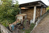
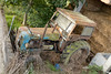
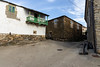
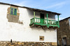
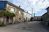
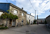
The above images may not be of the site on this page, but were taken nearby. They are loaded from Flickr so please click on them for image credits.
Click here to see more info for this site
Nearby sites
Click here to view sites on an interactive map of the areaKey: Red: member's photo, Blue: 3rd party photo, Yellow: other image, Green: no photo - please go there and take one, Grey: site destroyed
Download sites to:
KML (Google Earth)
GPX (GPS waypoints)
CSV (Garmin/Navman)
CSV (Excel)
To unlock full downloads you need to sign up as a Contributory Member. Otherwise downloads are limited to 50 sites.
Turn off the page maps and other distractions
Nearby sites listing. In the following links * = Image available
4.4km SSW 199° Castro de Covadela Castro or Chafurdão
6.3km NNE 17° Castro do Picato Castro or Chafurdão
6.8km SSW 198° Castro do Alto das Torres Castro or Chafurdão
7.5km ENE 68° Castro de Vilarmao Castro or Chafurdão
8.1km NNE 22° Pedrafita da Veiga Standing Stone (Menhir)
9.0km ENE 59° Castro de Corbacin Castro or Chafurdão
9.2km ENE 78° Castro de Piñeiras Castro or Chafurdão
9.3km NNE 14° Pedrafita da Goia Standing Stone (Menhir)
9.8km ENE 68° Castro de Mougán Castro or Chafurdão
10.0km NE 53° Castro de Grolos Castro or Chafurdão
10.5km WSW 245° Castro de Penedo Castro or Chafurdão
12.2km WNW 284° Castro de Marzá Castro or Chafurdão
13.5km SSW 195° Castro de Cumbraos (Taboada) Castro or Chafurdão
14.0km E 83° Castro de Coroa Castro or Chafurdão
14.6km SSW 198° Castro de Moreda (Taboada) Castro or Chafurdão
16.3km SSE 149° Castro de Abuíme Castro or Chafurdão
16.3km SSE 153° Castro de Vilacaíz Castro or Chafurdão
18.3km NW 315° Castro das Seixas Castro or Chafurdão
18.4km N 7° Castro de Facoi Castro or Chafurdão
19.3km SSW 210° Castro de Monte de Currao Castro or Chafurdão
19.4km S 184° Castro Candaz Castro or Chafurdão
19.4km N 353° Castro de Casa do Castro Castro or Chafurdão
19.5km WSW 240° Petróglifos Laxe Ferrada Rock Art
19.6km SW 231° Dolmen Couto dos Mouros* Burial Chamber or Dolmen
20.1km NNW 348° Castro de Lobengos Castro or Chafurdão
View more nearby sites and additional images


 We would like to know more about this location. Please feel free to add a brief description and any relevant information in your own language.
 Wir möchten mehr über diese Stätte erfahren. Bitte zögern Sie nicht, eine kurze Beschreibung und relevante Informationen in Deutsch hinzuzufügen.
 Nous aimerions en savoir encore un peu sur les lieux. S'il vous plaît n'hesitez pas à ajouter une courte description et tous les renseignements pertinents dans votre propre langue.
 Quisieramos informarnos un poco más de las lugares. No dude en añadir una breve descripción y otros datos relevantes en su propio idioma.