


<< Text Pages >> Dolmen de Abuíme - Burial Chamber or Dolmen in Spain in Galicia
Submitted by holger_rix on Sunday, 13 December 2015 Page Views: 613
Neolithic and Bronze AgeSite Name: Dolmen de AbuímeCountry: Spain
NOTE: This site is 3.94 km away from the location you searched for.
Region: Galicia Type: Burial Chamber or Dolmen
Nearest Village: Abuíme
Latitude: 42.559011N Longitude: 7.647411W
Condition:
| 5 | Perfect |
| 4 | Almost Perfect |
| 3 | Reasonable but with some damage |
| 2 | Ruined but still recognisable as an ancient site |
| 1 | Pretty much destroyed, possibly visible as crop marks |
| 0 | No data. |
| -1 | Completely destroyed |
| 5 | Superb |
| 4 | Good |
| 3 | Ordinary |
| 2 | Not Good |
| 1 | Awful |
| 0 | No data. |
| 5 | Can be driven to, probably with disabled access |
| 4 | Short walk on a footpath |
| 3 | Requiring a bit more of a walk |
| 2 | A long walk |
| 1 | In the middle of nowhere, a nightmare to find |
| 0 | No data. |
| 5 | co-ordinates taken by GPS or official recorded co-ordinates |
| 4 | co-ordinates scaled from a detailed map |
| 3 | co-ordinates scaled from a bad map |
| 2 | co-ordinates of the nearest village |
| 1 | co-ordinates of the nearest town |
| 0 | no data |
Be the first person to rate this site - see the 'Contribute!' box in the right hand menu.
Internal Links:
External Links:
Burial Chamber (Dolmen) in Galicia
Retains five pillars that define a polygonal chamber. A sixth slab is shifted a few meters; at its base shows signs of being cut so it must be used in tasks of stonework.
You may be viewing yesterday's version of this page. To see the most up to date information please register for a free account.
Do not use the above information on other web sites or publications without permission of the contributor.
Nearby Images from Flickr
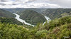
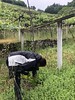
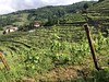
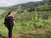
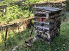
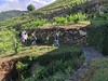
The above images may not be of the site on this page, but were taken nearby. They are loaded from Flickr so please click on them for image credits.
Click here to see more info for this site
Nearby sites
Click here to view sites on an interactive map of the areaKey: Red: member's photo, Blue: 3rd party photo, Yellow: other image, Green: no photo - please go there and take one, Grey: site destroyed
Download sites to:
KML (Google Earth)
GPX (GPS waypoints)
CSV (Garmin/Navman)
CSV (Excel)
To unlock full downloads you need to sign up as a Contributory Member. Otherwise downloads are limited to 50 sites.
Turn off the page maps and other distractions
Nearby sites listing. In the following links * = Image available
4.7km S 180° Castro de Moreda (Pantón) Castro or Chafurdão
4.7km S 182° Castro de Castillones Castro or Chafurdão
4.9km ESE 111° Castro de Moreda (Toiriz) Castro or Chafurdão
5.1km SE 141° Castro das Ribas Castro or Chafurdão
5.2km E 95° Castro do Eivedo Castro or Chafurdão
5.6km NNE 20° Dolmen de Carballo Burial Chamber or Dolmen
5.9km S 180° Castro de Vilar de Ortelle Castro or Chafurdão
6.9km SW 234° Castro de Marce Castro or Chafurdão
7.4km NW 320° Pedrafita de Toalde Standing Stone (Menhir)
9.1km NE 41° Castro de Ousende Castro or Chafurdão
10.3km SSE 160° Castro de Vilaoscura Castro or Chafurdão
11.0km SSE 158° Castro de Arroxo Castro or Chafurdão
11.1km SSE 158° Castro de Cadeiras Castro or Chafurdão
11.2km SSE 158° Castro de Gundivós Castro or Chafurdão
11.3km NNE 14° Castro de Albariza Castro or Chafurdão
11.8km ESE 114° Castro de Babela Castro or Chafurdão
13.4km NNW 327° Castro Candaz Castro or Chafurdão
13.8km WSW 253° Castro de Morgadán Castro or Chafurdão
14.0km S 179° Petróglifo da Tapada do Monte Rock Art
14.0km E 94° Castro do Cornado Castro or Chafurdão
14.2km E 88° Castro da Parte Castro or Chafurdão
16.1km N 6° Castro de Vilacaíz Castro or Chafurdão
16.3km SSW 201° Mamoas As Cabanas Barrow Cemetery
16.8km N 9° Castro de Abuíme Castro or Chafurdão
17.7km SSW 209° Castro de Torre da Cidá Castro or Chafurdão
View more nearby sites and additional images


 We would like to know more about this location. Please feel free to add a brief description and any relevant information in your own language.
 Wir möchten mehr über diese Stätte erfahren. Bitte zögern Sie nicht, eine kurze Beschreibung und relevante Informationen in Deutsch hinzuzufügen.
 Nous aimerions en savoir encore un peu sur les lieux. S'il vous plaît n'hesitez pas à ajouter une courte description et tous les renseignements pertinents dans votre propre langue.
 Quisieramos informarnos un poco más de las lugares. No dude en añadir una breve descripción y otros datos relevantes en su propio idioma.