


<< Text Pages >> Castro de Rebordaos - Castro or Chafurdão in Spain in Galicia
Submitted by TheCaptain on Wednesday, 08 September 2010 Page Views: 1546
Iron Age and Later PrehistorySite Name: Castro de RebordaosCountry: Spain
NOTE: This site is 0.231 km away from the location you searched for.
Region: Galicia Type: Castro or Chafurdão
Nearest Town: Lugo Nearest Village: Lugo
Latitude: 43.011378N Longitude: 7.55815W
Condition:
| 5 | Perfect |
| 4 | Almost Perfect |
| 3 | Reasonable but with some damage |
| 2 | Ruined but still recognisable as an ancient site |
| 1 | Pretty much destroyed, possibly visible as crop marks |
| 0 | No data. |
| -1 | Completely destroyed |
| 5 | Superb |
| 4 | Good |
| 3 | Ordinary |
| 2 | Not Good |
| 1 | Awful |
| 0 | No data. |
| 5 | Can be driven to, probably with disabled access |
| 4 | Short walk on a footpath |
| 3 | Requiring a bit more of a walk |
| 2 | A long walk |
| 1 | In the middle of nowhere, a nightmare to find |
| 0 | No data. |
| 5 | co-ordinates taken by GPS or official recorded co-ordinates |
| 4 | co-ordinates scaled from a detailed map |
| 3 | co-ordinates scaled from a bad map |
| 2 | co-ordinates of the nearest village |
| 1 | co-ordinates of the nearest town |
| 0 | no data |
Be the first person to rate this site - see the 'Contribute!' box in the right hand menu.
Internal Links:
External Links:
Castro in Galicia
Castro de Rebordaos is a Castro in the community of Lugo, Province of Lugo, region of Galicia
You may be viewing yesterday's version of this page. To see the most up to date information please register for a free account.
Do not use the above information on other web sites or publications without permission of the contributor.
Nearby Images from Flickr

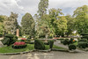
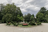
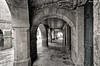
The above images may not be of the site on this page, but were taken nearby. They are loaded from Flickr so please click on them for image credits.
Click here to see more info for this site
Nearby sites
Click here to view sites on an interactive map of the areaKey: Red: member's photo, Blue: 3rd party photo, Yellow: other image, Green: no photo - please go there and take one, Grey: site destroyed
Download sites to:
KML (Google Earth)
GPX (GPS waypoints)
CSV (Garmin/Navman)
CSV (Excel)
To unlock full downloads you need to sign up as a Contributory Member. Otherwise downloads are limited to 50 sites.
Turn off the page maps and other distractions
Nearby sites listing. In the following links * = Image available
603m ESE 114° Centro Arqueológico San Roque* Museum
2.5km ENE 64° Mámoa de San Cibrao Burial Chamber or Dolmen
3.1km SSW 194° Castro de Toiriz Castro or Chafurdão
4.6km W 278° Dolmen de Adai Burial Chamber or Dolmen
4.8km W 278° Pena do Castrillón Petroglifos Rock Art
4.9km W 280° O Castrillón Henge Henge
10.9km NW 320° Pena Dereita Dolmen Burial Chamber or Dolmen
11.0km W 262° Castro de Facoi Castro or Chafurdão
11.2km NW 320° Castro de Penas do Castro Castro or Chafurdão
11.8km WNW 295° Bravos Dolmen Burial Chamber or Dolmen
13.0km W 278° Castro de O Cangallón Castro or Chafurdão
13.2km NW 312° Castro de Agra do Castro Castro or Chafurdão
13.3km WNW 288° Castro de Os Lagouzos Castro or Chafurdão
13.8km W 281° Moruxosa Dolmen* Burial Chamber or Dolmen
14.4km W 273° A Pedra das Cazolas Standing Stone (Menhir)
14.8km SSW 200° Castro de Grolos Castro or Chafurdão
15.3km SW 225° Pedrafita da Goia Standing Stone (Menhir)
15.4km W 268° Castro de Casa do Castro Castro or Chafurdão
15.6km NW 321° As Penas de Rodas* Natural Stone / Erratic / Other Natural Feature
15.9km SW 220° Pedrafita da Veiga Standing Stone (Menhir)
15.9km E 84° Castro de Silvades Castro or Chafurdão
16.1km SSW 200° Castro de Corbacin Castro or Chafurdão
16.6km SSW 194° Castro de Mougán Castro or Chafurdão
16.9km NW 323° Castro de Donalbai Castro or Chafurdão
17.4km W 270° Castro de Lobengos Castro or Chafurdão
View more nearby sites and additional images


 We would like to know more about this location. Please feel free to add a brief description and any relevant information in your own language.
 Wir möchten mehr über diese Stätte erfahren. Bitte zögern Sie nicht, eine kurze Beschreibung und relevante Informationen in Deutsch hinzuzufügen.
 Nous aimerions en savoir encore un peu sur les lieux. S'il vous plaît n'hesitez pas à ajouter une courte description et tous les renseignements pertinents dans votre propre langue.
 Quisieramos informarnos un poco más de las lugares. No dude en añadir una breve descripción y otros datos relevantes en su propio idioma.