 with our Megalithic Portal iPhone app")


<< Text Pages >> Pedrafita de Rebordiño - Standing Stone (Menhir) in Spain in Galicia
Submitted by holger_rix on Wednesday, 16 December 2015 Page Views: 659
Neolithic and Bronze AgeSite Name: Pedrafita de RebordiñoCountry: Spain
NOTE: This site is 5.365 km away from the location you searched for.
Region: Galicia Type: Standing Stone (Menhir)
Latitude: 42.086348N Longitude: 7.506832W
Condition:
| 5 | Perfect |
| 4 | Almost Perfect |
| 3 | Reasonable but with some damage |
| 2 | Ruined but still recognisable as an ancient site |
| 1 | Pretty much destroyed, possibly visible as crop marks |
| 0 | No data. |
| -1 | Completely destroyed |
| 5 | Superb |
| 4 | Good |
| 3 | Ordinary |
| 2 | Not Good |
| 1 | Awful |
| 0 | No data. |
| 5 | Can be driven to, probably with disabled access |
| 4 | Short walk on a footpath |
| 3 | Requiring a bit more of a walk |
| 2 | A long walk |
| 1 | In the middle of nowhere, a nightmare to find |
| 0 | No data. |
| 5 | co-ordinates taken by GPS or official recorded co-ordinates |
| 4 | co-ordinates scaled from a detailed map |
| 3 | co-ordinates scaled from a bad map |
| 2 | co-ordinates of the nearest village |
| 1 | co-ordinates of the nearest town |
| 0 | no data |
Be the first person to rate this site - see the 'Contribute!' box in the right hand menu.
Internal Links:
External Links:
Standing Stone (Menhir) in Galicia
You may be viewing yesterday's version of this page. To see the most up to date information please register for a free account.
Do not use the above information on other web sites or publications without permission of the contributor.
Nearby Images from Flickr
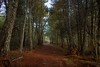
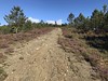
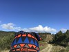
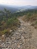
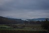
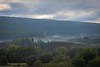
The above images may not be of the site on this page, but were taken nearby. They are loaded from Flickr so please click on them for image credits.
Click here to see more info for this site
Nearby sites
Click here to view sites on an interactive map of the areaKey: Red: member's photo, Blue: 3rd party photo, Yellow: other image, Green: no photo - please go there and take one, Grey: site destroyed
Download sites to:
KML (Google Earth)
GPX (GPS waypoints)
CSV (Garmin/Navman)
CSV (Excel)
To unlock full downloads you need to sign up as a Contributory Member. Otherwise downloads are limited to 50 sites.
Turn off the page maps and other distractions
Nearby sites listing. In the following links * = Image available
9.9km SSE 160° Petróglifo das Covas Rubias Rock Art
13.2km SSW 209° Castro de Lucenza Castro or Chafurdão
14.8km WNW 294° Pedra Alta de Antela* Standing Stone (Menhir)
16.2km SSW 202° Petróglifos Penedo do Muro Rock Art
16.2km NNW 342° Castro de Castro de Escuadro Castro or Chafurdão
18.1km W 261° Castro da Cidade Castro or Chafurdão
18.7km NNW 338° Asentamento romano de Vilardecás Ancient Village or Settlement
18.8km S 176° Petróglifos das Chás Rock Art
19.9km SSW 210° Castro de Saceda* Castro or Chafurdão
21.0km NNW 339° Castro de Santa Marta (Tioira) Castro or Chafurdão
21.2km NW 314° Petróglifos de Pena Coitela Rock Art
21.5km NW 316° Petróglifos de San Vitorio Rock Art
22.7km SSW 199° Castro de San Millao Castro or Chafurdão
23.0km NNW 328° Castro de Outeiro do Castro (Vixueses) Castro or Chafurdão
23.8km NW 321° Castro do Outeiro das Touciñas Castro or Chafurdão
25.2km NNW 329° Mámoa de Calvelo Round Barrow(s)
25.3km NNW 334° Mámoas de Velgachá Barrow Cemetery
25.4km SSW 212° Castro da Xironda Castro or Chafurdão
25.8km NNW 341° Mámoa das Carricas Round Barrow(s)
25.9km NW 308° Petróglifo Monte Gándara Rock Art
26.4km WNW 294° Castro de San Salvador Castro or Chafurdão
26.4km WNW 295° Castro do Castelo Castro or Chafurdão
27.8km NNW 328° Castro de Monte do Castro (Lamas do Monte) Castro or Chafurdão
28.0km NW 310° Castro en San Vicente de Coucieiro Castro or Chafurdão
28.5km NNW 330° Pedrafita do Couso Standing Stone (Menhir)
View more nearby sites and additional images


 We would like to know more about this location. Please feel free to add a brief description and any relevant information in your own language.
 Wir möchten mehr über diese Stätte erfahren. Bitte zögern Sie nicht, eine kurze Beschreibung und relevante Informationen in Deutsch hinzuzufügen.
 Nous aimerions en savoir encore un peu sur les lieux. S'il vous plaît n'hesitez pas à ajouter une courte description et tous les renseignements pertinents dans votre propre langue.
 Quisieramos informarnos un poco más de las lugares. No dude en añadir una breve descripción y otros datos relevantes en su propio idioma.