


<< Text Pages >> Castro de Ceranzos - Castro or Chafurdão in Spain in Galicia
Submitted by TheCaptain on Wednesday, 08 September 2010 Page Views: 1030
Iron Age and Later PrehistorySite Name: Castro de CeranzosCountry: Spain
NOTE: This site is 0.604 km away from the location you searched for.
Region: Galicia Type: Castro or Chafurdão
Nearest Town: Lugo Nearest Village: Xove
Latitude: 43.712796N Longitude: 7.549658W
Condition:
| 5 | Perfect |
| 4 | Almost Perfect |
| 3 | Reasonable but with some damage |
| 2 | Ruined but still recognisable as an ancient site |
| 1 | Pretty much destroyed, possibly visible as crop marks |
| 0 | No data. |
| -1 | Completely destroyed |
| 5 | Superb |
| 4 | Good |
| 3 | Ordinary |
| 2 | Not Good |
| 1 | Awful |
| 0 | No data. |
| 5 | Can be driven to, probably with disabled access |
| 4 | Short walk on a footpath |
| 3 | Requiring a bit more of a walk |
| 2 | A long walk |
| 1 | In the middle of nowhere, a nightmare to find |
| 0 | No data. |
| 5 | co-ordinates taken by GPS or official recorded co-ordinates |
| 4 | co-ordinates scaled from a detailed map |
| 3 | co-ordinates scaled from a bad map |
| 2 | co-ordinates of the nearest village |
| 1 | co-ordinates of the nearest town |
| 0 | no data |
Be the first person to rate this site - see the 'Contribute!' box in the right hand menu.
Internal Links:
External Links:
Castro in Galicia
Castro de Ceranzos is a Castro in the community of Xove, Province of Lugo, region of Galicia
You may be viewing yesterday's version of this page. To see the most up to date information please register for a free account.
Do not use the above information on other web sites or publications without permission of the contributor.
Nearby Images from Flickr
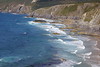
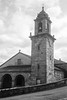
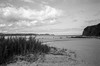
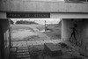
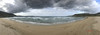
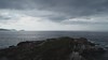
The above images may not be of the site on this page, but were taken nearby. They are loaded from Flickr so please click on them for image credits.
Click here to see more info for this site
Nearby sites
Click here to view sites on an interactive map of the areaKey: Red: member's photo, Blue: 3rd party photo, Yellow: other image, Green: no photo - please go there and take one, Grey: site destroyed
Download sites to:
KML (Google Earth)
GPX (GPS waypoints)
CSV (Garmin/Navman)
CSV (Excel)
To unlock full downloads you need to sign up as a Contributory Member. Otherwise downloads are limited to 50 sites.
Turn off the page maps and other distractions
Nearby sites listing. In the following links * = Image available
1.3km S 181° Castro de Illade Castro or Chafurdão
4.0km ENE 76° Castro de Morás Castro or Chafurdão
4.8km WSW 254° Medas do Castro Castro or Chafurdão
6.0km W 260° Castro de Suegos Castro or Chafurdão
6.5km W 279° Castro de Moutillós Castro or Chafurdão
8.0km ESE 107° Castro da Atalaia (Lieiro) Castro or Chafurdão
8.4km SSE 151° Castro do Torrillón Castro or Chafurdão
8.7km WNW 288° Castro de A Tarroeira Castro or Chafurdão
8.9km ESE 113° Castro de Castelo Castro or Chafurdão
10.4km SSE 158° Castro de Penas Agudas Castro or Chafurdão
11.3km SW 215° Pedrafita de Catarou Standing Stone (Menhir)
11.5km W 270° Castro de A Ínsua de San Martiño Castro or Chafurdão
12.0km WNW 292° Castro de Vilela (Espiñeiral) Castro or Chafurdão
12.3km ESE 106° Castro de Rueta Castro or Chafurdão
13.3km W 266° Castro do Sor Castro or Chafurdão
13.6km NW 307° Castro de Estaca de Bares Castro or Chafurdão
14.4km W 266° Dolmen do Forno dos Mouros da Pena Branca* Burial Chamber or Dolmen
16.1km ESE 107° Castro de Burela Castro or Chafurdão
17.1km W 279° Castro de Punta de Mourama Castro or Chafurdão
17.4km SW 223° Mámoas do Cristo dos Callós Barrow Cemetery
17.6km W 270° Castro de Céltigos Castro or Chafurdão
19.0km S 178° Arcas de Sinás Burial Chamber or Dolmen
19.7km ESE 118° Castro de Punta dos Castros (Cangas) Castro or Chafurdão
19.8km W 274° Castro de Castelos Castro or Chafurdão
20.3km SSE 165° Anta do Chao do Padorno Burial Chamber or Dolmen
View more nearby sites and additional images


 We would like to know more about this location. Please feel free to add a brief description and any relevant information in your own language.
 Wir möchten mehr über diese Stätte erfahren. Bitte zögern Sie nicht, eine kurze Beschreibung und relevante Informationen in Deutsch hinzuzufügen.
 Nous aimerions en savoir encore un peu sur les lieux. S'il vous plaît n'hesitez pas à ajouter une courte description et tous les renseignements pertinents dans votre propre langue.
 Quisieramos informarnos un poco más de las lugares. No dude en añadir una breve descripción y otros datos relevantes en su propio idioma.