


<< Our Photo Pages >> Castro de Viladonga - Castro or Chafurdão in Spain in Galicia
Submitted by yackoff on Tuesday, 05 April 2011 Page Views: 4854
Iron Age and Later PrehistorySite Name: Castro de ViladongaCountry: Spain
NOTE: This site is 6.139 km away from the location you searched for.
Region: Galicia Type: Castro or Chafurdão
Nearest Town: Lugo Nearest Village: Castro de Rei
Latitude: 43.160700N Longitude: 7.3887W
Condition:
| 5 | Perfect |
| 4 | Almost Perfect |
| 3 | Reasonable but with some damage |
| 2 | Ruined but still recognisable as an ancient site |
| 1 | Pretty much destroyed, possibly visible as crop marks |
| 0 | No data. |
| -1 | Completely destroyed |
| 5 | Superb |
| 4 | Good |
| 3 | Ordinary |
| 2 | Not Good |
| 1 | Awful |
| 0 | No data. |
| 5 | Can be driven to, probably with disabled access |
| 4 | Short walk on a footpath |
| 3 | Requiring a bit more of a walk |
| 2 | A long walk |
| 1 | In the middle of nowhere, a nightmare to find |
| 0 | No data. |
| 5 | co-ordinates taken by GPS or official recorded co-ordinates |
| 4 | co-ordinates scaled from a detailed map |
| 3 | co-ordinates scaled from a bad map |
| 2 | co-ordinates of the nearest village |
| 1 | co-ordinates of the nearest town |
| 0 | no data |
Internal Links:
External Links:
I have visited· I would like to visit
rrmoser visited on 17th Oct 2014 - their rating: Cond: 4 Amb: 5 Access: 5
rrmoser visited on 17th Oct 2014 - their rating: Cond: 4 Amb: 4 Access: 5 The museum is free and worth a visit.
Average ratings for this site from all visit loggers: Condition: 4 Ambience: 4.5 Access: 5
")
You may be viewing yesterday's version of this page. To see the most up to date information please register for a free account.
")
Do not use the above information on other web sites or publications without permission of the contributor.
Nearby Images from Flickr
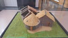
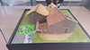
The above images may not be of the site on this page, but were taken nearby. They are loaded from Flickr so please click on them for image credits.
Click here to see more info for this site
Nearby sites
Click here to view sites on an interactive map of the areaKey: Red: member's photo, Blue: 3rd party photo, Yellow: other image, Green: no photo - please go there and take one, Grey: site destroyed
Download sites to:
KML (Google Earth)
GPX (GPS waypoints)
CSV (Garmin/Navman)
CSV (Excel)
To unlock full downloads you need to sign up as a Contributory Member. Otherwise downloads are limited to 50 sites.
Turn off the page maps and other distractions
Nearby sites listing. In the following links * = Image available
3.1km ESE 113° Castro de Andión Castro or Chafurdão
3.6km NNE 12° Castro de Escairo Castro or Chafurdão
4.5km NNW 347° Castro de Ameixende Castro or Chafurdão
4.7km NNW 348° Castro de Duarría Castro or Chafurdão
4.9km E 88° Castro de Hermunde Castro or Chafurdão
5.3km ESE 113° Castro da Poula Castro or Chafurdão
6.9km NNE 30° Dolmen de Mazoy* Burial Chamber or Dolmen
10.9km NNE 20° Castro de Saa (A Pastoriza) Castro or Chafurdão
11.3km NW 316° Castro de O Castro (Cospeito) Castro or Chafurdão
12.6km NNE 26° Castro de Gueimonde (San Mamede) Castro or Chafurdão
13.1km E 81° Penacova Dolmen* Burial Chamber or Dolmen
14.9km NNE 32° Castro da Olga Castro or Chafurdão
15.1km NW 306° Castro de Santa Cristina Castro or Chafurdão
15.2km S 172° Castro de Silvades Castro or Chafurdão
16.5km NW 304° Castro de Cospeito Castro or Chafurdão
17.6km WNW 296° Castro de Vilapene Castro or Chafurdão
17.6km WNW 303° Castro de San Paio Castro or Chafurdão
17.9km WNW 282° Castro de Torrillón Castro or Chafurdão
18.6km E 97° Mámoas do Chao da Cruz Barrow Cemetery
18.9km SE 145° Castro de Perrelos Castro or Chafurdão
18.9km WNW 294° Torre de Seixas Castro or Chafurdão
19.3km SW 217° Mámoa de San Cibrao Burial Chamber or Dolmen
19.6km WNW 281° Castro de O Castro (Xoibán) Castro or Chafurdão
19.7km WNW 290° Castro de Teixeiro Castro or Chafurdão
20.1km WNW 283° Castro de San Paio (Lentille) Castro or Chafurdão
View more nearby sites and additional images


 We would like to know more about this location. Please feel free to add a brief description and any relevant information in your own language.
 Wir möchten mehr über diese Stätte erfahren. Bitte zögern Sie nicht, eine kurze Beschreibung und relevante Informationen in Deutsch hinzuzufügen.
 Nous aimerions en savoir encore un peu sur les lieux. S'il vous plaît n'hesitez pas à ajouter une courte description et tous les renseignements pertinents dans votre propre langue.
 Quisieramos informarnos un poco más de las lugares. No dude en añadir una breve descripción y otros datos relevantes en su propio idioma.