

<< Text Pages >> Castro de Silvades - Castro or Chafurdão in Spain in Galicia
Submitted by johnstone on Sunday, 26 January 2020 Page Views: 258
Iron Age and Later PrehistorySite Name: Castro de SilvadesCountry: Spain
NOTE: This site is 5.401 km away from the location you searched for.
Region: Galicia Type: Castro or Chafurdão
Nearest Town: Lugo Nearest Village: Castroverde
Latitude: 43.025075N Longitude: 7.363288W
Condition:
| 5 | Perfect |
| 4 | Almost Perfect |
| 3 | Reasonable but with some damage |
| 2 | Ruined but still recognisable as an ancient site |
| 1 | Pretty much destroyed, possibly visible as crop marks |
| 0 | No data. |
| -1 | Completely destroyed |
| 5 | Superb |
| 4 | Good |
| 3 | Ordinary |
| 2 | Not Good |
| 1 | Awful |
| 0 | No data. |
| 5 | Can be driven to, probably with disabled access |
| 4 | Short walk on a footpath |
| 3 | Requiring a bit more of a walk |
| 2 | A long walk |
| 1 | In the middle of nowhere, a nightmare to find |
| 0 | No data. |
| 5 | co-ordinates taken by GPS or official recorded co-ordinates |
| 4 | co-ordinates scaled from a detailed map |
| 3 | co-ordinates scaled from a bad map |
| 2 | co-ordinates of the nearest village |
| 1 | co-ordinates of the nearest town |
| 0 | no data |
Be the first person to rate this site - see the 'Contribute!' box in the right hand menu.
Internal Links:
External Links:
Castro in Galicia
Can you send us a photo or more information about this site?
You may be viewing yesterday's version of this page. To see the most up to date information please register for a free account.
Do not use the above information on other web sites or publications without permission of the contributor.
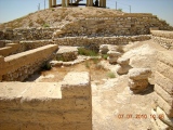
Nearby Images from Flickr
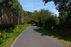
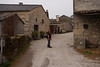
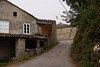
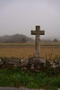
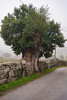
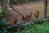
The above images may not be of the site on this page, but were taken nearby. They are loaded from Flickr so please click on them for image credits.
Click here to see more info for this site
Nearby sites
Click here to view sites on an interactive map of the areaKey: Red: member's photo, Blue: 3rd party photo, Yellow: other image, Green: no photo - please go there and take one, Grey: site destroyed
Download sites to:
KML (Google Earth)
GPX (GPS waypoints)
CSV (Garmin/Navman)
CSV (Excel)
To unlock full downloads you need to sign up as a Contributory Member. Otherwise downloads are limited to 50 sites.
Turn off the page maps and other distractions
Nearby sites listing. In the following links * = Image available
7.0km SE 127° Castro de Barreiros Castro or Chafurdão
8.9km E 92° Castro de Perrelos Castro or Chafurdão
9.0km SE 125° Castro de Pereira Castro or Chafurdão
10.2km ESE 106° Castro de Valdería Castro or Chafurdão
10.4km ESE 104° Castro da Corota Castro or Chafurdão
10.8km SSE 153° Castro de Pacios Castro or Chafurdão
12.0km SSE 166° Castro de Sobrado Castro or Chafurdão
13.3km NNE 12° Castro da Poula Castro or Chafurdão
13.6km W 268° Mámoa de San Cibrao Burial Chamber or Dolmen
13.9km N 3° Castro de Andión Castro or Chafurdão
14.7km ESE 121° Castro de Pedrafita Castro or Chafurdão
15.1km SE 146° Castro de Quintela Castro or Chafurdão
15.2km SSE 159° Castro de Santa Marta (Baralla) Castro or Chafurdão
15.2km N 352° Castro de Viladonga* Castro or Chafurdão
15.4km W 263° Centro Arqueológico San Roque* Museum
15.5km N 10° Castro de Hermunde Castro or Chafurdão
15.9km W 265° Castro de Rebordaos Castro or Chafurdão
16.4km SE 128° Castro de Carballedo Castro or Chafurdão
16.4km SSE 165° Castro de Lebruxo Castro or Chafurdão
17.2km WSW 255° Castro de Toiriz Castro or Chafurdão
17.5km SSE 155° Castro de Pousada (Baralla) Castro or Chafurdão
17.6km S 176° Castro de San Miguel Castro or Chafurdão
17.7km S 180° Castro de Trascastro (Sarria) Castro or Chafurdão
17.9km SSE 155° Castro da Croa Castro or Chafurdão
18.1km S 187° Castro de Sambreixo Castro or Chafurdão
View more nearby sites and additional images


 We would like to know more about this location. Please feel free to add a brief description and any relevant information in your own language.
 Wir möchten mehr über diese Stätte erfahren. Bitte zögern Sie nicht, eine kurze Beschreibung und relevante Informationen in Deutsch hinzuzufügen.
 Nous aimerions en savoir encore un peu sur les lieux. S'il vous plaît n'hesitez pas à ajouter une courte description et tous les renseignements pertinents dans votre propre langue.
 Quisieramos informarnos un poco más de las lugares. No dude en añadir una breve descripción y otros datos relevantes en su propio idioma.