 with our Megalithic Portal iPhone app")


<< Text Pages >> Algeriz Altar de Sacrificios - Barrow Cemetery in Portugal in Vila Real
Submitted by holger_rix on Monday, 07 December 2015 Page Views: 1494
Neolithic and Bronze AgeSite Name: Algeriz Altar de SacrificiosCountry: Portugal
NOTE: This site is 6.24 km away from the location you searched for.
Distrito: Vila Real Type: Barrow Cemetery
Nearest Village: Algeriz
Latitude: 41.590777N Longitude: 7.390682W
Condition:
| 5 | Perfect |
| 4 | Almost Perfect |
| 3 | Reasonable but with some damage |
| 2 | Ruined but still recognisable as an ancient site |
| 1 | Pretty much destroyed, possibly visible as crop marks |
| 0 | No data. |
| -1 | Completely destroyed |
| 5 | Superb |
| 4 | Good |
| 3 | Ordinary |
| 2 | Not Good |
| 1 | Awful |
| 0 | No data. |
| 5 | Can be driven to, probably with disabled access |
| 4 | Short walk on a footpath |
| 3 | Requiring a bit more of a walk |
| 2 | A long walk |
| 1 | In the middle of nowhere, a nightmare to find |
| 0 | No data. |
| 5 | co-ordinates taken by GPS or official recorded co-ordinates |
| 4 | co-ordinates scaled from a detailed map |
| 3 | co-ordinates scaled from a bad map |
| 2 | co-ordinates of the nearest village |
| 1 | co-ordinates of the nearest town |
| 0 | no data |
Be the first person to rate this site - see the 'Contribute!' box in the right hand menu.
Internal Links:
External Links:
Barrow Cemetery in Vila Real
You may be viewing yesterday's version of this page. To see the most up to date information please register for a free account.
")
Do not use the above information on other web sites or publications without permission of the contributor.
Nearby Images from Flickr

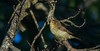
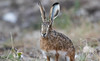

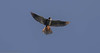
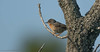
The above images may not be of the site on this page, but were taken nearby. They are loaded from Flickr so please click on them for image credits.
Click here to see more info for this site
Nearby sites
Click here to view sites on an interactive map of the areaKey: Red: member's photo, Blue: 3rd party photo, Yellow: other image, Green: no photo - please go there and take one, Grey: site destroyed
Download sites to:
KML (Google Earth)
GPX (GPS waypoints)
CSV (Garmin/Navman)
CSV (Excel)
To unlock full downloads you need to sign up as a Contributory Member. Otherwise downloads are limited to 50 sites.
Turn off the page maps and other distractions
Nearby sites listing. In the following links * = Image available
1.1km SW 226° Castro de Ribas Castro or Chafurdão
5.8km NNW 345° Castro de Vilanova Castro or Chafurdão
9.7km NE 34° Castro de Vilarandelo Castro or Chafurdão
10.7km WNW 292° Castro de Loivos Castro or Chafurdão
11.1km NNW 328° Castro de Santiago do Monte Castro or Chafurdão
13.7km NNE 16° Castro da Lama de Ouriço Castro or Chafurdão
17.9km NNW 338° Museo da Região Flaviense* Museum
19.5km E 86° Castro de São Juzenda Castro or Chafurdão
20.9km S 178° Castro de Palheiros Castro or Chafurdão
21.6km NNE 17° Pedra Bolideira* Natural Stone / Erratic / Other Natural Feature
23.5km ENE 72° Torre de Dona Chama Castro or Chafurdão
24.4km WNW 298° Castro de Cabeço Castro or Chafurdão
26.6km SSW 197° Castro do Pópulo* Castro or Chafurdão
27.3km SW 222° Ponte Romana de Arco* Rock Art
28.5km WNW 294° Castro de Carvalhelhos Castro or Chafurdão
29.2km SSW 193° Anta da Fonte Coberta* Burial Chamber or Dolmen
29.3km WSW 250° Mamoa do Alto do Cotorino Round Barrow(s)
29.8km WNW 285° Castro de Lesenho Castro or Chafurdão
30.5km SSW 196° Sepultura de Vila Chã* Rock Cut Tomb
30.5km SW 235° Veiga dos Fornos* Rock Art
30.8km WNW 282° Castro Outeiro Lesenho* Castro or Chafurdão
32.4km NW 316° Castro do Pedrário Castro or Chafurdão
34.2km SW 226° São Bento (Vila Real)* Castro or Chafurdão
35.9km SSE 167° Anta de Zedes* Burial Chamber or Dolmen
37.3km SSW 209° Mamoa de Madorras* Burial Chamber or Dolmen
View more nearby sites and additional images


 We would like to know more about this location. Please feel free to add a brief description and any relevant information in your own language.
 Wir möchten mehr über diese Stätte erfahren. Bitte zögern Sie nicht, eine kurze Beschreibung und relevante Informationen in Deutsch hinzuzufügen.
 Nous aimerions en savoir encore un peu sur les lieux. S'il vous plaît n'hesitez pas à ajouter une courte description et tous les renseignements pertinents dans votre propre langue.
 Quisieramos informarnos un poco más de las lugares. No dude en añadir una breve descripción y otros datos relevantes en su propio idioma.