


<< Text Pages >> Castro de Moura - Castro or Chafurdão in Spain in Galicia
Submitted by TheCaptain on Wednesday, 08 September 2010 Page Views: 1192
Iron Age and Later PrehistorySite Name: Castro de MouraCountry: Spain
NOTE: This site is 1.308 km away from the location you searched for.
Region: Galicia Type: Castro or Chafurdão
Nearest Town: Lugo Nearest Village: Samos
Latitude: 42.733000N Longitude: 7.301W
Condition:
| 5 | Perfect |
| 4 | Almost Perfect |
| 3 | Reasonable but with some damage |
| 2 | Ruined but still recognisable as an ancient site |
| 1 | Pretty much destroyed, possibly visible as crop marks |
| 0 | No data. |
| -1 | Completely destroyed |
| 5 | Superb |
| 4 | Good |
| 3 | Ordinary |
| 2 | Not Good |
| 1 | Awful |
| 0 | No data. |
| 5 | Can be driven to, probably with disabled access |
| 4 | Short walk on a footpath |
| 3 | Requiring a bit more of a walk |
| 2 | A long walk |
| 1 | In the middle of nowhere, a nightmare to find |
| 0 | No data. |
| 5 | co-ordinates taken by GPS or official recorded co-ordinates |
| 4 | co-ordinates scaled from a detailed map |
| 3 | co-ordinates scaled from a bad map |
| 2 | co-ordinates of the nearest village |
| 1 | co-ordinates of the nearest town |
| 0 | no data |
Be the first person to rate this site - see the 'Contribute!' box in the right hand menu.
Internal Links:
External Links:
Castro in Galicia
Castro de Moura is a Castro in the parish of Lóuzara, community of Samos, Province of Lugo, region of Galicia
You may be viewing yesterday's version of this page. To see the most up to date information please register for a free account.
Do not use the above information on other web sites or publications without permission of the contributor.
Nearby Images from Flickr
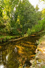
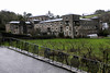
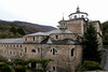
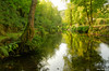
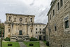
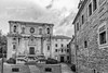
The above images may not be of the site on this page, but were taken nearby. They are loaded from Flickr so please click on them for image credits.
Click here to see more info for this site
Nearby sites
Click here to view sites on an interactive map of the areaKey: Red: member's photo, Blue: 3rd party photo, Yellow: other image, Green: no photo - please go there and take one, Grey: site destroyed
Download sites to:
KML (Google Earth)
GPX (GPS waypoints)
CSV (Garmin/Navman)
CSV (Excel)
To unlock full downloads you need to sign up as a Contributory Member. Otherwise downloads are limited to 50 sites.
Turn off the page maps and other distractions
Nearby sites listing. In the following links * = Image available
1.7km SSE 154° Castro de Escanlar Castro or Chafurdão
3.3km S 180° Castro de Valbón Castro or Chafurdão
4.1km WSW 239° Necrópole Megalítica do Campo de Valentín Barrow Cemetery
4.3km WSW 239° Serra do Edramo Dolmen Burial Chamber or Dolmen
5.2km SW 235° Castro de Formigueiros* Castro or Chafurdão
6.7km SSE 147° Castro da Moura Castro or Chafurdão
6.9km WSW 237° Necrópole Megalítica de Santa Mariña Barrow Cemetery
7.4km WSW 256° Castro de Cima da Ribeira Castro or Chafurdão
9.6km SSW 194° Castro de Santa Cristina Castro or Chafurdão
10.3km N 351° Castro de Armea (Sarria) Castro or Chafurdão
11.5km NE 39° Castro de Guilfrei Castro or Chafurdão
11.7km NNW 329° Castro de Goián Castro or Chafurdão
12.5km NNW 332° Castro de Fonteabuin Castro or Chafurdão
12.6km W 271° Castro da Chanca Castro or Chafurdão
12.6km WNW 287° Castro das Paredes Castro or Chafurdão
12.6km ENE 59° Castro Monte do Castro (Nogais) Castro or Chafurdão
13.2km SE 126° Castro de Miraz* Castro or Chafurdão
13.6km N 5° Castro de Laxes Castro or Chafurdão
13.7km NNW 338° Castro de Sampaio Castro or Chafurdão
13.7km NE 36° Vilouta Dolmen Burial Chamber or Dolmen
14.0km ENE 75° Castro da Coroa (Sinllán) Castro or Chafurdão
14.1km NNE 14° Castro de Vilameixe Castro or Chafurdão
14.1km SE 131° Castro de Brigo Castro or Chafurdão
14.2km SE 124° Castro de Meiraos Castro or Chafurdão
14.4km ENE 70° Castro de Vilaesteva Castro or Chafurdão
View more nearby sites and additional images


 We would like to know more about this location. Please feel free to add a brief description and any relevant information in your own language.
 Wir möchten mehr über diese Stätte erfahren. Bitte zögern Sie nicht, eine kurze Beschreibung und relevante Informationen in Deutsch hinzuzufügen.
 Nous aimerions en savoir encore un peu sur les lieux. S'il vous plaît n'hesitez pas à ajouter une courte description et tous les renseignements pertinents dans votre propre langue.
 Quisieramos informarnos un poco más de las lugares. No dude en añadir una breve descripción y otros datos relevantes en su propio idioma.