 with our Megalithic Portal iPhone app")


<< Text Pages >> Castro do Pico do Castro (Foz) - Castro or Chafurdão in Spain in Galicia
Submitted by holger_rix on Sunday, 13 December 2015 Page Views: 507
Iron Age and Later PrehistorySite Name: Castro do Pico do Castro (Foz) Alternative Name: Castro de MarzánCountry: Spain
NOTE: This site is 0.674 km away from the location you searched for.
Region: Galicia Type: Castro or Chafurdão
Nearest Town: Coruña Nearest Village: Foz
Latitude: 43.570270N Longitude: 7.26315W
Condition:
| 5 | Perfect |
| 4 | Almost Perfect |
| 3 | Reasonable but with some damage |
| 2 | Ruined but still recognisable as an ancient site |
| 1 | Pretty much destroyed, possibly visible as crop marks |
| 0 | No data. |
| -1 | Completely destroyed |
| 5 | Superb |
| 4 | Good |
| 3 | Ordinary |
| 2 | Not Good |
| 1 | Awful |
| 0 | No data. |
| 5 | Can be driven to, probably with disabled access |
| 4 | Short walk on a footpath |
| 3 | Requiring a bit more of a walk |
| 2 | A long walk |
| 1 | In the middle of nowhere, a nightmare to find |
| 0 | No data. |
| 5 | co-ordinates taken by GPS or official recorded co-ordinates |
| 4 | co-ordinates scaled from a detailed map |
| 3 | co-ordinates scaled from a bad map |
| 2 | co-ordinates of the nearest village |
| 1 | co-ordinates of the nearest town |
| 0 | no data |
Be the first person to rate this site - see the 'Contribute!' box in the right hand menu.
Internal Links:
External Links:
Castro in Galicia
You may be viewing yesterday's version of this page. To see the most up to date information please register for a free account.
Do not use the above information on other web sites or publications without permission of the contributor.
Nearby Images from Flickr
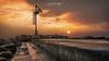
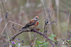
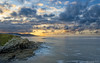
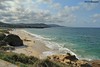
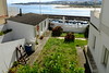
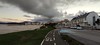
The above images may not be of the site on this page, but were taken nearby. They are loaded from Flickr so please click on them for image credits.
Click here to see more info for this site
Nearby sites
Click here to view sites on an interactive map of the areaKey: Red: member's photo, Blue: 3rd party photo, Yellow: other image, Green: no photo - please go there and take one, Grey: site destroyed
Download sites to:
KML (Google Earth)
GPX (GPS waypoints)
CSV (Garmin/Navman)
CSV (Excel)
To unlock full downloads you need to sign up as a Contributory Member. Otherwise downloads are limited to 50 sites.
Turn off the page maps and other distractions
Nearby sites listing. In the following links * = Image available
1.3km NE 51° Castro do Carreiro Castro or Chafurdão
1.3km N 351° Castro de Llas Castro or Chafurdão
1.3km SW 224° Castro do Río Castro or Chafurdão
2.2km E 97° Castro de San Bartolomé Castro or Chafurdão
3.0km SSW 213° Castro de Vilaronte Castro or Chafurdão
4.7km NW 322° Castro de Fazouro* Castro or Chafurdão
5.0km E 101° Castro da Punta San Pedro Castro or Chafurdão
5.7km NW 321° Castro de Nois Castro or Chafurdão
6.6km NW 323° Castro do Curveiro (Nois) Castro or Chafurdão
6.9km E 97° Castro da Punta do Gabito Castro or Chafurdão
8.3km ESE 114° A Roda Henge Henge
8.7km S 185° Castro de Vilamar Castro or Chafurdão
8.7km NW 320° Castro de Punta dos Castros (Cangas) Castro or Chafurdão
9.8km SSW 206° Castro de Picote (Santo André) Castro or Chafurdão
10.3km E 99° Castro da Devesa Castro or Chafurdão
11.6km E 99° Castro de Meirengos Castro or Chafurdão
12.0km SE 143° Castro da Aira da Croa de Arante Castro or Chafurdão
12.1km SE 133° Pedrafita Marco da Pena Verde Standing Stone (Menhir)
12.7km S 186° Castro da Bouza da Viña Castro or Chafurdão
13.2km SE 137° Castro da Croa (Ribadeo) Castro or Chafurdão
13.4km SE 142° Mámoa das Pallaregas Round Barrow(s)
13.5km NW 325° Castro de Burela Castro or Chafurdão
13.5km S 191° Castro de Chantado Castro or Chafurdão
14.9km ESE 123° Sa Podomorfos Rock Art
15.3km E 97° Castro de Fornelo (Piñeira) Castro or Chafurdão
View more nearby sites and additional images


 We would like to know more about this location. Please feel free to add a brief description and any relevant information in your own language.
 Wir möchten mehr über diese Stätte erfahren. Bitte zögern Sie nicht, eine kurze Beschreibung und relevante Informationen in Deutsch hinzuzufügen.
 Nous aimerions en savoir encore un peu sur les lieux. S'il vous plaît n'hesitez pas à ajouter une courte description et tous les renseignements pertinents dans votre propre langue.
 Quisieramos informarnos un poco más de las lugares. No dude en añadir una breve descripción y otros datos relevantes en su propio idioma.