


<< Our Photo Pages >> Museu do Sabugal - Museum in Portugal in Guarda
Submitted by Alta-Falisa on Tuesday, 02 June 2015 Page Views: 1311
MuseumsSite Name: Museu do SabugalCountry: Portugal
NOTE: This site is 16.167 km away from the location you searched for.
Distrito: Guarda Type: Museum
Nearest Town: Sabugal
Latitude: 40.352300N Longitude: 7.0929W
Condition:
| 5 | Perfect |
| 4 | Almost Perfect |
| 3 | Reasonable but with some damage |
| 2 | Ruined but still recognisable as an ancient site |
| 1 | Pretty much destroyed, possibly visible as crop marks |
| 0 | No data. |
| -1 | Completely destroyed |
| 5 | Superb |
| 4 | Good |
| 3 | Ordinary |
| 2 | Not Good |
| 1 | Awful |
| 0 | No data. |
| 5 | Can be driven to, probably with disabled access |
| 4 | Short walk on a footpath |
| 3 | Requiring a bit more of a walk |
| 2 | A long walk |
| 1 | In the middle of nowhere, a nightmare to find |
| 0 | No data. |
| 5 | co-ordinates taken by GPS or official recorded co-ordinates |
| 4 | co-ordinates scaled from a detailed map |
| 3 | co-ordinates scaled from a bad map |
| 2 | co-ordinates of the nearest village |
| 1 | co-ordinates of the nearest town |
| 0 | no data |
Internal Links:
External Links:
")
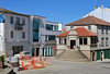
A small but very dynamic museum, retracing the major steps of regional and national history and regularly organizing thematic exhibitions. Pleasantly arranged, with very readable information panels in each room.
The visitors already versed in history will probably not learn much new to them. But it is always important to assess how history is perceived "elsewhere", what retained the attention.
Next to the Museum, the Castle of Sabugal is also worth a visit : the Old Town is built inside her walls.
Official site of the museum http://www.museusabugal.net/
You may be viewing yesterday's version of this page. To see the most up to date information please register for a free account.
")
")
")
Do not use the above information on other web sites or publications without permission of the contributor.
Nearby Images from Flickr
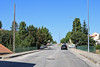
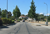
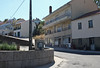

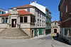
The above images may not be of the site on this page, but were taken nearby. They are loaded from Flickr so please click on them for image credits.
Click here to see more info for this site
Nearby sites
Click here to view sites on an interactive map of the areaKey: Red: member's photo, Blue: 3rd party photo, Yellow: other image, Green: no photo - please go there and take one, Grey: site destroyed
Download sites to:
KML (Google Earth)
GPX (GPS waypoints)
CSV (Garmin/Navman)
CSV (Excel)
To unlock full downloads you need to sign up as a Contributory Member. Otherwise downloads are limited to 50 sites.
Turn off the page maps and other distractions
Nearby sites listing. In the following links * = Image available
16.7km N 1° Sepultura antropomórfica de Rochoso* Rock Cut Tomb
18.2km N 1° Menires de Rochoso* Standing Stones
21.3km W 278° Torre de Centum Cellas Ancient Village or Settlement
21.9km W 272° Castro da Chandeirinha de Belmonte Castro or Chafurdão
22.3km W 264° Villa Romana da Fórnea Ancient Village or Settlement
23.2km SE 144° El Palancar Burial Chamber or Dolmen
24.3km WSW 257° Anta da Rotunda de Caria* Modern Stone Circle etc
25.1km N 355° Castro do Jarmelo Castro or Chafurdão
25.2km NE 45° Anta da Pedra de Anta Burial Chamber or Dolmen
25.4km NNW 327° Nossa Senhora da Póvoa de Mileu Ancient Village or Settlement
26.5km W 267° Castro de Orjais e ruínas dunha construción ao carón da capela de Nossa Senhora Castro or Chafurdão
26.9km WNW 301° Sepulturas antropomórficas de la Ermida de Nª Sª de Soito* Rock Cut Tomb
29.5km NW 322° Castro de Tintinolho Castro or Chafurdão
30.6km SSE 155° Salvaleon Castro or Chafurdão
31.7km NNW 344° Anta de Pêra do Moço* Burial Chamber or Dolmen
34.0km NNE 28° Piedra Caballero en Castelo Bom* Natural Stone / Erratic / Other Natural Feature
39.2km SW 225° Castro da Covilhã Velha Castro or Chafurdão
39.8km S 186° Idanha a Velha Ancient Village or Settlement
42.3km NW 323° Estação arqueólogica de São Gens* Rock Cut Tomb
42.6km W 276° Vale do Rossim* Rock Outcrop
43.1km W 266° Serra de Estrela* Rock Outcrop
45.3km W 279° Sabugueiro Cross II* Early Christian Sculptured Stone
46.1km NW 314° Castro de Santiago* Castro or Chafurdão
48.1km W 278° Sabugueiro Cross I* Early Christian Sculptured Stone
49.3km NNE 20° Necrópole de sepulturas escavadas na rocha em Malpartida* Rock Cut Tomb
View more nearby sites and additional images


 We would like to know more about this location. Please feel free to add a brief description and any relevant information in your own language.
 Wir möchten mehr über diese Stätte erfahren. Bitte zögern Sie nicht, eine kurze Beschreibung und relevante Informationen in Deutsch hinzuzufügen.
 Nous aimerions en savoir encore un peu sur les lieux. S'il vous plaît n'hesitez pas à ajouter une courte description et tous les renseignements pertinents dans votre propre langue.
 Quisieramos informarnos un poco más de las lugares. No dude en añadir una breve descripción y otros datos relevantes en su propio idioma.