


<< Text Pages >> Castro de Pumarega - Castro or Chafurdão in Spain in Galicia
Submitted by holger_rix on Sunday, 13 December 2015 Page Views: 582
Iron Age and Later PrehistorySite Name: Castro de PumaregaCountry: Spain
NOTE: This site is 0.378 km away from the location you searched for.
Region: Galicia Type: Castro or Chafurdão
Nearest Town: Coruña Nearest Village: Ribadeo
Latitude: 43.494070N Longitude: 7.10379W
Condition:
| 5 | Perfect |
| 4 | Almost Perfect |
| 3 | Reasonable but with some damage |
| 2 | Ruined but still recognisable as an ancient site |
| 1 | Pretty much destroyed, possibly visible as crop marks |
| 0 | No data. |
| -1 | Completely destroyed |
| 5 | Superb |
| 4 | Good |
| 3 | Ordinary |
| 2 | Not Good |
| 1 | Awful |
| 0 | No data. |
| 5 | Can be driven to, probably with disabled access |
| 4 | Short walk on a footpath |
| 3 | Requiring a bit more of a walk |
| 2 | A long walk |
| 1 | In the middle of nowhere, a nightmare to find |
| 0 | No data. |
| 5 | co-ordinates taken by GPS or official recorded co-ordinates |
| 4 | co-ordinates scaled from a detailed map |
| 3 | co-ordinates scaled from a bad map |
| 2 | co-ordinates of the nearest village |
| 1 | co-ordinates of the nearest town |
| 0 | no data |
Be the first person to rate this site - see the 'Contribute!' box in the right hand menu.
Internal Links:
External Links:
Castro in Galicia
You may be viewing yesterday's version of this page. To see the most up to date information please register for a free account.
Do not use the above information on other web sites or publications without permission of the contributor.
Nearby Images from Flickr
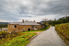
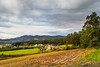

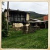
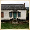
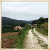
The above images may not be of the site on this page, but were taken nearby. They are loaded from Flickr so please click on them for image credits.
Click here to see more info for this site
Nearby sites
Click here to view sites on an interactive map of the areaKey: Red: member's photo, Blue: 3rd party photo, Yellow: other image, Green: no photo - please go there and take one, Grey: site destroyed
Download sites to:
KML (Google Earth)
GPX (GPS waypoints)
CSV (Garmin/Navman)
CSV (Excel)
To unlock full downloads you need to sign up as a Contributory Member. Otherwise downloads are limited to 50 sites.
Turn off the page maps and other distractions
Nearby sites listing. In the following links * = Image available
487m NNW 327° Sa Podomorfos Rock Art
2.4km ESE 118° Castro da Torre (Ribadeo) Castro or Chafurdão
3.9km ENE 58° Castro de Cárcovas Castro or Chafurdão
4.0km WSW 253° Castro da Croa (Ribadeo) Castro or Chafurdão
4.1km W 273° Pedrafita Marco da Pena Verde Standing Stone (Menhir)
5.0km WSW 246° Mámoa das Pallaregas Round Barrow(s)
5.7km W 259° Castro da Aira da Croa de Arante Castro or Chafurdão
5.9km SSW 209° Castro de Sante Castro or Chafurdão
6.9km NNW 349° Castro de Meirengos Castro or Chafurdão
7.1km NNE 19° Castro de Fornelo (Piñeira) Castro or Chafurdão
7.3km NW 314° A Roda Henge Henge
7.3km NNW 339° Castro da Devesa Castro or Chafurdão
8.1km NNE 33° Castro das Grobas Castro or Chafurdão
9.7km NW 322° Castro da Punta do Gabito Castro or Chafurdão
10.1km S 189° Dolmen do Pico da Modia Burial Chamber or Dolmen
10.1km S 188° Túmulo de Ceán Round Barrow(s)
10.4km SSW 197° Castro de Coas do Castro Castro or Chafurdão
10.4km SSW 196° Os Castros (Salcido) Castro or Chafurdão
10.9km NW 314° Castro da Punta San Pedro Castro or Chafurdão
11.7km S 183° Necrópole do Monte A Xunqueira Barrow Cemetery
13.5km NW 308° Castro de San Bartolomé Castro or Chafurdão
13.5km W 269° Castro de Vilamar Castro or Chafurdão
13.8km SE 138° Castro de Molexón Castro or Chafurdão
13.9km ENE 57° El Castelo d'Esteiro Castro or Chafurdão
14.8km WSW 254° Castro da Bouza da Viña Castro or Chafurdão
View more nearby sites and additional images


 We would like to know more about this location. Please feel free to add a brief description and any relevant information in your own language.
 Wir möchten mehr über diese Stätte erfahren. Bitte zögern Sie nicht, eine kurze Beschreibung und relevante Informationen in Deutsch hinzuzufügen.
 Nous aimerions en savoir encore un peu sur les lieux. S'il vous plaît n'hesitez pas à ajouter une courte description et tous les renseignements pertinents dans votre propre langue.
 Quisieramos informarnos un poco más de las lugares. No dude en añadir una breve descripción y otros datos relevantes en su propio idioma.