


<< Text Pages >> Dun Innisgall - Stone Fort or Dun in Scotland in Isle of Harris
Submitted by SolarMegalith on Tuesday, 20 December 2011 Page Views: 2258
Multi-periodSite Name: Dun InnisgallCountry: Scotland
NOTE: This site is 0.901 km away from the location you searched for.
County: Isle of Harris Type: Stone Fort or Dun
Nearest Town: Carminish
Map Ref: NG01948521
Latitude: 57.757194N Longitude: 7.01295W
Condition:
| 5 | Perfect |
| 4 | Almost Perfect |
| 3 | Reasonable but with some damage |
| 2 | Ruined but still recognisable as an ancient site |
| 1 | Pretty much destroyed, possibly visible as crop marks |
| 0 | No data. |
| -1 | Completely destroyed |
| 5 | Superb |
| 4 | Good |
| 3 | Ordinary |
| 2 | Not Good |
| 1 | Awful |
| 0 | No data. |
| 5 | Can be driven to, probably with disabled access |
| 4 | Short walk on a footpath |
| 3 | Requiring a bit more of a walk |
| 2 | A long walk |
| 1 | In the middle of nowhere, a nightmare to find |
| 0 | No data. |
| 5 | co-ordinates taken by GPS or official recorded co-ordinates |
| 4 | co-ordinates scaled from a detailed map |
| 3 | co-ordinates scaled from a bad map |
| 2 | co-ordinates of the nearest village |
| 1 | co-ordinates of the nearest town |
| 0 | no data |
Internal Links:
External Links:
Dun in Isle of Harris
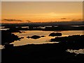
Remains of an Iron Age dun on a small islet. Traces of the outer wall can still be distinguished.
Read More at Canmore.
You may be viewing yesterday's version of this page. To see the most up to date information please register for a free account.
Do not use the above information on other web sites or publications without permission of the contributor.
Nearby Images from Geograph Britain and Ireland:
©2023(licence)
©2023(licence)
©2009(licence)
©2009(licence)
©2009(licence)
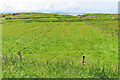
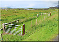
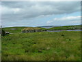
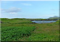
The above images may not be of the site on this page, they are loaded from Geograph.
Please Submit an Image of this site or go out and take one for us!
Click here to see more info for this site
Nearby sites
Key: Red: member's photo, Blue: 3rd party photo, Yellow: other image, Green: no photo - please go there and take one, Grey: site destroyed
Download sites to:
KML (Google Earth)
GPX (GPS waypoints)
CSV (Garmin/Navman)
CSV (Excel)
To unlock full downloads you need to sign up as a Contributory Member. Otherwise downloads are limited to 50 sites.
Turn off the page maps and other distractions
Nearby sites listing. In the following links * = Image available
3.3km SE 125° Roghadal (Rodel) Stone Circle (NG045831)
3.4km NW 313° Rubha Charnain* Rock Art (NF996877)
3.6km ESE 118° Dun Rodil Broch or Nuraghe (NG05018330)
4.1km WNW 288° Ensay Rock Art (NF981868)
4.1km WNW 286° Taigh Easaigh Standing Stone Standing Stone (Menhir) (NF9804186677)
7.8km NW 317° Rubh' an Teampuill, Toe Head* Broch or Nuraghe (NF97019133)
7.8km NW 316° Harris, Rubh' An Teampuill* Rock Art (NF96969129)
8.7km N 357° S46 Scarista* Stone Row / Alignment (NG0217793898)
8.7km N 356° Borvemore* Stone Row / Alignment (NG02029392)
8.9km N 5° Dun Borve (nr Scarista)* Broch or Nuraghe (NG034940)
9.8km WSW 251° Bhruist Stone Circle* Stone Circle (NF92418279)
10.2km WSW 247° Cnoc na Greana* Stone Row / Alignment (NF9230781876)
11.6km WSW 243° Cladh Maolrithe* Standing Stone (Menhir) (NF91218068)
11.7km N 9° Coire Na Feinne* Chambered Cairn (NG0471896628)
11.8km WSW 248° Sgalabraig* Souterrain (Fogou, Earth House) (NF90718153)
12.1km N 6° Clach Mhic Leoid* Standing Stone (Menhir) (NG04109718)
12.7km SSW 195° Dun Mhic Laitheann Stone Fort or Dun (NF9778873187)
14.3km WSW 237° Crois Mhic Jamain* Stone Row / Alignment (NF89397820)
14.4km SW 234° Dun an Sticir* Broch or Nuraghe (NF897776)
14.4km WSW 238° Port nan Long Souterrain (Fogou, Earth House) (NF892784)
14.4km SW 231° Beinn A Chaolais Stone Circle (NF900770)
15.2km WNW 289° Bhruist (Shillay) Stone Circle (NF880913)
15.3km SW 234° Baile Mhic' Phàil Stone Setting* Cairn (NF88937711)
15.5km N 353° Clach An Teampuill (Taransay)* Standing Stone (Menhir) (NB01280077)
16.8km SW 232° Dun Rosail Stone Fort or Dun (NF87837595)
View more nearby sites and additional images


 We would like to know more about this location. Please feel free to add a brief description and any relevant information in your own language.
 Wir möchten mehr über diese Stätte erfahren. Bitte zögern Sie nicht, eine kurze Beschreibung und relevante Informationen in Deutsch hinzuzufügen.
 Nous aimerions en savoir encore un peu sur les lieux. S'il vous plaît n'hesitez pas à ajouter une courte description et tous les renseignements pertinents dans votre propre langue.
 Quisieramos informarnos un poco más de las lugares. No dude en añadir una breve descripción y otros datos relevantes en su propio idioma.