 with our Megalithic Portal iPhone app")


<< Our Photo Pages >> Quebec ice dolmen - Modern Stone Circle etc in Canada
Submitted by theCaptain on Tuesday, 22 December 2009 Page Views: 10838
Modern SitesSite Name: Quebec ice dolmenCountry: Canada
NOTE: This site is 208.725 km away from the location you searched for.
Type: Modern Stone Circle etc
Nearest Town: Québec
Latitude: 46.809000N Longitude: 71.211W
Condition:
| 5 | Perfect |
| 4 | Almost Perfect |
| 3 | Reasonable but with some damage |
| 2 | Ruined but still recognisable as an ancient site |
| 1 | Pretty much destroyed, possibly visible as crop marks |
| 0 | No data. |
| -1 | Completely destroyed |
| 5 | Superb |
| 4 | Good |
| 3 | Ordinary |
| 2 | Not Good |
| 1 | Awful |
| 0 | No data. |
| 5 | Can be driven to, probably with disabled access |
| 4 | Short walk on a footpath |
| 3 | Requiring a bit more of a walk |
| 2 | A long walk |
| 1 | In the middle of nowhere, a nightmare to find |
| 0 | No data. |
| 5 | co-ordinates taken by GPS or official recorded co-ordinates |
| 4 | co-ordinates scaled from a detailed map |
| 3 | co-ordinates scaled from a bad map |
| 2 | co-ordinates of the nearest village |
| 1 | co-ordinates of the nearest town |
| 0 | no data |
Internal Links:
External Links:
I have visited· I would like to visit
TheCaptain has visited here
")
The year I visited, 1989, amongst all of the various ice carvngs and sculptures, there was a massive ice dolmen, made I believe by some Breton people. I could not of course, pass it by without taking a photograph.
Should you be thinking of visiting Québec for this wonderful carnival, be prepared for the cold. For the several days I was there, the temperature did not manage to rise above -25°C, and was at times touching -40°. This is seriously cold, and hurts; bare skin should not be exposed more than a few seconds.
Also beware the Caribou, a feisty alcoholic beverage, the recipe for which varies from the purist port, brandy and maple syrup, to others which can contain cheap red wine , whisky, vodka or basic ethanol! The drink is carried either in a pouch or a hollow walking stick.
You may be viewing yesterday's version of this page. To see the most up to date information please register for a free account.
Do not use the above information on other web sites or publications without permission of the contributor.
Nearby Images from Flickr
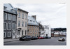
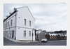
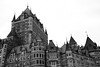

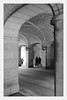
The above images may not be of the site on this page, but were taken nearby. They are loaded from Flickr so please click on them for image credits.
Click here to see more info for this site
Nearby sites
Click here to view sites on an interactive map of the areaKey: Red: member's photo, Blue: 3rd party photo, Yellow: other image, Green: no photo - please go there and take one, Grey: site destroyed
Download sites to:
KML (Google Earth)
GPX (GPS waypoints)
CSV (Garmin/Navman)
CSV (Excel)
To unlock full downloads you need to sign up as a Contributory Member. Otherwise downloads are limited to 50 sites.
Turn off the page maps and other distractions
Nearby sites listing. In the following links * = Image available
230.6km SW 233° Charles De Gaulle Obelisk* Modern Stone Circle etc
239.3km SSW 205° Balancing Stone Westfield Natural Stone / Erratic / Other Natural Feature
273.7km SSW 203° Elmore Balancing Rock* Natural Stone / Erratic / Other Natural Feature
290.9km SW 220° Earthwood Modern Stone Circle Modern Stone Circle etc
310.0km SW 226° Earthwood new stone circle Modern Stone Circle etc
356.0km SSW 194° Humming Stone Norwich (Summstein) Modern Stone Circle etc
375.3km SSW 196° Calendar II* Artificial Mound
379.0km WSW 248° Canadian Museum of History* Museum
382.6km SE 127° Machias Bay Petroglyphs Rock Art
393.8km S 187° Mount Kearsarge Indian Museum Museum
408.6km E 86° Augustine Mound Round Barrow(s)
410.4km S 180° Pawtuckaway Balancing Rock* Natural Stone / Erratic / Other Natural Feature
418.5km WSW 236° Maitland Tower* Modern Stone Circle etc
419.8km SSW 194° Bellows Falls Petroglyphs* Rock Art
441.0km S 180° America's Stonehenge* Ancient Village or Settlement
451.1km SSW 194° Brattleboro Petroglyphs Rock Art
457.1km SSW 194° Humming Stone Guilford (Summstein) Modern Stone Circle etc
471.5km SW 232° Perch Lake mounds* Artificial Mound
477.9km SSW 196° Burnt Hill Heath* Stone Circle
480.3km SSW 193° Turner's Falls Standing Stones
481.8km S 187° Wachusett Stone* Natural Stone / Erratic / Other Natural Feature
501.2km SSW 195° Balanced rock Goshen* Natural Stone / Erratic / Other Natural Feature
505.2km SSW 200° Balance Stone Lanesborough Natural Stone / Erratic / Other Natural Feature
509.0km SSW 193° Potential Grinding Stone at Northampton Site Polissoir
509.1km SSW 193° Early Archaic Settlement Site on North King Street* Ancient Village or Settlement
View more nearby sites and additional images


 We would like to know more about this location. Please feel free to add a brief description and any relevant information in your own language.
 Wir möchten mehr über diese Stätte erfahren. Bitte zögern Sie nicht, eine kurze Beschreibung und relevante Informationen in Deutsch hinzuzufügen.
 Nous aimerions en savoir encore un peu sur les lieux. S'il vous plaît n'hesitez pas à ajouter une courte description et tous les renseignements pertinents dans votre propre langue.
 Quisieramos informarnos un poco más de las lugares. No dude en añadir una breve descripción y otros datos relevantes en su propio idioma.