


<< Text Pages >> Armaghlughey - Ancient Village or Settlement in Ireland (Northern) in Co. Armagh
Submitted by Andy B on Monday, 14 September 2009 Page Views: 6474
Multi-periodSite Name: ArmaghlugheyCountry: Ireland (Northern)
NOTE: This site is 7.225 km away from the location you searched for.
County: Co. Armagh Type: Ancient Village or Settlement
Nearest Town: Ballygawley Nearest Village: Armaghlughey
Latitude: 54.460690N Longitude: 7.02239W
Condition:
| 5 | Perfect |
| 4 | Almost Perfect |
| 3 | Reasonable but with some damage |
| 2 | Ruined but still recognisable as an ancient site |
| 1 | Pretty much destroyed, possibly visible as crop marks |
| 0 | No data. |
| -1 | Completely destroyed |
| 5 | Superb |
| 4 | Good |
| 3 | Ordinary |
| 2 | Not Good |
| 1 | Awful |
| 0 | No data. |
| 5 | Can be driven to, probably with disabled access |
| 4 | Short walk on a footpath |
| 3 | Requiring a bit more of a walk |
| 2 | A long walk |
| 1 | In the middle of nowhere, a nightmare to find |
| 0 | No data. |
| 5 | co-ordinates taken by GPS or official recorded co-ordinates |
| 4 | co-ordinates scaled from a detailed map |
| 3 | co-ordinates scaled from a bad map |
| 2 | co-ordinates of the nearest village |
| 1 | co-ordinates of the nearest town |
| 0 | no data |
Internal Links:
External Links:
Ancient Settlement and possible Stone Circle in Co. Armagh. "Tyrone has a Stonehenge of its own" [Pause while the MegP Ed emits characteristic groan at this point]. Traces of a neolithic worship site near Ballygawley that could be Tyrone's version of Stonehenge have been discovered by archaeologists working on the site of the A4 dual carriageway.
The three-year long excavation project, which was carried out by Headland Group, a Scottish based firm, is one of the largest in Northern Ireland to date.
Scientists uncovered a roughly 5,000 year-old circular site in the townland of Armaghlughey which contains graves, evidence of timber buildings and burnt pits that bear a strong resemblance to Stonehenge and the Giant's Ring near Belfast, both of which are prehistoric stone circle sites.
At a nearby excavation, the archaeologists were also surprised to find a 6,000 year old pit, with small quantities of human bone and pottery flakes.
A single cremation burial bit with an inverted urn, dated to between 1910 and 1730BC, was subsequently discovered.
It's believed that rituals and ceremonies took place at the site, possibly even sacrifices. One difference to Stonehenge is that the building remains are made out of wood rather than stone.
The archaeologists also found evidence of Christian worship further west of the site where a large early Medieval ringfort or possible ecclesiastical site was excavated.
In total there were 65 sites or areas of archaeological potential on the A4/5, including numerous burnt mounds (prehistoric cooking sites), two ring forts, a prehistoric settlement, a Bronze Age ritual timber alignment and three very large ring ditch enclosures, which were probably burial mounds, and a mill lade.
Following field work, summary reports on each of the sites was produced and submitted to Dr Michael Avery of Archaeological Associates (Ireland) and Kate Robb of John Cronin Consultants.
The Edinburgh based firm of archaeologists said it had ensured that the A4 roadworks proceeded without damaging historical sites and artefacts and where there were unexpected discoveries, recorded and excavated these sites to professional standards.
The team are currently working on the final publication of their findings which should be submitted to the Roads Service in Spring 2010.
Source: Tyrone Times
Note: 4,000-year-old timber circle found in Tyrone, see comment
You may be viewing yesterday's version of this page. To see the most up to date information please register for a free account.
Do not use the above information on other web sites or publications without permission of the contributor.
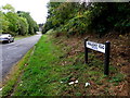
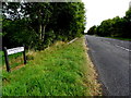
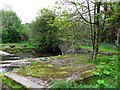
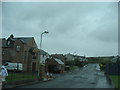
Nearby Images from Geograph Britain and Ireland:
©2014(licence)
©2014(licence)
©2010(licence)
©2009(licence)
©2014(licence)
The above images may not be of the site on this page, they are loaded from Geograph.
Please Submit an Image of this site or go out and take one for us!
Click here to see more info for this site
Nearby sites
Click here to view sites on an interactive map of the areaKey: Red: member's photo, Blue: 3rd party photo, Yellow: other image, Green: no photo - please go there and take one, Grey: site destroyed
Download sites to:
KML (Google Earth)
GPX (GPS waypoints)
CSV (Garmin/Navman)
CSV (Excel)
To unlock full downloads you need to sign up as a Contributory Member. Otherwise downloads are limited to 50 sites.
Turn off the page maps and other distractions
Nearby sites listing. In the following links * = Image available
3.2km WNW 290° Sess Kilgreen Passage Grave Passage Grave (H6040358432)
3.4km WNW 292° Sess Kilgreen* Standing Stone (Menhir) (H6025758605)
8.8km W 261° Knockmany* Passage Grave (H547559)
11.3km SW 224° Carnfadrig* Chambered Tomb
11.4km SW 224° Carnfadrig Megalithic Tombs Burial Chamber or Dolmen (H556490)
12.2km SSW 212° Ballywholan* Chambered Tomb
12.2km SSW 213° Carnagat Dual Court Tomb Court Tomb (H570470)
12.7km NNE 16° Altmore Court Tomb Court Tomb (H6687569578)
13.4km NNE 23° Cornamaddy B Stone Circle (H686697)
13.4km NNE 23° Cornamaddy Stone Row / Alignment (H6858069720)
13.4km NNE 23° Cornamaddy A Stone Circle (H685698)
13.5km NNE 23° Turnabarson NW Stone Circle (H6856069870)
13.6km NNE 25° Turnabarson SE Stone Circle (H6894069770)
15.6km N 359° Creggandevesky Stone Circle (H630730)
16.0km WSW 242° Clogherny Butterlope Stone Row / Alignment (H493497)
16.1km N 8° Tremoge SW Stone Row / Alignment (H654733)
16.1km N 8° Tremoge SW Stone Circle (H654733)
16.4km N 9° Tremoge NE Stone Row / Alignment (H657736)
16.4km N 9° Tremoge Center W. E Stone Circle (H65727365)
16.4km N 9° Tremoge Center W. W Stone Circle (H65727365)
16.4km N 9° Tremoge Center E Stone Circle (H65727365)
16.6km N 8° Tremoge N Stone Row / Alignment (H655738)
17.7km N 5° Creggandevesky* Court Tomb (H6459975037)
17.9km N 5° Cregganconroe SW Stone Row / Alignment (H648752)
17.9km N 5° Cregganconroe SW Stone Circle (H6479075210)
View more nearby sites and additional images


 We would like to know more about this location. Please feel free to add a brief description and any relevant information in your own language.
 Wir möchten mehr über diese Stätte erfahren. Bitte zögern Sie nicht, eine kurze Beschreibung und relevante Informationen in Deutsch hinzuzufügen.
 Nous aimerions en savoir encore un peu sur les lieux. S'il vous plaît n'hesitez pas à ajouter une courte description et tous les renseignements pertinents dans votre propre langue.
 Quisieramos informarnos un poco más de las lugares. No dude en añadir una breve descripción y otros datos relevantes en su propio idioma.