


<< Our Photo Pages >> Callanish 18 - Standing Stone (Menhir) in Scotland in Isle of Lewis
Submitted by Anonymous on Thursday, 15 February 2001 Page Views: 5236
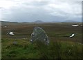
Neolithic and Bronze AgeSite Name: Callanish 18 Alternative Name: Loch Crogach, Callanish XVIIICountry: Scotland
NOTE: This site is 5.969 km away from the location you searched for.
County: Isle of Lewis Type: Standing Stone (Menhir)
Nearest Town: Stornoway Nearest Village: Callanish
Map Ref: NB24402923 Landranger Map Number: 8
Latitude: 58.165619N Longitude: 6.688077W
Condition:
| 5 | Perfect |
| 4 | Almost Perfect |
| 3 | Reasonable but with some damage |
| 2 | Ruined but still recognisable as an ancient site |
| 1 | Pretty much destroyed, possibly visible as crop marks |
| 0 | No data. |
| -1 | Completely destroyed |
| 5 | Superb |
| 4 | Good |
| 3 | Ordinary |
| 2 | Not Good |
| 1 | Awful |
| 0 | No data. |
| 5 | Can be driven to, probably with disabled access |
| 4 | Short walk on a footpath |
| 3 | Requiring a bit more of a walk |
| 2 | A long walk |
| 1 | In the middle of nowhere, a nightmare to find |
| 0 | No data. |
| 5 | co-ordinates taken by GPS or official recorded co-ordinates |
| 4 | co-ordinates scaled from a detailed map |
| 3 | co-ordinates scaled from a bad map |
| 2 | co-ordinates of the nearest village |
| 1 | co-ordinates of the nearest town |
| 0 | no data |
Internal Links:
External Links:
")
A small standing stone placed on an outcrop behind the southeastern end of H-shaped lake. Although this stone is less than 1m high, it can be recognized from far distance. This stone might be a marker of the edge of an area or a guiding landmark for some observation. Canmore site no. 4145.
You may be viewing yesterday's version of this page. To see the most up to date information please register for a free account.
")
")
Do not use the above information on other web sites or publications without permission of the contributor.
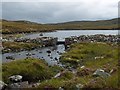
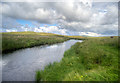
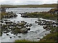
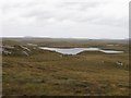
Nearby Images from Geograph Britain and Ireland:
©2016(licence)
©2016(licence)
©2016(licence)
©2009(licence)
©2016(licence)
The above images may not be of the site on this page, they are loaded from Geograph.
Please Submit an Image of this site or go out and take one for us!
Click here to see more info for this site
Nearby sites
Key: Red: member's photo, Blue: 3rd party photo, Yellow: other image, Green: no photo - please go there and take one, Grey: site destroyed
Download sites to:
KML (Google Earth)
GPX (GPS waypoints)
CSV (Garmin/Navman)
CSV (Excel)
To unlock full downloads you need to sign up as a Contributory Member. Otherwise downloads are limited to 50 sites.
Turn off the page maps and other distractions
Nearby sites listing. In the following links * = Image available
1.1km N 9° Callanish 6* Standing Stones (NB24653034)
1.2km WNW 301° Callanish 5* Stone Row / Alignment (NB23432990)
1.2km WNW 289° Callanish 9* Standing Stones (NB233297)
1.5km NW 305° Callanish 7* Ancient Mine, Quarry or other Industry (NB232302)
1.8km NW 306° Callanish 4* Stone Circle (NB2298830412)
2.9km NNW 342° Callanish 17* Stone Circle (NB237320)
3.3km NW 325° Cnoc Fillibhir Mhor* Stone Row / Alignment (NB22683207)
3.9km NW 322° Loch Roag Timber Circle (NB222325)
3.9km NNW 328° Callanish 3* Stone Circle (NB2251532710)
4.0km NNW 333° Callanish 14* Standing Stone (Menhir) (NB228329)
4.0km NW 323° Callanish 2* Stone Circle (NB2221432614)
4.6km NNW 338° Callanish 10* Stone Circle (NB22973362)
4.6km NW 322° Callanish 19* Stone Circle (NB218331)
4.9km NW 317° Callanish* Stone Circle (NB2129833013)
4.9km NW 317° Callanish I* Stone Circle (NB2128633009)
5.5km NW 322° Callanish 16* Standing Stone (Menhir) (NB213338)
5.7km NW 325° Callanish 13* Standing Stones (NB215341)
6.1km NNW 331° Olcote Kerbed Cairn* Cairn (NB2179634733)
6.4km NNW 330° Callanish 12* Standing Stone (Menhir) (NB2155634967)
6.8km NNW 337° Callanish 11* Standing Stone (Menhir) (NB22233569)
7.1km NNW 328° Cnoc a Phrionnsa* Chambered Cairn (NB211355)
7.3km E 86° Achmore* Stone Circle (NB31742926)
8.5km NW 304° Callanish 15* Standing Stone (Menhir) (NB177345)
9.2km WNW 300° Dun Barraglom Broch or Nuraghe (NB16773435)
9.2km WNW 299° Barraglom Cup-Marked Rock Rock Art (NB167343)
View more nearby sites and additional images


 We would like to know more about this location. Please feel free to add a brief description and any relevant information in your own language.
 Wir möchten mehr über diese Stätte erfahren. Bitte zögern Sie nicht, eine kurze Beschreibung und relevante Informationen in Deutsch hinzuzufügen.
 Nous aimerions en savoir encore un peu sur les lieux. S'il vous plaît n'hesitez pas à ajouter une courte description et tous les renseignements pertinents dans votre propre langue.
 Quisieramos informarnos un poco más de las lugares. No dude en añadir una breve descripción y otros datos relevantes en su propio idioma.