 with our Megalithic Portal iPhone app")


<< Text Pages >> Navan Site B - Timber Circle in Ireland (Northern) in Co. Armagh
Submitted by vicky on Sunday, 22 December 2002 Page Views: 7918
Neolithic and Bronze AgeSite Name: Navan Site BCountry: Ireland (Northern)
NOTE: This site is 2.735 km away from the location you searched for.
County: Co. Armagh Type: Timber Circle
Map Ref: H848451
Discoverer Map Number: D19
Latitude: 54.347559N Longitude: 6.696709W
Condition:
| 5 | Perfect |
| 4 | Almost Perfect |
| 3 | Reasonable but with some damage |
| 2 | Ruined but still recognisable as an ancient site |
| 1 | Pretty much destroyed, possibly visible as crop marks |
| 0 | No data. |
| -1 | Completely destroyed |
| 5 | Superb |
| 4 | Good |
| 3 | Ordinary |
| 2 | Not Good |
| 1 | Awful |
| 0 | No data. |
| 5 | Can be driven to, probably with disabled access |
| 4 | Short walk on a footpath |
| 3 | Requiring a bit more of a walk |
| 2 | A long walk |
| 1 | In the middle of nowhere, a nightmare to find |
| 0 | No data. |
| 5 | co-ordinates taken by GPS or official recorded co-ordinates |
| 4 | co-ordinates scaled from a detailed map |
| 3 | co-ordinates scaled from a bad map |
| 2 | co-ordinates of the nearest village |
| 1 | co-ordinates of the nearest town |
| 0 | no data |
Internal Links:
External Links:
Timber Circle in Co. Armagh
Have you visited this site? Please add a comment below.
You may be viewing yesterday's version of this page. To see the most up to date information please register for a free account.
Do not use the above information on other web sites or publications without permission of the contributor.
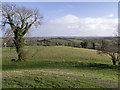
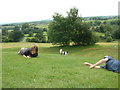
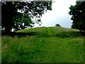
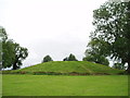
Nearby Images from Geograph Britain and Ireland:

©2005(licence)
©2015(licence)
©2005(licence)
©2014(licence)
©2017(licence)
The above images may not be of the site on this page, they are loaded from Geograph.
Please Submit an Image of this site or go out and take one for us!
Click here to see more info for this site
Nearby sites
Click here to view sites on an interactive map of the areaKey: Red: member's photo, Blue: 3rd party photo, Yellow: other image, Green: no photo - please go there and take one, Grey: site destroyed
Download sites to:
KML (Google Earth)
GPX (GPS waypoints)
CSV (Garmin/Navman)
CSV (Excel)
To unlock full downloads you need to sign up as a Contributory Member. Otherwise downloads are limited to 50 sites.
Turn off the page maps and other distractions
Nearby sites listing. In the following links * = Image available
141m NW 316° Navan Fort* Henge (H847452)
481m SW 220° Navan Centre Museum
1.2km NW 319° Ballybrolly Stone Circle (H840460)
7.8km SSE 148° Bull's Stone (Ballymacnab)* Ancient Cross (H89033855)
8.5km SE 130° Vicar's Cairn* Passage Grave
16.8km NNE 29° Derrycaw Standing Stone* Standing Stone (Menhir) (H928599)
24.1km SSW 206° Lennan Portal Tomb Portal Tomb (H74502324)
24.2km SE 134° Eswary Stone Row* Stone Row / Alignment (J025285)
24.2km SE 134° Eswary Court Tomb* Court Tomb (J0270428676)
24.5km WNW 301° Armaghlughey Ancient Village or Settlement
25.6km E 100° The Three Sisters* Stone Row / Alignment
26.5km E 99° Drumnahare* Standing Stone (Menhir) (J111415)
27.4km SE 143° Ballard Longstone* Standing Stone (Menhir) (J01622337)
27.5km ESE 113° Donaghmore High Cross Ancient Cross (J1044334964)
27.6km SSE 149° Latbirget Court Tomb (H9940821636)
27.7km SE 145° St Moninna's Holy Well (Killevy)* Holy Well or Sacred Spring (J010226)
27.7km W 275° Ballywholan* Chambered Tomb
27.7km WNW 300° Sess Kilgreen Passage Grave Passage Grave (H6040358432)
27.8km W 275° Carnagat Dual Court Tomb Court Tomb (H570470)
27.8km S 169° Annaghmare* Court Tomb (H9049017820)
27.9km SSE 149° Ballykeel* Portal Tomb (H9952721328)
27.9km WNW 300° Sess Kilgreen* Standing Stone (Menhir) (H6025758605)
27.9km SSW 197° Drumguillew Lower Court Tomb Court Tomb (H771182)
28.7km SSE 149° The Oul Grave Portal Tomb (H9991820624)
29.3km NNW 328° Turnabarson SE Stone Circle (H6894069770)
View more nearby sites and additional images


 We would like to know more about this location. Please feel free to add a brief description and any relevant information in your own language.
 Wir möchten mehr über diese Stätte erfahren. Bitte zögern Sie nicht, eine kurze Beschreibung und relevante Informationen in Deutsch hinzuzufügen.
 Nous aimerions en savoir encore un peu sur les lieux. S'il vous plaît n'hesitez pas à ajouter une courte description et tous les renseignements pertinents dans votre propre langue.
 Quisieramos informarnos un poco más de las lugares. No dude en añadir una breve descripción y otros datos relevantes en su propio idioma.