


<< Text Pages >> Arnabost - Souterrain (Fogou, Earth House) in Scotland in Isle of Coll
Submitted by Anne T on Wednesday, 19 April 2017 Page Views: 1300
Iron Age and Later PrehistorySite Name: ArnabostCountry: Scotland County: Isle of Coll Type: Souterrain (Fogou, Earth House)
Nearest Village: Arnabost
Map Ref: NM20966003
Latitude: 56.648602N Longitude: 6.553981W
Condition:
| 5 | Perfect |
| 4 | Almost Perfect |
| 3 | Reasonable but with some damage |
| 2 | Ruined but still recognisable as an ancient site |
| 1 | Pretty much destroyed, possibly visible as crop marks |
| 0 | No data. |
| -1 | Completely destroyed |
| 5 | Superb |
| 4 | Good |
| 3 | Ordinary |
| 2 | Not Good |
| 1 | Awful |
| 0 | No data. |
| 5 | Can be driven to, probably with disabled access |
| 4 | Short walk on a footpath |
| 3 | Requiring a bit more of a walk |
| 2 | A long walk |
| 1 | In the middle of nowhere, a nightmare to find |
| 0 | No data. |
| 5 | co-ordinates taken by GPS or official recorded co-ordinates |
| 4 | co-ordinates scaled from a detailed map |
| 3 | co-ordinates scaled from a bad map |
| 2 | co-ordinates of the nearest village |
| 1 | co-ordinates of the nearest town |
| 0 | no data |
Be the first person to rate this site - see the 'Contribute!' box in the right hand menu.
Internal Links:
External Links:
Souterrain (Fogou, Earth House) in Argyll
Details of this souterrain on the Isle of Coll are given on The Northern Antiquarian's (TNA) page: Arnabost, Coll, Argyll.
More information can be found on Canmore ID 21706, which tells us: "There is now no trace of the souterrain that was discovered at Arnabost about 1855 during the construction of the road from Sorisdale to Ballyhaugh; it lay under the carrigeway, immediately S of the junction with the road to Arinagour. From the entrance, which was situated on the NW side of the road and is now covered by a modern house, the passage extended SE in a gentle arc for about 11.6m before it broadened into a roughly circular chamber about 2.1m in diameter. The passage was about 0.7m in width and the walls were corbelled, rising to a maximum height if about 1.3m. The roof consisted partly of stone lintels and, according to the original account (E Beveridge 1903), partly of wood. The use of wood is most unusual, but it has also been inferred in the case of the souterrain at Bankfoot, Perthshire (NO03SE 13)."
In 1896 the chamber was excavated and a bronze pin, several fragments of coarse pottery, at least two flint flakes, and some bones and shells were found; two blue glass beads and 'a piece of twisted gold' are also said to have been found on other occasions. Only the two beads and the pin are known to have survived; one bead is in the Glasgow Art Gallery and Museum, and the other bead and the pin are in the National Museum of Antiquities of Scotland."
The Canmore Entry also tantalisingly adds "the passage is repurted to be still under the modern road, but its truncated SE end was sealed up with dry-stone walling some years ago."
Note: Have you visited this site? Are you able to confirm its existence? Do you have any photographs or further information you can add?
You may be viewing yesterday's version of this page. To see the most up to date information please register for a free account.
Do not use the above information on other web sites or publications without permission of the contributor.
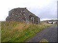
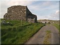
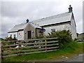
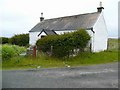
Nearby Images from Geograph Britain and Ireland:
©2009(licence)
©2011(licence)
©2014(licence)
©2008(licence)
©2006(licence)
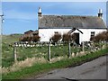
The above images may not be of the site on this page, they are loaded from Geograph.
Please Submit an Image of this site or go out and take one for us!
Click here to see more info for this site
Nearby sites
Key: Red: member's photo, Blue: 3rd party photo, Yellow: other image, Green: no photo - please go there and take one, Grey: site destroyed
Download sites to:
KML (Google Earth)
GPX (GPS waypoints)
CSV (Garmin/Navman)
CSV (Excel)
To unlock full downloads you need to sign up as a Contributory Member. Otherwise downloads are limited to 50 sites.
Turn off the page maps and other distractions
Nearby sites listing. In the following links * = Image available
3.4km SW 234° Clach na Ban-righ Natural Stone / Erratic / Other Natural Feature (NM181582)
4.0km SSW 212° Cnoc nan Tota Standing Stone (Menhir) (NM1858956758)
4.7km SSE 162° Fiskary Bay Mesolithic Settlement Ancient Village or Settlement (NM221555)
5.9km SW 223° Totronald* Standing Stones (NM1666455985)
8.8km SW 217° Traigh Chrossapol Standing Stone (Menhir) (NM1518853301)
15.9km ESE 108° Port Na Caillich Stone Fort or Dun (NM35785408)
16.7km ESE 110° Lag Standing Stones* Standing Stones (NM3626753307)
17.2km ESE 109° Allt Cill Chriosd Stone Fort or Dun (NM36885328)
17.6km SW 225° Caolas Standing Stone* Standing Stone (Menhir) (NM07744835)
17.6km SW 221° Dun Mor A'Chaolais* Broch or Nuraghe (NM084476)
17.6km SE 131° Dun Haunn Stone Fort or Dun (NM33434749)
17.8km ESE 115° Calgary Pier Stone Fort or Dun (NM36705151)
17.9km ESE 108° Cillchriosd Rock Art (NM37665347)
17.9km ESE 108° Cillchriosd* Standing Stone (Menhir) (NM3772553502)
18.2km ESE 121° Creag A' Chaisteal Rock Art (NM35874957)
19.1km ESE 110° Calgary* Stone Row / Alignment (NM38495231)
19.1km SSE 156° Dun Cruit Stone Fort or Dun (NM27634206)
19.5km SW 233° Dun Beag (Vaul)* Stone Fort or Dun (NM04634926)
19.6km ESE 108° Dun Mhadaidh* Stone Fort or Dun (NM39145260)
19.8km SW 233° Dun Mor Vaul* Broch or Nuraghe (NM04234927)
20.9km E 99° Quinish (Stone Row)* Stone Row / Alignment (NM41355524)
21.3km ESE 108° Dun Auladh Round Cairn (NM40815212)
21.4km ESE 103° Quinish Cist* Cist (NM41505385)
21.4km SW 234° Tiree Ringing Rock* Natural Stone / Erratic / Other Natural Feature (NM02684869)
21.7km SW 225° Dun Ghott* Stone Fort or Dun (NM04584567)
View more nearby sites and additional images


 We would like to know more about this location. Please feel free to add a brief description and any relevant information in your own language.
 Wir möchten mehr über diese Stätte erfahren. Bitte zögern Sie nicht, eine kurze Beschreibung und relevante Informationen in Deutsch hinzuzufügen.
 Nous aimerions en savoir encore un peu sur les lieux. S'il vous plaît n'hesitez pas à ajouter une courte description et tous les renseignements pertinents dans votre propre langue.
 Quisieramos informarnos un poco más de las lugares. No dude en añadir una breve descripción y otros datos relevantes en su propio idioma.