

<< Our Photo Pages >> Hurlstone - Holed Stone in Ireland (Republic of) in Co. Louth
Submitted by Anthony_Weir on Monday, 14 October 2002 Page Views: 8148
Neolithic and Bronze AgeSite Name: HurlstoneCountry: Ireland (Republic of)
NOTE: This site is 3.604 km away from the location you searched for.
County: Co. Louth Type: Holed Stone
Nearest Town: Ardee
Map Ref: N9426987509
Discovery Map Number: D14
Latitude: 53.828672N Longitude: 6.569061W
Condition:
| 5 | Perfect |
| 4 | Almost Perfect |
| 3 | Reasonable but with some damage |
| 2 | Ruined but still recognisable as an ancient site |
| 1 | Pretty much destroyed, possibly visible as crop marks |
| 0 | No data. |
| -1 | Completely destroyed |
| 5 | Superb |
| 4 | Good |
| 3 | Ordinary |
| 2 | Not Good |
| 1 | Awful |
| 0 | No data. |
| 5 | Can be driven to, probably with disabled access |
| 4 | Short walk on a footpath |
| 3 | Requiring a bit more of a walk |
| 2 | A long walk |
| 1 | In the middle of nowhere, a nightmare to find |
| 0 | No data. |
| 5 | co-ordinates taken by GPS or official recorded co-ordinates |
| 4 | co-ordinates scaled from a detailed map |
| 3 | co-ordinates scaled from a bad map |
| 2 | co-ordinates of the nearest village |
| 1 | co-ordinates of the nearest town |
| 0 | no data |
Internal Links:
External Links:
I have visited· I would like to visit
bishop_pam: would like to visit We could not find this despite following all instructions and wading across a stream - we were near Hurlestone Manor but no sign of the Stone.
")
700 metres down a track leading SW off the R.24 on the SE side, this superb slab, 1.6metres high and 1.8 metres broad at the base, has a perfectly circular perforation roughly in the middle. It is 20 cms in diameter, splaying to about 25 cms. This part of Lough used to be rich in standing-stones, and “The Hurl Stone” is one of a chain of stones possibly forming some kind of boundary – though equally it might be the only remnant (a perforated door-slab) of a wedge-tomb.
You may be viewing yesterday's version of this page. To see the most up to date information please register for a free account.
Do not use the above information on other web sites or publications without permission of the contributor.
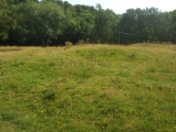
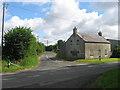
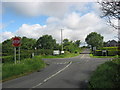
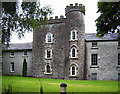
Nearby Images from Geograph Britain and Ireland:
©2010(licence)

©2007(licence)
©2010(licence)
©2020(licence)
©2020(licence)
The above images may not be of the site on this page, they are loaded from Geograph.
Please Submit an Image of this site or go out and take one for us!
Click here to see more info for this site
Nearby sites
Click here to view sites on an interactive map of the areaKey: Red: member's photo, Blue: 3rd party photo, Yellow: other image, Green: no photo - please go there and take one, Grey: site destroyed
Download sites to:
KML (Google Earth)
GPX (GPS waypoints)
CSV (Garmin/Navman)
CSV (Excel)
To unlock full downloads you need to sign up as a Contributory Member. Otherwise downloads are limited to 50 sites.
Turn off the page maps and other distractions
Nearby sites listing. In the following links * = Image available
5.2km W 273° Garret's Stone Standing Stone (Menhir) (N891877)
7.3km S 178° Grangegeeth Sculptured Stone
7.4km SE 124° Tinure* Rock Art (O005835)
11.5km ESE 120° Muiredach's Cross (Monasterboice)* Ancient Cross (O044820)
12.5km S 173° Hill of Slane* Artificial Mound
14.2km SSE 147° Townleyhall Passage Tomb* Passage Grave (O0222075723)
15.1km SSE 160° Knowth* Passage Grave (N99697342)
15.1km SSE 160° Knowth Timber Circle* Timber Circle (N997734)
15.9km SSE 151° Dowth Passage Grave* Passage Grave (O02377377)
16.1km SSE 147° Dowth Henge* Henge (O034742)
16.1km SSE 158° Newgrange* Passage Grave (O00747272)
16.1km SSE 158° Newgrange Stone Circle* Stone Circle (O007727)
16.1km SSE 148° Dowth Hall* Passage Grave
16.5km SE 138° Oldbridge Logboat, River Boyne Not Known (by us)
16.6km SSE 148° Donore Mystery Mound Artificial Mound (O0334573550)
16.6km SSE 159° Recently Discovered Prehistoric Cropmark near Newgrange* Misc. Earthwork
16.7km SSE 155° Newgrange Standing Stones* Standing Stones
17.6km NNE 23° Clochafarmore* Standing Stone (Menhir) (J007039)
19.3km N 8° Ballinloughan* Rock Art (H966067)
19.4km SE 132° Millmount* Artificial Mound
21.2km SSW 204° Donaghmore Stone Circle (N860680)
22.2km ESE 116° Baltray* Standing Stones
23.4km NNE 18° Killin Stone Circle (J010100)
23.8km NNE 21° Balregan Standing Stones (J023100)
24.6km NNE 25° Carn Beg Stone Circle
View more nearby sites and additional images


 We would like to know more about this location. Please feel free to add a brief description and any relevant information in your own language.
 Wir möchten mehr über diese Stätte erfahren. Bitte zögern Sie nicht, eine kurze Beschreibung und relevante Informationen in Deutsch hinzuzufügen.
 Nous aimerions en savoir encore un peu sur les lieux. S'il vous plaît n'hesitez pas à ajouter une courte description et tous les renseignements pertinents dans votre propre langue.
 Quisieramos informarnos un poco más de las lugares. No dude en añadir una breve descripción y otros datos relevantes en su propio idioma.