


<< Our Photo Pages >> Slievenagh - Stone Circle in Ireland (Northern) in Co. Antrim
Submitted by Tom_Bullock on Monday, 14 October 2002 Page Views: 7365
Neolithic and Bronze AgeSite Name: SlievenaghCountry: Ireland (Northern)
NOTE: This site is 3.226 km away from the location you searched for.
County: Co. Antrim Type: Stone Circle
Map Ref: C9895602726
Discoverer Map Number: D36
Latitude: 54.862487N Longitude: 6.459679W
Condition:
| 5 | Perfect |
| 4 | Almost Perfect |
| 3 | Reasonable but with some damage |
| 2 | Ruined but still recognisable as an ancient site |
| 1 | Pretty much destroyed, possibly visible as crop marks |
| 0 | No data. |
| -1 | Completely destroyed |
| 5 | Superb |
| 4 | Good |
| 3 | Ordinary |
| 2 | Not Good |
| 1 | Awful |
| 0 | No data. |
| 5 | Can be driven to, probably with disabled access |
| 4 | Short walk on a footpath |
| 3 | Requiring a bit more of a walk |
| 2 | A long walk |
| 1 | In the middle of nowhere, a nightmare to find |
| 0 | No data. |
| 5 | co-ordinates taken by GPS or official recorded co-ordinates |
| 4 | co-ordinates scaled from a detailed map |
| 3 | co-ordinates scaled from a bad map |
| 2 | co-ordinates of the nearest village |
| 1 | co-ordinates of the nearest town |
| 0 | no data |
Internal Links:
External Links:
I have visited· I would like to visit
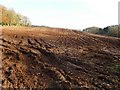
Izntit visited on 25th May 2015 - their rating: Cond: 2 Amb: 3 Access: 3 GPS co-ordinates bring you to a locked gated private road. Compass position on smartphone unreadable at this point - bizarre! New to megalithic portal so didn't realise access onto private-owned land - sorry! Jumped over fences / awkward hedges to get in (easier route over farm gates noted on way back), keeping dog on lead as cows in field where ancient site is located. Rocks on circular mound, large central ones. Some stones appear burnt on one side where they look like they have been cut. Ruined site but was worth the visit, esp as so little information available anywhere about this place. Perhaps seeking permission to visit from the land owner might give some more clues.
")
Site sourced from Aubrey Burl's stone circles listing. Our contributor below thinks this was misplaced so we have updated the location. Burl's location was H991028
Have you visited this site? Please add a comment below.
You may be viewing yesterday's version of this page. To see the most up to date information please register for a free account.
")
Do not use the above information on other web sites or publications without permission of the contributor.
Nearby Images from Geograph Britain and Ireland:
©2011(licence)
©2007(licence)
©2007(licence)
©2007(licence)
©2011(licence)
The above images may not be of the site on this page, they are loaded from Geograph.
Please Submit an Image of this site or go out and take one for us!
Click here to see more info for this site
Nearby sites
Click here to view sites on an interactive map of the areaKey: Red: member's photo, Blue: 3rd party photo, Yellow: other image, Green: no photo - please go there and take one, Grey: site destroyed
Download sites to:
KML (Google Earth)
GPX (GPS waypoints)
CSV (Garmin/Navman)
CSV (Excel)
To unlock full downloads you need to sign up as a Contributory Member. Otherwise downloads are limited to 50 sites.
Turn off the page maps and other distractions
Nearby sites listing. In the following links * = Image available
13.4km E 98° Ballymena Ring Fort Hillfort
14.6km N 355° Craigs Lower Passage Grave* Passage Grave (C9739617278)
14.8km N 357° The Broad Stone (Craigs)* Court Tomb (C978175)
14.8km W 277° Drumlamph Wood* Modern Stone Circle etc
14.9km W 267° Tirnony* Portal Tomb (C840017)
15.1km E 95° Ballymarlagh* Court Tomb (D14040175)
15.4km N 356° Craigs Standing Stone 1* Standing Stone (Menhir) (NW139765)
15.5km N 357° Craigs Standing Stone 2* Standing Stone (Menhir) (NW140766)
15.6km N 357° Craigs Standing Stone Hill* Standing Stone (Menhir) (NW141767)
15.9km NNE 13° Ballymacaldrack* Court Tomb (D02161830)
17.0km E 83° St. Patrick's Stone* Standing Stone (Menhir) (NW310621)
17.0km NW 325° Moneydig* Passage Grave
17.3km WNW 297° Tamnyrankin* Court Tomb
17.6km WNW 299° Calleen Braigs Standing Stones (C8333010950)
18.0km WNW 290° Knockoneill* Court Tomb (C819086)
18.5km WNW 302° Cuilbane Stone Circle (C8304812206)
18.5km WNW 302° Tamney Cromlech* Stone Circle (NV988719)
18.6km NE 50° Lisnamanny Stone Circle Stone Circle (D130150)
18.9km ESE 111° Carncome Standing Stone* Standing Stone (Menhir)
19.2km NE 48° Lisnamanny Standing Stone* Standing Stone (Menhir) (D1305015860)
19.2km NE 50° Two Standing Stones in Lisnamanny* Standing Stones (D1345015470)
19.3km NE 42° Standing Stone (Scotchomerbane)* Standing Stone (Menhir) (NW278746)
19.4km NE 47° Standing Stone (Skerry West)* Standing Stone (Menhir) (NW289735)
19.7km NW 311° Garvagh Pyramid* Modern Stone Circle etc
20.5km W 265° Coolnasillagh Chambered Tomb (C7855000390)
View more nearby sites and additional images


 We would like to know more about this location. Please feel free to add a brief description and any relevant information in your own language.
 Wir möchten mehr über diese Stätte erfahren. Bitte zögern Sie nicht, eine kurze Beschreibung und relevante Informationen in Deutsch hinzuzufügen.
 Nous aimerions en savoir encore un peu sur les lieux. S'il vous plaît n'hesitez pas à ajouter une courte description et tous les renseignements pertinents dans votre propre langue.
 Quisieramos informarnos un poco más de las lugares. No dude en añadir una breve descripción y otros datos relevantes en su propio idioma.