

<< Our Photo Pages >> Lisboy - Standing Stone (Menhir) in Ireland (Northern) in Co. Antrim
Submitted by Ptarmigan on Wednesday, 29 March 2017 Page Views: 1324
Neolithic and Bronze AgeSite Name: LisboyCountry: Ireland (Northern)
NOTE: This site is 5.697 km away from the location you searched for.
County: Co. Antrim Type: Standing Stone (Menhir)
Nearest Town: Ballymoney Nearest Village: Killyrammer
Map Ref: NW180837
Latitude: 55.067431N Longitude: 6.41874W
Condition:
| 5 | Perfect |
| 4 | Almost Perfect |
| 3 | Reasonable but with some damage |
| 2 | Ruined but still recognisable as an ancient site |
| 1 | Pretty much destroyed, possibly visible as crop marks |
| 0 | No data. |
| -1 | Completely destroyed |
| 5 | Superb |
| 4 | Good |
| 3 | Ordinary |
| 2 | Not Good |
| 1 | Awful |
| 0 | No data. |
| 5 | Can be driven to, probably with disabled access |
| 4 | Short walk on a footpath |
| 3 | Requiring a bit more of a walk |
| 2 | A long walk |
| 1 | In the middle of nowhere, a nightmare to find |
| 0 | No data. |
| 5 | co-ordinates taken by GPS or official recorded co-ordinates |
| 4 | co-ordinates scaled from a detailed map |
| 3 | co-ordinates scaled from a bad map |
| 2 | co-ordinates of the nearest village |
| 1 | co-ordinates of the nearest town |
| 0 | no data |
Internal Links:
External Links:
")
NI Monument 1226
You may be viewing yesterday's version of this page. To see the most up to date information please register for a free account.
")
")
")
Do not use the above information on other web sites or publications without permission of the contributor.
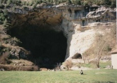
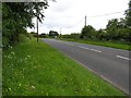
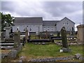
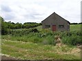
Nearby Images from Geograph Britain and Ireland:
©2008(licence)
©2008(licence)
©2008(licence)
©2008(licence)
©2008(licence)
The above images may not be of the site on this page, they are loaded from Geograph.
Please Submit an Image of this site or go out and take one for us!
Click here to see more info for this site
Nearby sites
Click here to view sites on an interactive map of the areaKey: Red: member's photo, Blue: 3rd party photo, Yellow: other image, Green: no photo - please go there and take one, Grey: site destroyed
Download sites to:
KML (Google Earth)
GPX (GPS waypoints)
CSV (Garmin/Navman)
CSV (Excel)
To unlock full downloads you need to sign up as a Contributory Member. Otherwise downloads are limited to 50 sites.
Turn off the page maps and other distractions
Nearby sites listing. In the following links * = Image available
1.6km NNE 21° Drumaqueran Carved Cross* Ancient Cross (NW1867185144)
4.1km N 2° Stranocum Fort* Hillfort (NW184878)
4.6km SE 125° Knockahollet motte and Bailey* Hillfort (NW2160380827)
6.5km NNE 11° Carnfeogue Standing Stone* Standing Stone (Menhir) (NW197900)
7.1km E 94° Tully N* Standing Stones (D082252)
7.2km ESE 107° Black Lough Standing Stone 3* Standing Stone (Menhir) (D0803123693)
7.2km NNE 19° Carnrig Fort* Artificial Mound (NW208904)
7.3km ESE 108° Black Lough Standing Stone 2* Standing Stone (Menhir) (D0809823469)
7.4km S 173° Ballymacaldrack* Court Tomb (D02161830)
7.6km E 94° Loughguile Standing Stone* Standing Stone (Menhir) (NW2555282739)
7.7km ESE 109° Black Lough Standing Stone 1* Standing Stone (Menhir) (D0842323282)
7.8km ENE 59° Doonavernon Motte* Hillfort (NW249873)
8.0km SSW 205° Craigs Standing Stone Hill* Standing Stone (Menhir) (NW141767)
8.1km SSW 206° Craigs Standing Stone 2* Standing Stone (Menhir) (NW140766)
8.3km SSW 206° Craigs Standing Stone 1* Standing Stone (Menhir) (NW139765)
8.7km SSW 203° The Broad Stone (Craigs)* Court Tomb (C978175)
9.1km SSW 205° Craigs Lower Passage Grave* Passage Grave (C9739617278)
9.3km NNW 344° Drumlesk* Chambered Tomb (C983345)
9.3km N 350° Deffrick Castle* Souterrain (Fogou, Earth House) (NW170930)
9.4km NNW 331° Decorated Stone, Derrykeighan* Sculptured Stone (NW139922)
9.5km NE 49° Alcrossagh Fort* Hillfort (NW256894)
11.7km NE 42° Knockans Standing Stone* Standing Stone (Menhir) (NW2632591923)
11.9km NE 47° Tullaghore Cross* Ancient Cross (NW2721091351)
12.4km NE 41° Knockans Rath / Souterrain* Souterrain (Fogou, Earth House) (NW267926)
12.5km NNE 12° Druid's Altar (Mosside)* Cairn (NW213958)
View more nearby sites and additional images


 We would like to know more about this location. Please feel free to add a brief description and any relevant information in your own language.
 Wir möchten mehr über diese Stätte erfahren. Bitte zögern Sie nicht, eine kurze Beschreibung und relevante Informationen in Deutsch hinzuzufügen.
 Nous aimerions en savoir encore un peu sur les lieux. S'il vous plaît n'hesitez pas à ajouter une courte description et tous les renseignements pertinents dans votre propre langue.
 Quisieramos informarnos un poco más de las lugares. No dude en añadir una breve descripción y otros datos relevantes en su propio idioma.