


<< Other Photo Pages >> Cueva de Maltravieso - Rock Art in Spain in Extremadura
Submitted by holger_rix on Friday, 04 December 2015 Page Views: 1021
Rock ArtSite Name: Cueva de MaltraviesoCountry: Spain Region: Extremadura Type: Rock Art
Nearest Town: Cáceres
Latitude: 39.457490N Longitude: 6.37084W
Condition:
| 5 | Perfect |
| 4 | Almost Perfect |
| 3 | Reasonable but with some damage |
| 2 | Ruined but still recognisable as an ancient site |
| 1 | Pretty much destroyed, possibly visible as crop marks |
| 0 | No data. |
| -1 | Completely destroyed |
| 5 | Superb |
| 4 | Good |
| 3 | Ordinary |
| 2 | Not Good |
| 1 | Awful |
| 0 | No data. |
| 5 | Can be driven to, probably with disabled access |
| 4 | Short walk on a footpath |
| 3 | Requiring a bit more of a walk |
| 2 | A long walk |
| 1 | In the middle of nowhere, a nightmare to find |
| 0 | No data. |
| 5 | co-ordinates taken by GPS or official recorded co-ordinates |
| 4 | co-ordinates scaled from a detailed map |
| 3 | co-ordinates scaled from a bad map |
| 2 | co-ordinates of the nearest village |
| 1 | co-ordinates of the nearest town |
| 0 | no data |
Be the first person to rate this site - see the 'Contribute!' box in the right hand menu.
Internal Links:
External Links:
")
You may be viewing yesterday's version of this page. To see the most up to date information please register for a free account.
Do not use the above information on other web sites or publications without permission of the contributor.
Nearby Images from Flickr


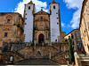
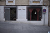
The above images may not be of the site on this page, but were taken nearby. They are loaded from Flickr so please click on them for image credits.
Click here to see more info for this site
Nearby sites
Click here to view sites on an interactive map of the areaKey: Red: member's photo, Blue: 3rd party photo, Yellow: other image, Green: no photo - please go there and take one, Grey: site destroyed
Download sites to:
KML (Google Earth)
GPX (GPS waypoints)
CSV (Garmin/Navman)
CSV (Excel)
To unlock full downloads you need to sign up as a Contributory Member. Otherwise downloads are limited to 50 sites.
Turn off the page maps and other distractions
Nearby sites listing. In the following links * = Image available
1.7km N 1° Cáceres Museum* Museum
2.9km N 7° Castro de Valdeagudo Castro or Chafurdão
3.0km N 6° Las Seguras Burial Chamber or Dolmen
3.4km S 177° Cueva de Santa Ana Cave or Rock Shelter
6.5km WSW 247° Yacimiento Arqueológico de El Millar Ancient Village or Settlement
11.1km W 266° Las Cuatro Hermanas Castro or Chafurdão
11.1km W 266° Malpartida de Plasencia 1 Burial Chamber or Dolmen
11.1km W 266° Le Redondilla Burial Chamber or Dolmen
11.2km W 266° Los Barruecos* Castro or Chafurdão
11.2km W 266° Malpartida de Plasencia 2 Burial Chamber or Dolmen
12.0km WSW 257° Malpartida de Cáceres* Rock Cut Tomb
12.7km SW 234° Hijadilla Dolmen 2 Burial Chamber or Dolmen
12.7km SSE 162° Herguijiela Burial Chamber or Dolmen
12.8km SW 224° La Mogollona Burial Chamber or Dolmen
12.9km SW 235° Hijadilla Dolmen 3 Burial Chamber or Dolmen
12.9km SW 232° Hijadilla Dolmen 1 Burial Chamber or Dolmen
13.3km W 276° La Estación Dolmen* Burial Chamber or Dolmen
15.7km SE 132° Redondilla Burial Chamber or Dolmen
17.2km S 169° Garabato Dolmen* Burial Chamber or Dolmen
17.6km N 355° Castro del Castillejo Castro or Chafurdão
23.5km NNE 26° Villa Romana de Monroy Ancient Village or Settlement
27.6km W 263° Palomas 2 Burial Chamber or Dolmen
27.7km W 263° Palomas 1 Burial Chamber or Dolmen
29.6km W 263° Tumbas de los Moros Barrow Cemetery
31.0km NNW 348° Eras del Garrote Dolmen 1* Burial Chamber or Dolmen
View more nearby sites and additional images


 We would like to know more about this location. Please feel free to add a brief description and any relevant information in your own language.
 Wir möchten mehr über diese Stätte erfahren. Bitte zögern Sie nicht, eine kurze Beschreibung und relevante Informationen in Deutsch hinzuzufügen.
 Nous aimerions en savoir encore un peu sur les lieux. S'il vous plaît n'hesitez pas à ajouter une courte description et tous les renseignements pertinents dans votre propre langue.
 Quisieramos informarnos un poco más de las lugares. No dude en añadir una breve descripción y otros datos relevantes en su propio idioma.