

<< Our Photo Pages >> Shipman Head Chambered Cairn - Chambered Cairn in England in Isles of Scilly
Submitted by Bladup on Wednesday, 01 June 2022 Page Views: 639
Neolithic and Bronze AgeSite Name: Shipman Head Chambered CairnCountry: England
NOTE: This site is 0.291 km away from the location you searched for.
County: Isles of Scilly Type: Chambered Cairn
Map Ref: SV87621540
Latitude: 49.956858N Longitude: 6.356804W
Condition:
| 5 | Perfect |
| 4 | Almost Perfect |
| 3 | Reasonable but with some damage |
| 2 | Ruined but still recognisable as an ancient site |
| 1 | Pretty much destroyed, possibly visible as crop marks |
| 0 | No data. |
| -1 | Completely destroyed |
| 5 | Superb |
| 4 | Good |
| 3 | Ordinary |
| 2 | Not Good |
| 1 | Awful |
| 0 | No data. |
| 5 | Can be driven to, probably with disabled access |
| 4 | Short walk on a footpath |
| 3 | Requiring a bit more of a walk |
| 2 | A long walk |
| 1 | In the middle of nowhere, a nightmare to find |
| 0 | No data. |
| 5 | co-ordinates taken by GPS or official recorded co-ordinates |
| 4 | co-ordinates scaled from a detailed map |
| 3 | co-ordinates scaled from a bad map |
| 2 | co-ordinates of the nearest village |
| 1 | co-ordinates of the nearest town |
| 0 | no data |
Internal Links:
External Links:
")
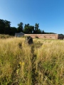
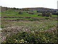
A large Chambered Cairn with a ruined chamber and possible cists, Approx 25m diameter by 0.6m high. Off centre to the north is the cover-stone, 2.7m by 1.3m, but the whole cairn has been much dug into and multilated. Two large kerbstones stand upright on the east side of the mound.
You may be viewing yesterday's version of this page. To see the most up to date information please register for a free account.
")
")
")
Do not use the above information on other web sites or publications without permission of the contributor.
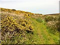
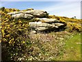
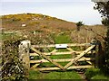
Nearby Images from Geograph Britain and Ireland:
©2013(licence)

©2005(licence)
©2013(licence)
©2013(licence)
©2013(licence)
The above images may not be of the site on this page, they are loaded from Geograph.
Please Submit an Image of this site or go out and take one for us!
Click here to see more info for this site
Nearby sites
Key: Red: member's photo, Blue: 3rd party photo, Yellow: other image, Green: no photo - please go there and take one, Grey: site destroyed
Download sites to:
KML (Google Earth)
GPX (GPS waypoints)
CSV (Garmin/Navman)
CSV (Excel)
To unlock full downloads you need to sign up as a Contributory Member. Otherwise downloads are limited to 50 sites.
Turn off the page maps and other distractions
Nearby sites listing. In the following links * = Image available
215m NNE 18° Shipman Head Down cairn cemetery* Cairn (SV877156)
650m N 355° Shipman Head Down, Bryher* Hillfort (SV87601605)
670m SW 221° Gweal Hill, Bryher* Chambered Tomb (SV87151492)
818m SSE 153° Green Bay Prehistoric field system and Cist* Ancient Village or Settlement (SV87951465)
917m SSE 165° Hillside Farm, Bryher* Chambered Tomb (SV878145)
985m E 79° New Grimsby Cairn* Cairn (SV88601553)
1.1km ENE 64° Castle Down, Tresco* Chambered Tomb (SV886158)
1.1km S 191° Heathy Hill Settlement* Ancient Village or Settlement (SV87361437)
1.1km SSE 168° Top Rock Entrance Grave and Cairn* Chambered Cairn (SV8779914266)
1.2km SSE 162° Bonfire Carn, Bryher* Chambered Cairn (SV87931424)
1.2km SSE 168° Samson Hill, Bryher* Chambered Tomb (SV878142)
1.3km SSE 168° Works Carn, Bryher* Chambered Cairn (SV87821413)
1.3km ENE 78° Dials Rocks Settlement* Ancient Village or Settlement (SV88911559)
1.3km NE 46° Tregarthen Hill* Passage Grave (SV8865516272)
1.5km NE 40° Tregarthen Hill Settlement* Ancient Village or Settlement (SV88631646)
1.5km E 95° Vane Hill Cairns* Barrow Cemetery (SV89091519)
1.5km NE 38° Piper's Hole* Cave or Rock Shelter (SV88621654)
1.8km SE 124° Abbey Hill Cairns* Barrow Cemetery (SV89051431)
1.8km E 92° Middle Down Cairn* Cairn (SV89431524)
2.0km SE 124° Roman Altar at Tresco Gardens* Sculptured Stone (SV892142)
2.2km S 174° Ballard Point Entrance Grave* Chambered Cairn (SV87711324)
2.2km E 100° Borough Cairn* Cairn (SV89761491)
2.3km SE 138° Appletree Bay prehistoric field system* Ancient Village or Settlement (SV89101358)
2.3km S 174° Samson, North Hill* Burial Chamber or Dolmen (SV87711305)
2.5km SSE 168° Samson Flats Intertidal Remains* Ancient Village or Settlement (SV880129)
View more nearby sites and additional images


 We would like to know more about this location. Please feel free to add a brief description and any relevant information in your own language.
 Wir möchten mehr über diese Stätte erfahren. Bitte zögern Sie nicht, eine kurze Beschreibung und relevante Informationen in Deutsch hinzuzufügen.
 Nous aimerions en savoir encore un peu sur les lieux. S'il vous plaît n'hesitez pas à ajouter une courte description et tous les renseignements pertinents dans votre propre langue.
 Quisieramos informarnos un poco más de las lugares. No dude en añadir una breve descripción y otros datos relevantes en su propio idioma.