

<< Text Pages >> Tigh An Duine - Stone Fort or Dun in Scotland in Isle of Mull
Submitted by Andy B on Tuesday, 19 October 2010 Page Views: 5253
Multi-periodSite Name: Tigh An DuineCountry: Scotland
NOTE: This site is 6.356 km away from the location you searched for.
County: Isle of Mull Type: Stone Fort or Dun
Map Ref: NM36944013
Latitude: 56.479575N Longitude: 6.273941W
Condition:
| 5 | Perfect |
| 4 | Almost Perfect |
| 3 | Reasonable but with some damage |
| 2 | Ruined but still recognisable as an ancient site |
| 1 | Pretty much destroyed, possibly visible as crop marks |
| 0 | No data. |
| -1 | Completely destroyed |
| 5 | Superb |
| 4 | Good |
| 3 | Ordinary |
| 2 | Not Good |
| 1 | Awful |
| 0 | No data. |
| 5 | Can be driven to, probably with disabled access |
| 4 | Short walk on a footpath |
| 3 | Requiring a bit more of a walk |
| 2 | A long walk |
| 1 | In the middle of nowhere, a nightmare to find |
| 0 | No data. |
| 5 | co-ordinates taken by GPS or official recorded co-ordinates |
| 4 | co-ordinates scaled from a detailed map |
| 3 | co-ordinates scaled from a bad map |
| 2 | co-ordinates of the nearest village |
| 1 | co-ordinates of the nearest town |
| 0 | no data |
Be the first person to rate this site - see the 'Contribute!' box in the right hand menu.
Internal Links:
External Links:
Stone Fort or Dun in Isle of Mull
Dun, Tigh an Duine: The summit of a rocky crag on the SE coast of Gometra, about 100m SSW of the headland known as Tigh an Duine, is occupied by the remains of a roughly circular dun and its outwork. Precipitous rock-faces up to 9m high provide strong natural protection on nearly all sides, and at present the only easy means of access to the summit is bay way of a narrow, but gently sloping, grassy path on the NW.
The dun measures 11m in internal diameter and has been defended by a dry-stone wall which varies from 2.4m to 3.7m in thickness. The wall has been reduced, for the most part, to a grass-covered band of stony debris in which several stretches of inner and outer facing stones survive in situ. The outer face is best preserved on the E, immediately N of the entrance, where it stands 0.6m high in two courses. Within the body of the wall on the SE there are traces, too indefinite to plan, of what may have been an internal revetment, and on the S, lying at right angles to the line of the inner face, of which it forms part, there is a large slab which may have served as a corner-stone of a passage leading into an intramural cell or gallery. The entrance of the dun has been checked for a door and measures approximately 0.8m wide at its outer end.
Source: Canmore
You may be viewing yesterday's version of this page. To see the most up to date information please register for a free account.
Do not use the above information on other web sites or publications without permission of the contributor.
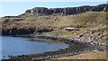
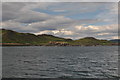
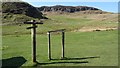
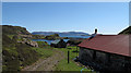
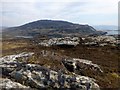
Nearby Images from Geograph Britain and Ireland:
©2019(licence)
©2010(licence)
©2019(licence)
©2010(licence)
©2013(licence)
The above images may not be of the site on this page, they are loaded from Geograph.
Please Submit an Image of this site or go out and take one for us!
Click here to see more info for this site
Nearby sites
Key: Red: member's photo, Blue: 3rd party photo, Yellow: other image, Green: no photo - please go there and take one, Grey: site destroyed
Download sites to:
KML (Google Earth)
GPX (GPS waypoints)
CSV (Garmin/Navman)
CSV (Excel)
To unlock full downloads you need to sign up as a Contributory Member. Otherwise downloads are limited to 50 sites.
Turn off the page maps and other distractions
Nearby sites listing. In the following links * = Image available
3.5km ESE 105° Cragaig* Standing Stones (NM40283901)
5.2km N 5° Dun Aisgain Stone Fort or Dun (NM37744524)
5.4km NNE 15° Dun Ban, Tostarie Stone Fort or Dun (NM38694524)
5.7km E 95° Ulva Standing Stone Standing Stone (Menhir) (NM42563926)
5.9km NNE 22° Torr Damh* Cairn (NM39434544)
5.9km NNE 19° Tostarie* Standing Stone (Menhir) (NM3918145614)
6.3km NNE 23° Tobar Ninian* Holy Well or Sacred Spring (NM3976545784)
7.1km ENE 60° Dun nan Gall* Broch or Nuraghe (NM43344331)
7.7km ENE 64° Dun Choinichean Stone Fort or Dun (NM44094312)
7.9km E 97° Meall Min Rock Art (NM447387)
8.1km NNW 331° Dun Haunn Stone Fort or Dun (NM33434749)
8.3km ESE 120° Inch Kenneth Stone Standing Stone (Menhir) (NM4385835492)
9.5km W 278° Dun Cruit Stone Fort or Dun (NM27634206)
9.5km N 350° Creag A' Chaisteal Rock Art (NM35874957)
11.4km N 355° Calgary Pier Stone Fort or Dun (NM36705151)
11.5km NNE 28° Torr A'chlachain, Mull Hillfort (NM42945000)
12.3km N 4° Calgary* Stone Row / Alignment (NM38495231)
12.3km NNE 33° Torr Aint* Hillfort (NM44265005)
12.6km NNE 14° Dun Auladh Round Cairn (NM40815212)
12.6km N 6° Dun Mhadaidh* Stone Fort or Dun (NM39145260)
12.7km NNE 27° Aintuim Cairn Round Cairn (NM43445103)
13.1km N 356° Allt Cill Chriosd Stone Fort or Dun (NM36885328)
13.2km NNE 23° Torr A'mhanaich Hillfort (NM42855192)
13.2km N 354° Lag Standing Stones* Standing Stones (NM3626753307)
13.3km N 360° Cillchriosd Rock Art (NM37665347)
View more nearby sites and additional images


 We would like to know more about this location. Please feel free to add a brief description and any relevant information in your own language.
 Wir möchten mehr über diese Stätte erfahren. Bitte zögern Sie nicht, eine kurze Beschreibung und relevante Informationen in Deutsch hinzuzufügen.
 Nous aimerions en savoir encore un peu sur les lieux. S'il vous plaît n'hesitez pas à ajouter une courte description et tous les renseignements pertinents dans votre propre langue.
 Quisieramos informarnos un poco más de las lugares. No dude en añadir una breve descripción y otros datos relevantes en su propio idioma.