


<< Our Photo Pages >> Isles of Scilly Museum - Museum in England in Isles of Scilly
Submitted by coldrum on Sunday, 25 January 2009 Page Views: 6159
MuseumsSite Name: Isles of Scilly MuseumCountry: England
NOTE: This site is 0.429 km away from the location you searched for.
County: Isles of Scilly Type: Museum
Nearest Town: Hugh Town
Map Ref: SV904105
Latitude: 49.914361N Longitude: 6.314227W
Condition:
| 5 | Perfect |
| 4 | Almost Perfect |
| 3 | Reasonable but with some damage |
| 2 | Ruined but still recognisable as an ancient site |
| 1 | Pretty much destroyed, possibly visible as crop marks |
| 0 | No data. |
| -1 | Completely destroyed |
| 5 | Superb |
| 4 | Good |
| 3 | Ordinary |
| 2 | Not Good |
| 1 | Awful |
| 0 | No data. |
| 5 | Can be driven to, probably with disabled access |
| 4 | Short walk on a footpath |
| 3 | Requiring a bit more of a walk |
| 2 | A long walk |
| 1 | In the middle of nowhere, a nightmare to find |
| 0 | No data. |
| 5 | co-ordinates taken by GPS or official recorded co-ordinates |
| 4 | co-ordinates scaled from a detailed map |
| 3 | co-ordinates scaled from a bad map |
| 2 | co-ordinates of the nearest village |
| 1 | co-ordinates of the nearest town |
| 0 | no data |
Be the first person to rate this site - see the 'Contribute!' box in the right hand menu.
Internal Links:
External Links:
I have visited· I would like to visit
lucasn visited - their rating: Cond: 5 Amb: 3 Access: 4
")
Museum with artefacts from various periods of the history of the Scilly Isles.
Website: www.iosmuseum.org
You may be viewing yesterday's version of this page. To see the most up to date information please register for a free account.
Do not use the above information on other web sites or publications without permission of the contributor.
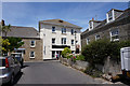
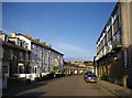
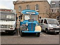
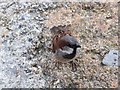
Nearby Images from Geograph Britain and Ireland:
©2018(licence)
©2008(licence)
©2011(licence)
©2011(licence)
©2018(licence)
The above images may not be of the site on this page, they are loaded from Geograph.
Please Submit an Image of this site or go out and take one for us!
Click here to see more info for this site
Nearby sites
Key: Red: member's photo, Blue: 3rd party photo, Yellow: other image, Green: no photo - please go there and take one, Grey: site destroyed
Download sites to:
KML (Google Earth)
GPX (GPS waypoints)
CSV (Garmin/Navman)
CSV (Excel)
To unlock full downloads you need to sign up as a Contributory Member. Otherwise downloads are limited to 50 sites.
Turn off the page maps and other distractions
Nearby sites listing. In the following links * = Image available
232m ESE 118° Buzza Hill* Burial Chamber or Dolmen (SV90601038)
259m ESE 114° King Edward's Tower Chambered Cairn* Chambered Cairn (SV90631038)
315m WSW 248° Porthcressa Barrow Cemetery (SV901104)
669m ESE 113° Carn Gwavel Souterrain (Fogou, Earth House) (SV910102)
681m NE 48° Mount Flagon Menhir* Standing Stone (Menhir) (SV90931093)
1.1km ESE 120° Carn Leh* Ancient Village or Settlement (SV913099)
1.1km SSE 147° Peninnis Head Boundary Misc. Earthwork (SV90970952)
1.2km SE 142° Peninnis Head* Cairn (SV911095)
1.3km SSE 147° Peninnis Head Settlement* Ancient Village or Settlement (SV91050938)
1.3km N 4° Carn Morval Down (3) Misc. Earthwork (SV90581182)
1.5km ENE 67° Rocky Hill* Ancient Cross (SV918110)
1.5km ESE 103° Porth Minick* Ancient Village or Settlement (SV91841007)
1.5km NNE 13° Carn Morval Down (2)* Cairn (SV90841196)
1.5km N 10° Carn Morval Down (1)* Chambered Tomb (SV90761199)
1.5km ESE 102° Inner Blue Cairn* Cairn (SV91901010)
1.7km NE 51° Holy Vale Longstone* Standing Stone (Menhir) (SV91771147)
1.7km NE 40° Town Lane (St Mary's) Cist (SV91571175)
1.8km E 98° Salakee Down 3 Chambered Tomb (SV92171016)
1.9km E 80° Higher Moor Cairns* Barrow Cemetery (SV92261073)
1.9km NNE 15° Bant's Carn* Burial Chamber or Dolmen (SV90991230)
1.9km ESE 101° Salakee Down 5* Chambered Tomb (SV92241002)
1.9km N 10° Halangy Porth Cist* Cist (SV90851235)
1.9km E 99° Salakee Down 6 (2 cairns)* Chambered Tomb (SV92271009)
1.9km E 94° Salakee Down 2 Chambered Tomb (SV92321025)
1.9km E 101° Salakee Down 4* Chambered Tomb (SV92281003)
View more nearby sites and additional images


 We would like to know more about this location. Please feel free to add a brief description and any relevant information in your own language.
 Wir möchten mehr über diese Stätte erfahren. Bitte zögern Sie nicht, eine kurze Beschreibung und relevante Informationen in Deutsch hinzuzufügen.
 Nous aimerions en savoir encore un peu sur les lieux. S'il vous plaît n'hesitez pas à ajouter une courte description et tous les renseignements pertinents dans votre propre langue.
 Quisieramos informarnos un poco más de las lugares. No dude en añadir una breve descripción y otros datos relevantes en su propio idioma.