


<< Our Photo Pages >> Carncome Standing Stone - Standing Stone (Menhir) in Ireland (Northern) in Co. Antrim
Submitted by Ptarmigan on Tuesday, 27 March 2018 Page Views: 2183
Neolithic and Bronze AgeSite Name: Carncome Standing StoneCountry: Ireland (Northern)
NOTE: This site is 1.006 km away from the location you searched for.
County: Co. Antrim Type: Standing Stone (Menhir)
Nearest Town: Ballymena Nearest Village: Kells
Latitude: 54.800589N Longitude: 6.184341W
Condition:
| 5 | Perfect |
| 4 | Almost Perfect |
| 3 | Reasonable but with some damage |
| 2 | Ruined but still recognisable as an ancient site |
| 1 | Pretty much destroyed, possibly visible as crop marks |
| 0 | No data. |
| -1 | Completely destroyed |
| 5 | Superb |
| 4 | Good |
| 3 | Ordinary |
| 2 | Not Good |
| 1 | Awful |
| 0 | No data. |
| 5 | Can be driven to, probably with disabled access |
| 4 | Short walk on a footpath |
| 3 | Requiring a bit more of a walk |
| 2 | A long walk |
| 1 | In the middle of nowhere, a nightmare to find |
| 0 | No data. |
| 5 | co-ordinates taken by GPS or official recorded co-ordinates |
| 4 | co-ordinates scaled from a detailed map |
| 3 | co-ordinates scaled from a bad map |
| 2 | co-ordinates of the nearest village |
| 1 | co-ordinates of the nearest town |
| 0 | no data |
Internal Links:
External Links:
")
For more information see NI Monument 2752
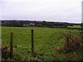
You can't miss the stone as it is on the roadside, built into the front wall of a garden.
You may be viewing yesterday's version of this page. To see the most up to date information please register for a free account.
Do not use the above information on other web sites or publications without permission of the contributor.
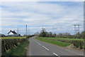
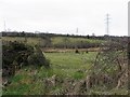
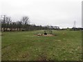
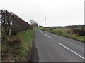
Nearby Images from Geograph Britain and Ireland:
©2015(licence)
©2011(licence)
©2011(licence)
©2011(licence)
©2010(licence)
The above images may not be of the site on this page, they are loaded from Geograph.
Please Submit an Image of this site or go out and take one for us!
Click here to see more info for this site
Nearby sites
Click here to view sites on an interactive map of the areaKey: Red: member's photo, Blue: 3rd party photo, Yellow: other image, Green: no photo - please go there and take one, Grey: site destroyed
Download sites to:
KML (Google Earth)
GPX (GPS waypoints)
CSV (Garmin/Navman)
CSV (Excel)
To unlock full downloads you need to sign up as a Contributory Member. Otherwise downloads are limited to 50 sites.
Turn off the page maps and other distractions
Nearby sites listing. In the following links * = Image available
5.4km SE 137° Browndod Court Tomb* Court Tomb
6.1km NNW 335° Ballymarlagh* Court Tomb (D14040175)
6.7km NW 319° Ballymena Ring Fort Hillfort
7.0km SSE 147° Tobergill Stone Circle (J20839051)
8.5km SSE 149° Donegore Hill Causewayed Enclosure
9.0km N 355° St. Patrick's Stone* Standing Stone (Menhir) (NW310621)
9.2km SSE 158° Donegore Moat* Artificial Mound
9.2km SE 129° Doagh* Holed Stone (J2416590683)
11.5km SE 135° Moyadam* Standing Stone (Menhir) (J2510388312)
15.6km NNE 31° Tamybuck Wedge Tomb* Wedge Tomb (NW401660)
15.8km SE 141° Craigarogan* Chambered Tomb (J270842)
16.0km E 88° Carndoo* Court Tomb (J32849731)
17.1km NNE 32° Antynanum* Court Tomb (D25561094)
17.6km NNE 23° Ticloy* Portal Tomb (D232127)
18.1km E 92° Tureagh Stone Circle (J350960)
18.5km ESE 116° West Division Stone Row / Alignment (J338887)
18.7km ENE 66° Larne Standing Stone* Standing Stone (Menhir)
18.9km WNW 291° Slievenagh* Stone Circle (C9895602726)
19.1km N 350° Lisnamanny Stone Circle Stone Circle (D130150)
19.4km E 86° Ballrickard More Stone Circle (J362981)
19.4km NE 54° Dunteige* Wedge Tomb (D32350798)
19.5km N 352° Two Standing Stones in Lisnamanny* Standing Stones (D1345015470)
19.7km ENE 58° Linford Barrows* Artificial Mound (D33230723)
19.8km ENE 57° Linford Round Cairn Round Cairn
19.9km N 351° Lisnamanny Standing Stone* Standing Stone (Menhir) (D1305015860)
View more nearby sites and additional images


 We would like to know more about this location. Please feel free to add a brief description and any relevant information in your own language.
 Wir möchten mehr über diese Stätte erfahren. Bitte zögern Sie nicht, eine kurze Beschreibung und relevante Informationen in Deutsch hinzuzufügen.
 Nous aimerions en savoir encore un peu sur les lieux. S'il vous plaît n'hesitez pas à ajouter une courte description et tous les renseignements pertinents dans votre propre langue.
 Quisieramos informarnos un poco más de las lugares. No dude en añadir una breve descripción y otros datos relevantes en su propio idioma.