


<< Our Photo Pages >> Tinkler's Point Entrance Grave - Chambered Cairn in England in Cornwall
Submitted by Bladup on Saturday, 08 July 2023 Page Views: 289
Neolithic and Bronze AgeSite Name: Tinkler's Point Entrance GraveCountry: England
NOTE: This site is 0.19 km away from the location you searched for.
County: Cornwall Type: Chambered Cairn
Map Ref: SV91691649
Latitude: 49.968749N Longitude: 6.301099W
Condition:
| 5 | Perfect |
| 4 | Almost Perfect |
| 3 | Reasonable but with some damage |
| 2 | Ruined but still recognisable as an ancient site |
| 1 | Pretty much destroyed, possibly visible as crop marks |
| 0 | No data. |
| -1 | Completely destroyed |
| 5 | Superb |
| 4 | Good |
| 3 | Ordinary |
| 2 | Not Good |
| 1 | Awful |
| 0 | No data. |
| 5 | Can be driven to, probably with disabled access |
| 4 | Short walk on a footpath |
| 3 | Requiring a bit more of a walk |
| 2 | A long walk |
| 1 | In the middle of nowhere, a nightmare to find |
| 0 | No data. |
| 5 | co-ordinates taken by GPS or official recorded co-ordinates |
| 4 | co-ordinates scaled from a detailed map |
| 3 | co-ordinates scaled from a bad map |
| 2 | co-ordinates of the nearest village |
| 1 | co-ordinates of the nearest town |
| 0 | no data |
Internal Links:
External Links:
")
Tinkler's Point Entrance Grave is an entrance grave which was excavated by O'Neil in 1950. It is recorded as a mound with part kerb by Russell and by the OS as a partly kerbed cairn, 22m in diameter and 1.0m high, with a depression, 8.0m in diameter and 0.5m deep in its centre. This site was revisited by CAU in 1988 and described as a large mound roughly circular in plan (dimensions as OS), composed of stone and earth. On the north side is part of a complete kerb 0.7m high. In the centre of the mound is a sub-rectangular depression 2.0m by 1.0m and 0.5m deep, orientated NNE-SSW which must be the remains of a chamber, Large stones lie at the North West of the Cairn
For more information on this scheduled monument and surrounding cairn cemetery, see Historic England List ID 1018109.
You may be viewing yesterday's version of this page. To see the most up to date information please register for a free account.
")
")
Do not use the above information on other web sites or publications without permission of the contributor.
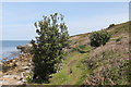
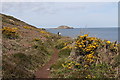
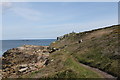
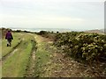
Nearby Images from Geograph Britain and Ireland:

©2011(licence)
©2019(licence)
©2019(licence)
©2019(licence)
©2012(licence)
The above images may not be of the site on this page, they are loaded from Geograph.
Please Submit an Image of this site or go out and take one for us!
Click here to see more info for this site
Nearby sites
Key: Red: member's photo, Blue: 3rd party photo, Yellow: other image, Green: no photo - please go there and take one, Grey: site destroyed
Download sites to:
KML (Google Earth)
GPX (GPS waypoints)
CSV (Garmin/Navman)
CSV (Excel)
To unlock full downloads you need to sign up as a Contributory Member. Otherwise downloads are limited to 50 sites.
Turn off the page maps and other distractions
Nearby sites listing. In the following links * = Image available
130m SSE 154° Tinklers Hill, St Martins* Cairn (SV91741637)
495m SE 142° Middle Town Well* Holy Well or Sacred Spring (SV91971608)
571m ENE 62° Top Rock Hill Chambered Cairn* Chambered Cairn (SV92211673)
629m ENE 76° Little Bay Settlement* Ancient Village or Settlement (SV92311661)
710m W 272° Tean Great Hill Chambered Cairn* Chambered Cairn (SV90981655)
917m SE 130° Knackyboy Cairn, St Martins Chambered Cairn (SV92361586)
1.0km ESE 116° Barnacle Rock Entrance Grave* Chambered Tomb (SV92611598)
1.1km WSW 255° West Porth Cairn* Cairn (SV90631627)
1.1km ESE 119° Plains House Cairn* Cairn (SV92641590)
1.2km WSW 259° Old Man Entrance Grave* Chambered Cairn (SV90471632)
1.3km NNE 22° White Island* Chambered Cairn (SV92231764)
1.5km ESE 106° Turfy Hill Cairn* Cairn (SV93071600)
1.6km SE 128° Upidas Outcrop* Rock Outcrop (SV92911543)
1.8km SE 135° Cruther's Hill Cemetery* Barrow Cemetery (SV92901514)
2.0km ESE 108° Hill Bennigates Cairn* Cairn (SV93531579)
2.0km ESE 102° Burnt Hill Bronze Age Settlement* Ancient Village or Settlement (SV93651596)
2.0km ESE 121° Higher Town Bay* Stone Row / Alignment (SV93381533)
2.1km ESE 122° Higher Town Bay Cist (St Martin's) Cist (SV934153)
2.3km ESE 111° John Battys Hill Chambered Cairn* Chambered Cairn (SV93801553)
2.5km ESE 114° Gun Hill Kerb Cairn and Cist* Cairn (SV93901537)
2.5km SW 227° Borough Cairn* Cairn (SV89761491)
2.5km E 96° St Martin's Head Cairns* Barrow Cemetery (SV94181609)
2.6km WSW 238° Middle Down Cairn* Cairn (SV89431524)
2.6km ESE 102° Chapel Down Standing Stone* Standing Stone (Menhir) (SV94191579)
2.8km ESE 102° Chapel Down Field System* Sculptured Stone (SV94381574)
View more nearby sites and additional images


 We would like to know more about this location. Please feel free to add a brief description and any relevant information in your own language.
 Wir möchten mehr über diese Stätte erfahren. Bitte zögern Sie nicht, eine kurze Beschreibung und relevante Informationen in Deutsch hinzuzufügen.
 Nous aimerions en savoir encore un peu sur les lieux. S'il vous plaît n'hesitez pas à ajouter une courte description et tous les renseignements pertinents dans votre propre langue.
 Quisieramos informarnos un poco más de las lugares. No dude en añadir una breve descripción y otros datos relevantes en su propio idioma.