 with our Megalithic Portal iPhone app")


<< Text Pages >> Villa Romana de Monroy - Ancient Village or Settlement in Spain in Extremadura
Submitted by holger_rix on Saturday, 05 December 2015 Page Views: 875
Multi-periodSite Name: Villa Romana de MonroyCountry: Spain
NOTE: This site is 7.912 km away from the location you searched for.
Region: Extremadura Type: Ancient Village or Settlement
Latitude: 39.648099N Longitude: 6.252344W
Condition:
| 5 | Perfect |
| 4 | Almost Perfect |
| 3 | Reasonable but with some damage |
| 2 | Ruined but still recognisable as an ancient site |
| 1 | Pretty much destroyed, possibly visible as crop marks |
| 0 | No data. |
| -1 | Completely destroyed |
| 5 | Superb |
| 4 | Good |
| 3 | Ordinary |
| 2 | Not Good |
| 1 | Awful |
| 0 | No data. |
| 5 | Can be driven to, probably with disabled access |
| 4 | Short walk on a footpath |
| 3 | Requiring a bit more of a walk |
| 2 | A long walk |
| 1 | In the middle of nowhere, a nightmare to find |
| 0 | No data. |
| 5 | co-ordinates taken by GPS or official recorded co-ordinates |
| 4 | co-ordinates scaled from a detailed map |
| 3 | co-ordinates scaled from a bad map |
| 2 | co-ordinates of the nearest village |
| 1 | co-ordinates of the nearest town |
| 0 | no data |
Be the first person to rate this site - see the 'Contribute!' box in the right hand menu.
Internal Links:
External Links:
Ancient Village or Settlement in Extremadura
You may be viewing yesterday's version of this page. To see the most up to date information please register for a free account.
Do not use the above information on other web sites or publications without permission of the contributor.
Nearby Images from Flickr
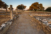
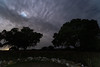
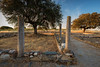
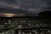
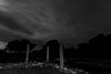
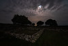
The above images may not be of the site on this page, but were taken nearby. They are loaded from Flickr so please click on them for image credits.
Click here to see more info for this site
Nearby sites
Click here to view sites on an interactive map of the areaKey: Red: member's photo, Blue: 3rd party photo, Yellow: other image, Green: no photo - please go there and take one, Grey: site destroyed
Download sites to:
KML (Google Earth)
GPX (GPS waypoints)
CSV (Garmin/Navman)
CSV (Excel)
To unlock full downloads you need to sign up as a Contributory Member. Otherwise downloads are limited to 50 sites.
Turn off the page maps and other distractions
Nearby sites listing. In the following links * = Image available
12.4km WSW 253° Castro del Castillejo Castro or Chafurdão
18.8km WNW 299° Eras del Garrote Dolmen 1* Burial Chamber or Dolmen
19.6km NNW 344° Arroyo del Rayo Burial Chamber or Dolmen
19.6km WNW 300° Guadancil Dolmen 2 Burial Chamber or Dolmen
19.7km NW 307° Puente de Alconétar* Not Known (by us)
20.7km SSW 208° Las Seguras Burial Chamber or Dolmen
20.8km SSW 208° Castro de Valdeagudo Castro or Chafurdão
22.0km SSW 207° Cáceres Museum* Museum
23.0km NNE 26° Cerro de la Atalaya Burial Chamber or Dolmen
23.5km SSW 206° Cueva de Maltravieso* Rock Art
24.1km ENE 57° Torrejon el Rubio Burial Chamber or Dolmen
26.0km WNW 283° Miraltajo Burial Chamber or Dolmen
26.1km WNW 283° Guadancil 1 Burial Chamber or Dolmen
26.2km WNW 283° Guadancil 3 Burial Chamber or Dolmen
26.2km WNW 283° Eras del Garrote 2* Burial Chamber or Dolmen
26.3km WNW 283° Las Minas Burial Chamber or Dolmen
26.3km NE 41° Monfrague Pinturas Rupestres* Rock Art
26.4km NW 314° Portezuelo Burial Chamber or Dolmen
26.6km SSW 202° Cueva de Santa Ana Cave or Rock Shelter
28.7km SW 214° Yacimiento Arqueológico de El Millar Ancient Village or Settlement
30.5km SW 224° Las Cuatro Hermanas Castro or Chafurdão
30.5km SW 224° Malpartida de Plasencia 1 Burial Chamber or Dolmen
30.6km SW 224° Los Barruecos* Castro or Chafurdão
30.6km SW 224° Malpartida de Plasencia 2 Burial Chamber or Dolmen
30.6km SW 224° Le Redondilla Burial Chamber or Dolmen
View more nearby sites and additional images


 We would like to know more about this location. Please feel free to add a brief description and any relevant information in your own language.
 Wir möchten mehr über diese Stätte erfahren. Bitte zögern Sie nicht, eine kurze Beschreibung und relevante Informationen in Deutsch hinzuzufügen.
 Nous aimerions en savoir encore un peu sur les lieux. S'il vous plaît n'hesitez pas à ajouter une courte description et tous les renseignements pertinents dans votre propre langue.
 Quisieramos informarnos un poco más de las lugares. No dude en añadir una breve descripción y otros datos relevantes en su propio idioma.