


<< Text Pages >> Lacara 2 - Burial Chamber or Dolmen in Spain in Extremadura
Submitted by TheCaptain on Wednesday, 08 September 2010 Page Views: 2255
Neolithic and Bronze AgeSite Name: Lacara 2Country: Spain Region: Extremadura Type: Burial Chamber or Dolmen
Nearest Town: Badajoz Nearest Village: Merida
Latitude: 38.900000N Longitude: 6.332W
Condition:
| 5 | Perfect |
| 4 | Almost Perfect |
| 3 | Reasonable but with some damage |
| 2 | Ruined but still recognisable as an ancient site |
| 1 | Pretty much destroyed, possibly visible as crop marks |
| 0 | No data. |
| -1 | Completely destroyed |
| 5 | Superb |
| 4 | Good |
| 3 | Ordinary |
| 2 | Not Good |
| 1 | Awful |
| 0 | No data. |
| 5 | Can be driven to, probably with disabled access |
| 4 | Short walk on a footpath |
| 3 | Requiring a bit more of a walk |
| 2 | A long walk |
| 1 | In the middle of nowhere, a nightmare to find |
| 0 | No data. |
| 5 | co-ordinates taken by GPS or official recorded co-ordinates |
| 4 | co-ordinates scaled from a detailed map |
| 3 | co-ordinates scaled from a bad map |
| 2 | co-ordinates of the nearest village |
| 1 | co-ordinates of the nearest town |
| 0 | no data |
Be the first person to rate this site - see the 'Contribute!' box in the right hand menu.
Internal Links:
External Links:
Burial chamber in Extremadura
Lacara 2 is a burial chamber in the community of Merida, Province of Badajoz, region of Extremadura
You may be viewing yesterday's version of this page. To see the most up to date information please register for a free account.
Do not use the above information on other web sites or publications without permission of the contributor.
Nearby Images from Flickr
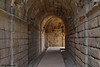
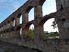
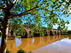
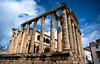
The above images may not be of the site on this page, but were taken nearby. They are loaded from Flickr so please click on them for image credits.
Click here to see more info for this site
Nearby sites
Click here to view sites on an interactive map of the areaKey: Red: member's photo, Blue: 3rd party photo, Yellow: other image, Green: no photo - please go there and take one, Grey: site destroyed
Download sites to:
KML (Google Earth)
GPX (GPS waypoints)
CSV (Garmin/Navman)
CSV (Excel)
To unlock full downloads you need to sign up as a Contributory Member. Otherwise downloads are limited to 50 sites.
Turn off the page maps and other distractions
Nearby sites listing. In the following links * = Image available
87m W 270° Lauriana Burial Chamber or Dolmen
206m WNW 303° Lacara Castro or Chafurdão
239m NNW 339° Sequero 1 Castro or Chafurdão
334m N 0° Canchal de Sequero 2 Castro or Chafurdão
2.1km NW 322° Alcazaba de Mérida Ancient Village or Settlement
18.3km NNW 335° Dolmen de Lácara* Burial Chamber or Dolmen
23.6km NW 322° La Nava de Santiago Burial Chamber or Dolmen
24.5km SSW 198° Huerta Montero Tholos* Burial Chamber or Dolmen
24.7km W 273° Canchal de Sequero 3 Castro or Chafurdão
29.4km N 358° Carmonita Dolmen* Burial Chamber or Dolmen
30.5km WSW 250° La Pijotilla 1 Burial Chamber or Dolmen
31.2km SSW 206° Pieza del Librito Burial Chamber or Dolmen
33.1km NW 317° Cueva del Monje* Burial Chamber or Dolmen
33.5km NW 315° Cueva del Moro* Burial Chamber or Dolmen
36.0km NE 39° Burdalo 2 Burial Chamber or Dolmen
36.0km NE 39° Burdalo 1 Burial Chamber or Dolmen
38.6km NW 307° Dolmen de la Roca Burial Chamber or Dolmen
38.6km NNE 24° La Cancha Burial Chamber or Dolmen
38.6km NW 307° El Portugues Burial Chamber or Dolmen
40.0km SW 218° Dehesa las Yeguas Burial Chamber or Dolmen
40.6km E 82° Don Benito Burial Chamber or Dolmen
45.1km N 360° Garabato Dolmen* Burial Chamber or Dolmen
47.3km ESE 112° Dolmen Sierra Gorda* Burial Chamber or Dolmen
49.9km N 1° Herguijiela Burial Chamber or Dolmen
50.0km WNW 300° Peña Hincada dolmen* Burial Chamber or Dolmen
View more nearby sites and additional images


 We would like to know more about this location. Please feel free to add a brief description and any relevant information in your own language.
 Wir möchten mehr über diese Stätte erfahren. Bitte zögern Sie nicht, eine kurze Beschreibung und relevante Informationen in Deutsch hinzuzufügen.
 Nous aimerions en savoir encore un peu sur les lieux. S'il vous plaît n'hesitez pas à ajouter une courte description et tous les renseignements pertinents dans votre propre langue.
 Quisieramos informarnos un poco más de las lugares. No dude en añadir una breve descripción y otros datos relevantes en su propio idioma.