 with our Megalithic Portal iPhone app")


<< Our Photo Pages >> St Bronagh's Graveyard (Kilbroney) - Ancient Cross in Ireland (Northern) in Co. Down
Submitted by Sunny100 on Saturday, 04 September 2010 Page Views: 9354
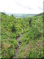
Early Medieval (Dark Age)Site Name: St Bronagh's Graveyard (Kilbroney) Alternative Name: St Bronagh's Cross, The Kilbroney CrossCountry: Ireland (Northern)
NOTE: This site is 5.842 km away from the location you searched for.
County: Co. Down Type: Ancient Cross
Nearest Town: Rostrevor Nearest Village: Kilbroney
Map Ref: J195174
Latitude: 54.091898N Longitude: 6.174368W
Condition:
| 5 | Perfect |
| 4 | Almost Perfect |
| 3 | Reasonable but with some damage |
| 2 | Ruined but still recognisable as an ancient site |
| 1 | Pretty much destroyed, possibly visible as crop marks |
| 0 | No data. |
| -1 | Completely destroyed |
| 5 | Superb |
| 4 | Good |
| 3 | Ordinary |
| 2 | Not Good |
| 1 | Awful |
| 0 | No data. |
| 5 | Can be driven to, probably with disabled access |
| 4 | Short walk on a footpath |
| 3 | Requiring a bit more of a walk |
| 2 | A long walk |
| 1 | In the middle of nowhere, a nightmare to find |
| 0 | No data. |
| 5 | co-ordinates taken by GPS or official recorded co-ordinates |
| 4 | co-ordinates scaled from a detailed map |
| 3 | co-ordinates scaled from a bad map |
| 2 | co-ordinates of the nearest village |
| 1 | co-ordinates of the nearest town |
| 0 | no data |
Internal Links:
External Links:
I have visited· I would like to visit
Sunny100 would like to visit
MAIGO has visited here
 (PID:109366)")
The 5th century Celtic cross is of the straight armed type with a slender shaft. It has no central wheel-head, but is richly carved with ornamentation and in the centre of the two arms a flat boss or circle. Apparantly, the cross marks the site of the saint's grave. Close by a granite cross of uncertain date. The ruins of St Brona's church probably stand on the site of her convent, which according to legend, she set up to help shipwrecked sailors on the nearby shores of Carlingford Lough.
Also of interest here St Bronagh's Bell, dating from c900 CE. This was found hidden away in 1855 in an ivy-covered tree. It is now housed in the nearby Roman Catholic church.
You may be viewing yesterday's version of this page. To see the most up to date information please register for a free account.
 (PID:109367)")
Do not use the above information on other web sites or publications without permission of the contributor.
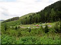
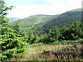
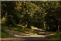
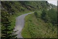
Nearby Images from Geograph Britain and Ireland:
©2012(licence)
©2014(licence)
©2006(licence)
©2007(licence)
©2012(licence)
The above images may not be of the site on this page, they are loaded from Geograph.
Please Submit an Image of this site or go out and take one for us!
Click here to see more info for this site
Nearby sites
Click here to view sites on an interactive map of the areaKey: Red: member's photo, Blue: 3rd party photo, Yellow: other image, Green: no photo - please go there and take one, Grey: site destroyed
Download sites to:
KML (Google Earth)
GPX (GPS waypoints)
CSV (Garmin/Navman)
CSV (Excel)
To unlock full downloads you need to sign up as a Contributory Member. Otherwise downloads are limited to 50 sites.
Turn off the page maps and other distractions
Nearby sites listing. In the following links * = Image available
4.2km ESE 120° Kilfeaghan* Portal Tomb (J232154)
8.1km NNW 331° Tamnaharry* Standing Stone (Menhir)
9.5km ENE 78° Moyard Court Tomb Chambered Tomb
9.6km ESE 106° Dunnaman* Court Tomb
9.7km NNW 332° Edenmore Court Tomb (J14752583)
9.7km WNW 283° Clontygora E* Wedge Tomb
9.8km N 359° Mullaghmore (Co. Down)* Stone Circle (J191272)
9.8km WNW 283° Clontygora* Court Tomb (J0986519419)
9.8km W 262° Ravensdale Park Stone Row / Alignment (J098157)
10.3km WSW 255° Ravensdale Dolmen Burial Chamber or Dolmen (J0962314529)
11.3km W 262° Ravensdale Park* Modern Stone Circle etc (J083156)
11.4km ESE 104° Kilkeel* Portal Tomb (J307149)
11.7km SW 218° Rockmarshall Court Tomb
12.5km WSW 254° Aghadh Na Sceach* Chambered Tomb
12.8km NNW 326° Crobane* Standing Stone (Menhir) (J121279)
12.8km WSW 242° Proleek Wedge Tomb* Wedge Tomb (J0833611000)
12.9km WSW 242° Proleek Dolmen* Portal Tomb (J0826511033)
13.0km SW 235° Bellurgan Stone Circle (J090097)
13.6km W 261° Kilnasaggart Pillar Stone* Early Christian Sculptured Stone (J061149)
14.4km NNE 21° Goward* Portal Tomb (J244310)
14.5km WNW 299° Ballymacdermot* Court Tomb (J06562403)
15.6km NNW 333° Saval More Stone Pair* Standing Stones
15.6km NNW 333° Killybeg* Standing Stones (J121312)
15.7km N 353° Barnmeen* Standing Stone (Menhir) (J172330)
16.0km E 83° The Longstone (Co. Down)* Standing Stone (Menhir)
View more nearby sites and additional images


 We would like to know more about this location. Please feel free to add a brief description and any relevant information in your own language.
 Wir möchten mehr über diese Stätte erfahren. Bitte zögern Sie nicht, eine kurze Beschreibung und relevante Informationen in Deutsch hinzuzufügen.
 Nous aimerions en savoir encore un peu sur les lieux. S'il vous plaît n'hesitez pas à ajouter une courte description et tous les renseignements pertinents dans votre propre langue.
 Quisieramos informarnos un poco más de las lugares. No dude en añadir una breve descripción y otros datos relevantes en su propio idioma.