


<< Our Photo Pages >> St. Patrick's Stone - Standing Stone (Menhir) in Ireland (Northern) in Co. Antrim
Submitted by Ptarmigan on Monday, 19 June 2017 Page Views: 1694
Neolithic and Bronze AgeSite Name: St. Patrick's StoneCountry: Ireland (Northern)
NOTE: This site is 6.113 km away from the location you searched for.
County: Co. Antrim Type: Standing Stone (Menhir)
Nearest Town: Ballymena Nearest Village: Broughshane
Map Ref: NW310621
Latitude: 54.881063N Longitude: 6.195471W
Condition:
| 5 | Perfect |
| 4 | Almost Perfect |
| 3 | Reasonable but with some damage |
| 2 | Ruined but still recognisable as an ancient site |
| 1 | Pretty much destroyed, possibly visible as crop marks |
| 0 | No data. |
| -1 | Completely destroyed |
| 5 | Superb |
| 4 | Good |
| 3 | Ordinary |
| 2 | Not Good |
| 1 | Awful |
| 0 | No data. |
| 5 | Can be driven to, probably with disabled access |
| 4 | Short walk on a footpath |
| 3 | Requiring a bit more of a walk |
| 2 | A long walk |
| 1 | In the middle of nowhere, a nightmare to find |
| 0 | No data. |
| 5 | co-ordinates taken by GPS or official recorded co-ordinates |
| 4 | co-ordinates scaled from a detailed map |
| 3 | co-ordinates scaled from a bad map |
| 2 | co-ordinates of the nearest village |
| 1 | co-ordinates of the nearest town |
| 0 | no data |
Internal Links:
External Links:
")
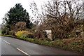
This stone is part of a field boundary, at the end of a dry stone wall and the start of a hedge.
NI Monument 2272
You may be viewing yesterday's version of this page. To see the most up to date information please register for a free account.
")
")
")
Do not use the above information on other web sites or publications without permission of the contributor.
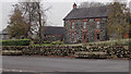
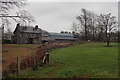
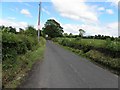
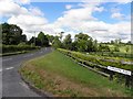
Nearby Images from Geograph Britain and Ireland:
©2016(licence)
©2016(licence)
©2010(licence)
©2010(licence)
©2016(licence)
The above images may not be of the site on this page, they are loaded from Geograph.
Please Submit an Image of this site or go out and take one for us!
Click here to see more info for this site
Nearby sites
Click here to view sites on an interactive map of the areaKey: Red: member's photo, Blue: 3rd party photo, Yellow: other image, Green: no photo - please go there and take one, Grey: site destroyed
Download sites to:
KML (Google Earth)
GPX (GPS waypoints)
CSV (Garmin/Navman)
CSV (Excel)
To unlock full downloads you need to sign up as a Contributory Member. Otherwise downloads are limited to 50 sites.
Turn off the page maps and other distractions
Nearby sites listing. In the following links * = Image available
3.9km SSW 209° Ballymarlagh* Court Tomb (D14040175)
5.3km SW 223° Ballymena Ring Fort Hillfort
9.0km S 175° Carncome Standing Stone* Standing Stone (Menhir)
9.9km ENE 63° Tamybuck Wedge Tomb* Wedge Tomb (NW401660)
10.2km NNW 345° Lisnamanny Stone Circle Stone Circle (D130150)
10.5km NE 46° Ticloy* Portal Tomb (D232127)
10.5km NNW 348° Two Standing Stones in Lisnamanny* Standing Stones (D1345015470)
11.0km NNW 347° Lisnamanny Standing Stone* Standing Stone (Menhir) (D1305015860)
11.2km ENE 61° Antynanum* Court Tomb (D25561094)
11.6km NNW 346° Standing Stone (Skerry West)* Standing Stone (Menhir) (NW289735)
12.9km NNW 342° Standing Stone (Scotchomerbane)* Standing Stone (Menhir) (NW278746)
13.7km SSE 161° Browndod Court Tomb* Court Tomb
15.5km SSE 163° Tobergill Stone Circle (J20839051)
16.4km ENE 72° Deer Park Farms* Standing Stone (Menhir) (NW470661)
16.6km ENE 72° Goakstown* Wedge Tomb
16.7km E 82° Dunteige* Wedge Tomb (D32350798)
16.7km SSE 152° Doagh* Holed Stone (J2416590683)
17.0km SSE 162° Donegore Hill Causewayed Enclosure
17.0km W 263° Slievenagh* Stone Circle (C9895602726)
17.4km E 85° Linford Barrows* Artificial Mound (D33230723)
17.4km E 84° Linford Round Cairn Round Cairn
17.8km E 94° Larne Standing Stone* Standing Stone (Menhir)
17.9km SSE 167° Donegore Moat* Artificial Mound
18.2km ENE 75° Ballygilbert* Standing Stone (Menhir) (D334104)
18.2km E 87° Knockdhu* Promontory Fort / Cliff Castle (NW493620)
View more nearby sites and additional images


 We would like to know more about this location. Please feel free to add a brief description and any relevant information in your own language.
 Wir möchten mehr über diese Stätte erfahren. Bitte zögern Sie nicht, eine kurze Beschreibung und relevante Informationen in Deutsch hinzuzufügen.
 Nous aimerions en savoir encore un peu sur les lieux. S'il vous plaît n'hesitez pas à ajouter une courte description et tous les renseignements pertinents dans votre propre langue.
 Quisieramos informarnos un poco más de las lugares. No dude en añadir una breve descripción y otros datos relevantes en su propio idioma.