


<< Text Pages >> Abhainn Cille Mhaire - Standing Stones in Scotland in Isle of Skye
Submitted by Andy B on Tuesday, 19 October 2010 Page Views: 3505
Neolithic and Bronze AgeSite Name: Abhainn Cille MhaireCountry: Scotland
NOTE: This site is 2.843 km away from the location you searched for.
County: Isle of Skye Type: Standing Stones
Map Ref: NG54611952
Latitude: 57.200544N Longitude: 6.06428W
Condition:
| 5 | Perfect |
| 4 | Almost Perfect |
| 3 | Reasonable but with some damage |
| 2 | Ruined but still recognisable as an ancient site |
| 1 | Pretty much destroyed, possibly visible as crop marks |
| 0 | No data. |
| -1 | Completely destroyed |
| 5 | Superb |
| 4 | Good |
| 3 | Ordinary |
| 2 | Not Good |
| 1 | Awful |
| 0 | No data. |
| 5 | Can be driven to, probably with disabled access |
| 4 | Short walk on a footpath |
| 3 | Requiring a bit more of a walk |
| 2 | A long walk |
| 1 | In the middle of nowhere, a nightmare to find |
| 0 | No data. |
| 5 | co-ordinates taken by GPS or official recorded co-ordinates |
| 4 | co-ordinates scaled from a detailed map |
| 3 | co-ordinates scaled from a bad map |
| 2 | co-ordinates of the nearest village |
| 1 | co-ordinates of the nearest town |
| 0 | no data |
Be the first person to rate this site - see the 'Contribute!' box in the right hand menu.
Internal Links:
External Links:
Standing Stones in Isle of Skye
Circular Stone Setting. Site recorded in the spring of 1997 during a field survey carried out by Martin Wildgoose and associates on part of the John Muir Trust's Strathaird Estate. The surveyed portion lies to the S and E of Bla Bheinn, some 3000ha of undulating lowland terrain lying between the coast and the Cuillin mountains.
Source: Canmore
You may be viewing yesterday's version of this page. To see the most up to date information please register for a free account.
Do not use the above information on other web sites or publications without permission of the contributor.
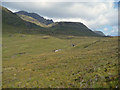
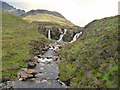
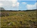
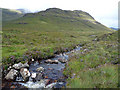
Nearby Images from Geograph Britain and Ireland:
©2009(licence)

©2009(licence)
©2009(licence)
©2009(licence)
©2009(licence)
The above images may not be of the site on this page, they are loaded from Geograph.
Please Submit an Image of this site or go out and take one for us!
Click here to see more info for this site
Nearby sites
Key: Red: member's photo, Blue: 3rd party photo, Yellow: other image, Green: no photo - please go there and take one, Grey: site destroyed
Download sites to:
KML (Google Earth)
GPX (GPS waypoints)
CSV (Garmin/Navman)
CSV (Excel)
To unlock full downloads you need to sign up as a Contributory Member. Otherwise downloads are limited to 50 sites.
Turn off the page maps and other distractions
Nearby sites listing. In the following links * = Image available
1.4km S 177° Kilmarie Standing Stones (NG54591814)
1.9km S 185° Na Clachan Bhreige* Stone Circle (NG5433817681)
2.3km SSE 160° Cnocan nan Gobhar* Round Cairn (NG55261735)
2.4km SSE 162° Kilmarie (Strathaird) Stone Circle (NG552172)
2.8km ENE 74° Dun Mor (Torrin)* Broch or Nuraghe (NG57402015)
2.9km E 80° Dun Beag (Loch Slapin)* Stone Fort or Dun (NG57511984)
2.9km SE 146° Dun Ringill* Broch or Nuraghe (NG561170)
3.3km SSE 164° Cadha nan Ingrean* Stone Fort or Dun (NG55331625)
4.0km S 175° An Reidhean* Stone Circle (NG54701548)
4.4km ENE 76° Clach na h'Annait* Standing Stone (Menhir) (NG58952029)
4.8km E 84° High Pasture Cave* Cave or Rock Shelter (NG59431971)
5.1km S 189° Allt Na Cille Standing Stone (Menhir) (NG53501453)
5.2km S 180° Dun Liath (Elgol)* Broch or Nuraghe (NG54331427)
5.4km ESE 109° Dun Kearstack* Hillfort (NG596175)
5.5km S 184° Allt Na Cille Souterrain (Fogou, Earth House) (NG539141)
5.7km SSW 204° Raven's Stone (Elgol) Standing Stone (Menhir) (NG520144)
7.3km S 185° Dun Grugaig (Skye)* Stone Fort or Dun (NG53541229)
7.4km E 81° Kilchrist, Glebe* Stone Circle (NG61972027)
7.5km ENE 63° Buaile Nan Aodan Standing Stones (NG61452255)
7.6km ESE 112° Dun Boreraig Fort* Hillfort (NG615162)
8.0km ESE 110° Dun Boreraig Stone* Standing Stone (Menhir) (NG61951638)
8.5km ENE 69° Suardal* Chambered Cairn (NG62722203)
8.7km NW 321° River Sligachan Stone Circle (NG49582662)
9.0km SE 137° Inver Aulavaig 1* Cairn (NG60441259)
9.1km SE 136° Inver Aulavaig 2* Cairn (NG6059112629)
View more nearby sites and additional images


 We would like to know more about this location. Please feel free to add a brief description and any relevant information in your own language.
 Wir möchten mehr über diese Stätte erfahren. Bitte zögern Sie nicht, eine kurze Beschreibung und relevante Informationen in Deutsch hinzuzufügen.
 Nous aimerions en savoir encore un peu sur les lieux. S'il vous plaît n'hesitez pas à ajouter une courte description et tous les renseignements pertinents dans votre propre langue.
 Quisieramos informarnos un poco más de las lugares. No dude en añadir una breve descripción y otros datos relevantes en su propio idioma.