


<< Text Pages >> Dun Urgadul - Stone Fort or Dun in Scotland in Isle of Mull
Submitted by Andy B on Tuesday, 19 October 2010 Page Views: 3699
Multi-periodSite Name: Dun UrgadulCountry: Scotland
NOTE: This site is 0.932 km away from the location you searched for.
County: Isle of Mull Type: Stone Fort or Dun
Map Ref: NM49475527
Latitude: 56.622075N Longitude: 6.085654W
Condition:
| 5 | Perfect |
| 4 | Almost Perfect |
| 3 | Reasonable but with some damage |
| 2 | Ruined but still recognisable as an ancient site |
| 1 | Pretty much destroyed, possibly visible as crop marks |
| 0 | No data. |
| -1 | Completely destroyed |
| 5 | Superb |
| 4 | Good |
| 3 | Ordinary |
| 2 | Not Good |
| 1 | Awful |
| 0 | No data. |
| 5 | Can be driven to, probably with disabled access |
| 4 | Short walk on a footpath |
| 3 | Requiring a bit more of a walk |
| 2 | A long walk |
| 1 | In the middle of nowhere, a nightmare to find |
| 0 | No data. |
| 5 | co-ordinates taken by GPS or official recorded co-ordinates |
| 4 | co-ordinates scaled from a detailed map |
| 3 | co-ordinates scaled from a bad map |
| 2 | co-ordinates of the nearest village |
| 1 | co-ordinates of the nearest town |
| 0 | no data |
Internal Links:
External Links:
Stone Fort or Dun in Isle of Mull
On the W end of a prominent rocky ridge situated 800m W of Tobermory, and about 100m N of the road to Glengorm, there is a pear-shaped dun measuring 13m by 11m within a wall 3.7m thick. The N and S sides and the W end of the ridge are steeply inclined, rising up to 12m in height on the SW, but from the SE there is an easy approach up a gentle slope. The wall now appears as a grass-grown bank of debris standing up to 0.8m in height internally and 2.1m externally, in which stretches of both inner and outer facing-stones are visible as shown on the plan. For added stability the wall has been built in two thickness on the WNW, an interior revetment being exposed for a length of 4.3m. the entrance faces E and is about 0.9m wide.
To protect the vulnerable SE side of the dun, an outer wall has been drawn almost straight across the ridge from NNE to SSW. Originally this outwork must have been a massive structure, but it is now reduced to a low boulder-strewn scarp, at the SSW end of which a number of large outer facing-stones can be seen. There is no trace of an inner face and the position of the entrance is uncertain.
Source: Canmore
You may be viewing yesterday's version of this page. To see the most up to date information please register for a free account.
Do not use the above information on other web sites or publications without permission of the contributor.
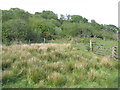
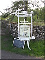
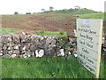
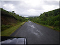
Nearby Images from Geograph Britain and Ireland:
©2019(licence)
©2019(licence)
©2019(licence)
©2010(licence)
©2006(licence)
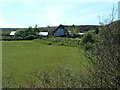
The above images may not be of the site on this page, they are loaded from Geograph.
Please Submit an Image of this site or go out and take one for us!
Click here to see more info for this site
Nearby sites
Key: Red: member's photo, Blue: 3rd party photo, Yellow: other image, Green: no photo - please go there and take one, Grey: site destroyed
Download sites to:
KML (Google Earth)
GPX (GPS waypoints)
CSV (Garmin/Navman)
CSV (Excel)
To unlock full downloads you need to sign up as a Contributory Member. Otherwise downloads are limited to 50 sites.
Turn off the page maps and other distractions
Nearby sites listing. In the following links * = Image available
1.2km SSE 153° Balliscate* Stone Row / Alignment (NM49965413)
6.2km WSW 246° Maol Mor* Stone Row / Alignment (NM4360453056)
6.3km WNW 284° Glengorm* Stone Row / Alignment (NM43475713)
6.4km W 275° An Sean Dun Stone Fort or Dun (NM43105624)
6.4km WSW 236° Dervaig centre* Stone Row / Alignment (NM43905203)
6.5km SW 234° Priest's Well (Dervaig)* Holy Well or Sacred Spring (NM440518)
6.5km SW 235° Dervaig 3* Standing Stones (NM43935189)
6.5km SW 235° Dervaig D Stone Row / Alignment (NM43935189)
6.7km SW 234° Dervaig SSE* Stone Row / Alignment (NM4385951655)
7.2km WNW 286° Dun Ara* Stone Fort or Dun (NM42725771)
7.3km SW 231° Aintuim Cairn Round Cairn (NM43445103)
7.4km SW 221° Torr Aint* Hillfort (NM44265005)
7.4km WSW 240° Torr A'mhanaich Hillfort (NM42855192)
7.5km SE 129° Ardnacross Cairn* Cairn (NM55025014)
7.7km SE 139° Ardnacross North* Stone Row / Alignment (NM5417949181)
7.7km SE 139° Ardnacross Cairns* Cairn (NM54184914)
7.7km SE 139° Ardnacross South* Stone Row / Alignment (NM5419049135)
7.8km SE 130° An Sean Chaisteal* Broch or Nuraghe (NM55104988)
8.1km WSW 256° Quinish Cist* Cist (NM41505385)
8.1km W 266° Quinish (Stone Row)* Stone Row / Alignment (NM41355524)
8.4km SW 228° Torr A'chlachain, Mull Hillfort (NM42945000)
8.5km SSE 163° Ledmore Crannog (NM51514696)
8.9km NNW 345° Greadal Fhinn* Chambered Cairn (NM47656397)
9.0km S 171° Tenga (Mull)* Stone Circle (NM50394631)
9.2km WSW 247° Dun Auladh Round Cairn (NM40815212)
View more nearby sites and additional images


 We would like to know more about this location. Please feel free to add a brief description and any relevant information in your own language.
 Wir möchten mehr über diese Stätte erfahren. Bitte zögern Sie nicht, eine kurze Beschreibung und relevante Informationen in Deutsch hinzuzufügen.
 Nous aimerions en savoir encore un peu sur les lieux. S'il vous plaît n'hesitez pas à ajouter une courte description et tous les renseignements pertinents dans votre propre langue.
 Quisieramos informarnos un poco más de las lugares. No dude en añadir una breve descripción y otros datos relevantes en su propio idioma.