


<< Our Photo Pages >> An Dun (Mull) - Stone Fort or Dun in Scotland in Isle of Mull
Submitted by Andy B on Friday, 16 April 2010 Page Views: 5627
Multi-periodSite Name: An Dun (Mull)Country: Scotland
NOTE: This site is 4.644 km away from the location you searched for.
County: Isle of Mull Type: Stone Fort or Dun
Map Ref: NM484254
Latitude: 56.353834N Longitude: 6.074209W
Condition:
| 5 | Perfect |
| 4 | Almost Perfect |
| 3 | Reasonable but with some damage |
| 2 | Ruined but still recognisable as an ancient site |
| 1 | Pretty much destroyed, possibly visible as crop marks |
| 0 | No data. |
| -1 | Completely destroyed |
| 5 | Superb |
| 4 | Good |
| 3 | Ordinary |
| 2 | Not Good |
| 1 | Awful |
| 0 | No data. |
| 5 | Can be driven to, probably with disabled access |
| 4 | Short walk on a footpath |
| 3 | Requiring a bit more of a walk |
| 2 | A long walk |
| 1 | In the middle of nowhere, a nightmare to find |
| 0 | No data. |
| 5 | co-ordinates taken by GPS or official recorded co-ordinates |
| 4 | co-ordinates scaled from a detailed map |
| 3 | co-ordinates scaled from a bad map |
| 2 | co-ordinates of the nearest village |
| 1 | co-ordinates of the nearest town |
| 0 | no data |
Internal Links:
External Links:
I have visited· I would like to visit
Andy B has visited here
 (PID:55954)")
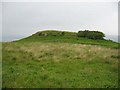
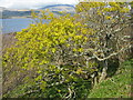
Site of An Dun, on the southern shore of Loch Scridain.
You may be viewing yesterday's version of this page. To see the most up to date information please register for a free account.
Do not use the above information on other web sites or publications without permission of the contributor.
Andy B has found this location on Google Street View:
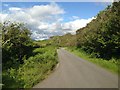
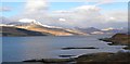
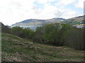
Nearby Images from Geograph Britain and Ireland:
©2006(licence)
©2015(licence)
©2013(licence)
©2012(licence)
©2012(licence)
The above images may not be of the site on this page, they are loaded from Geograph.
Please Submit an Image of this site or go out and take one for us!
Click here to see more info for this site
Nearby sites
Key: Red: member's photo, Blue: 3rd party photo, Yellow: other image, Green: no photo - please go there and take one, Grey: site destroyed
Download sites to:
KML (Google Earth)
GPX (GPS waypoints)
CSV (Garmin/Navman)
CSV (Excel)
To unlock full downloads you need to sign up as a Contributory Member. Otherwise downloads are limited to 50 sites.
Turn off the page maps and other distractions
Nearby sites listing. In the following links * = Image available
6.5km ENE 61° Rossal* Standing Stone (Menhir) (NM543282)
7.7km NE 50° Uluvalt Standing Stones* Standing Stones (NM54633002)
7.8km NE 51° Uluvalt Standing Stone* Standing Stone (Menhir) (NM54692997)
9.1km WSW 247° Taoslin* Standing Stone (Menhir) (NM3973122388)
10.4km N 4° Dishig* Standing Stone (Menhir) (NM49693574)
10.7km E 92° Tobar Chaluim Chille (Mull)* Holy Well or Sacred Spring (NM591244)
10.8km SW 234° Uisken.* Standing Stone (Menhir) (NM3919119632)
11.0km NNW 332° Inch Kenneth Stone Standing Stone (Menhir) (NM4385835492)
11.8km WSW 249° Suie* Standing Stones (NM37062185)
12.4km SW 235° Ardalanish* Standing Stones (NM37841887)
13.1km E 87° Lochbuie Kerb Cairn* Cairn (NM6155225255)
13.2km E 87° Lochbuie Standing Stone* Standing Stone (Menhir) (NM61632542)
13.3km E 88° Loch Buie Stone Circle* Stone Circle (NM61772510)
13.3km E 88° Loch Buie Stone Row* Stone Row / Alignment (NM6179025110)
13.4km WSW 254° Tirghoil* Standing Stone (Menhir) (NM35322242)
13.8km NNW 341° Meall Min Rock Art (NM447387)
15.0km NNW 334° Ulva Standing Stone Standing Stone (Menhir) (NM42563926)
15.2km NNE 21° Carn Ban (Mull)* Cairn (NM54653934)
15.4km NNE 20° Gruline 1* Standing Stone (Menhir) (NM54553959)
15.4km NNE 19° Gruline 2* Standing Stone (Menhir) (NM543397)
15.8km NW 326° Cragaig* Standing Stones (NM40283901)
16.2km WSW 255° Poit Na H-I Stone* Standing Stone (Menhir) (NM3251022174)
16.8km NNE 12° Kellan Wood Stone Fort or Dun (NM52914163)
17.0km NNE 15° Torr Nam Fiann* Stone Fort or Dun (NM53904157)
17.1km W 259° Loch Poit Na H-I* Crannog (NM31432313)
View more nearby sites and additional images


 We would like to know more about this location. Please feel free to add a brief description and any relevant information in your own language.
 Wir möchten mehr über diese Stätte erfahren. Bitte zögern Sie nicht, eine kurze Beschreibung und relevante Informationen in Deutsch hinzuzufügen.
 Nous aimerions en savoir encore un peu sur les lieux. S'il vous plaît n'hesitez pas à ajouter une courte description et tous les renseignements pertinents dans votre propre langue.
 Quisieramos informarnos un poco más de las lugares. No dude en añadir una breve descripción y otros datos relevantes en su propio idioma.