


<< Text Pages >> Cueva del Moro (Tarifa) - Cave or Rock Shelter in Spain in Andalucía
Submitted by holger_rix on Wednesday, 23 December 2015 Page Views: 1997
Natural PlacesSite Name: Cueva del Moro (Tarifa)Country: Spain
NOTE: This site is 23.55 km away from the location you searched for.
Region: Andalucía Type: Cave or Rock Shelter
Latitude: 36.101205N Longitude: 5.793227W
Condition:
| 5 | Perfect |
| 4 | Almost Perfect |
| 3 | Reasonable but with some damage |
| 2 | Ruined but still recognisable as an ancient site |
| 1 | Pretty much destroyed, possibly visible as crop marks |
| 0 | No data. |
| -1 | Completely destroyed |
| 5 | Superb |
| 4 | Good |
| 3 | Ordinary |
| 2 | Not Good |
| 1 | Awful |
| 0 | No data. |
| 5 | Can be driven to, probably with disabled access |
| 4 | Short walk on a footpath |
| 3 | Requiring a bit more of a walk |
| 2 | A long walk |
| 1 | In the middle of nowhere, a nightmare to find |
| 0 | No data. |
| 5 | co-ordinates taken by GPS or official recorded co-ordinates |
| 4 | co-ordinates scaled from a detailed map |
| 3 | co-ordinates scaled from a bad map |
| 2 | co-ordinates of the nearest village |
| 1 | co-ordinates of the nearest town |
| 0 | no data |
Be the first person to rate this site - see the 'Contribute!' box in the right hand menu.
Internal Links:
External Links:
Cave or Rock Shelter in Andalucía
You may be viewing yesterday's version of this page. To see the most up to date information please register for a free account.
Do not use the above information on other web sites or publications without permission of the contributor.
Nearby Images from Flickr
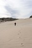
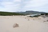

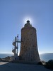
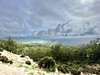
The above images may not be of the site on this page, but were taken nearby. They are loaded from Flickr so please click on them for image credits.
Click here to see more info for this site
Nearby sites
Click here to view sites on an interactive map of the areaKey: Red: member's photo, Blue: 3rd party photo, Yellow: other image, Green: no photo - please go there and take one, Grey: site destroyed
Download sites to:
KML (Google Earth)
GPX (GPS waypoints)
CSV (Garmin/Navman)
CSV (Excel)
To unlock full downloads you need to sign up as a Contributory Member. Otherwise downloads are limited to 50 sites.
Turn off the page maps and other distractions
Nearby sites listing. In the following links * = Image available
789m SSE 152° Ranchiles Natural Stone / Erratic / Other Natural Feature
2.2km SE 124° Baelo Claudia* Ancient Village or Settlement
3.6km NE 46° Silla del Papa* Hillfort
8.9km ESE 109° Los Algarbes* Rock Cut Tomb
9.3km ENE 65° Dolmen del Bujeo* Burial Chamber or Dolmen
9.7km ENE 64° Menhir de Tribucio Standing Stone (Menhir)
19.7km ESE 120° Tarifa Castro or Chafurdão
24.6km NNE 12° Cueva Tajo de Las Figuras Cave or Rock Shelter
35.5km ENE 75° Carteia* Ancient Village or Settlement
47.2km NE 39° Chinchilla* Ancient Village or Settlement
47.8km NE 39° Castillo de Jimena de la Frontera* Hillfort
49.4km ENE 64° Yacimiento Arqueológico Barbesula Ancient Village or Settlement
57.9km NE 49° Ruinas Romanas de Lacipo* Ancient Village or Settlement
65.1km NE 54° Necrópolis Prehistórica de Corominas* Museum
65.3km S 190° Ad Mercuri* Ancient Village or Settlement
67.2km NNW 331° Portus Gaditanus* Ancient Village or Settlement
71.7km NNE 26° Calzada Ubrique-Benaocaz* Ancient Trackway
72.1km NNE 25° Ciudad Palatina Ocuri Ancient Village or Settlement
76.0km ENE 59° Villa Romana de las Torres* Ancient Village or Settlement
78.0km N 10° Menhir de La Lancha* Standing Stone (Menhir)
78.7km S 190° Msoura* Stone Circle
80.6km NE 35° La Pileta* Cave or Rock Shelter
80.7km N 10° Alberite Dolmen* Chambered Tomb
81.0km NE 39° Dólmen del Cortijo de la Mimbre Burial Chamber or Dolmen
82.0km NE 39° Dólmen de Monteiro* Burial Chamber or Dolmen
View more nearby sites and additional images


 We would like to know more about this location. Please feel free to add a brief description and any relevant information in your own language.
 Wir möchten mehr über diese Stätte erfahren. Bitte zögern Sie nicht, eine kurze Beschreibung und relevante Informationen in Deutsch hinzuzufügen.
 Nous aimerions en savoir encore un peu sur les lieux. S'il vous plaît n'hesitez pas à ajouter une courte description et tous les renseignements pertinents dans votre propre langue.
 Quisieramos informarnos un poco más de las lugares. No dude en añadir una breve descripción y otros datos relevantes en su propio idioma.