


<< Text Pages >> Pabay Chapel - Ancient Temple in Scotland in Highlands
Submitted by Laura_m on Saturday, 09 August 2008 Page Views: 5098
Multi-periodSite Name: Pabay Chapel Alternative Name: teampullCountry: Scotland
NOTE: This site is 5.672 km away from the location you searched for.
County: Highlands Type: Ancient Temple
Nearest Town: Portree Nearest Village: Broadford
Map Ref: NG67362651
Latitude: 57.269840N Longitude: 5.860302W
Condition:
| 5 | Perfect |
| 4 | Almost Perfect |
| 3 | Reasonable but with some damage |
| 2 | Ruined but still recognisable as an ancient site |
| 1 | Pretty much destroyed, possibly visible as crop marks |
| 0 | No data. |
| -1 | Completely destroyed |
| 5 | Superb |
| 4 | Good |
| 3 | Ordinary |
| 2 | Not Good |
| 1 | Awful |
| 0 | No data. |
| 5 | Can be driven to, probably with disabled access |
| 4 | Short walk on a footpath |
| 3 | Requiring a bit more of a walk |
| 2 | A long walk |
| 1 | In the middle of nowhere, a nightmare to find |
| 0 | No data. |
| 5 | co-ordinates taken by GPS or official recorded co-ordinates |
| 4 | co-ordinates scaled from a detailed map |
| 3 | co-ordinates scaled from a bad map |
| 2 | co-ordinates of the nearest village |
| 1 | co-ordinates of the nearest town |
| 0 | no data |
Internal Links:
External Links:
Ancient Temple in Highlands
Ancient chapel of uncertain dedication on a small island in Broadford Bay, Skye. Probably related to the Irish-Gaelic Christian Missionary movement of the 8th - 14th centuries. (Will update with photographs and further details next week).
You may be viewing yesterday's version of this page. To see the most up to date information please register for a free account.
Do not use the above information on other web sites or publications without permission of the contributor.
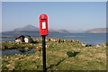
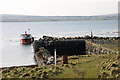
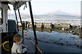
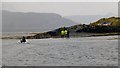
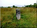
Nearby Images from Geograph Britain and Ireland:
©2006(licence)
©2006(licence)
©2006(licence)
©2014(licence)
©2014(licence)
The above images may not be of the site on this page, they are loaded from Geograph.
Please Submit an Image of this site or go out and take one for us!
Click here to see more info for this site
Nearby sites
Key: Red: member's photo, Blue: 3rd party photo, Yellow: other image, Green: no photo - please go there and take one, Grey: site destroyed
Download sites to:
KML (Google Earth)
GPX (GPS waypoints)
CSV (Garmin/Navman)
CSV (Excel)
To unlock full downloads you need to sign up as a Contributory Member. Otherwise downloads are limited to 50 sites.
Turn off the page maps and other distractions
Nearby sites listing. In the following links * = Image available
2.6km SE 145° Tobar Ashik* Holy Well or Sacred Spring (NG6873324291)
3.2km SSW 194° Achadh A'chuirn* Chambered Cairn (NG66422343)
4.0km SW 231° Corry cist, cairn and souterrain Cist (NG641242)
4.2km SW 226° Corry chambered cairn* Chambered Cairn (NG6416623779)
6.2km ENE 78° Sligeanach Kildonan Stone Row / Alignment (NG735275)
6.4km SW 223° Suardal* Chambered Cairn (NG62722203)
7.1km SW 233° Buaile Nan Aodan Standing Stones (NG61452255)
8.2km SW 218° Kilchrist, Glebe* Stone Circle (NG61972027)
8.9km SSW 192° Heaste Stone Standing Stone (Menhir) (NG6505117847)
10.4km SW 226° High Pasture Cave* Cave or Rock Shelter (NG59431971)
10.4km SW 230° Clach na h'Annait* Standing Stone (Menhir) (NG58952029)
11.5km SSW 205° Dun Boreraig Stone* Standing Stone (Menhir) (NG61951638)
11.8km SW 234° Dun Mor (Torrin)* Broch or Nuraghe (NG57402015)
11.8km SSW 206° Dun Boreraig Fort* Hillfort (NG615162)
11.9km SW 233° Dun Beag (Loch Slapin)* Stone Fort or Dun (NG57511984)
11.9km SW 217° Dun Kearstack* Hillfort (NG596175)
12.1km NW 307° Eyre Point* Burial Chamber or Dolmen (NG581343)
12.3km NW 306° Eyre Standing Stone Standing Stone (Menhir) (NG57753432)
12.6km NNE 14° Toscaig (Applecross) Standing Stones (NG712385)
12.9km NW 307° Eyre Stone Rows* Stone Row / Alignment (NG57493488)
13.9km NW 320° Hallaig* Stone Row / Alignment (NG591377)
14.2km ESE 109° Bernera Farm* Rock Art (NG80552110)
14.2km SSW 200° Tobar Chaon* Holy Well or Sacred Spring (NG61711340)
14.4km SSW 199° Teampuill Chaon* Early Christian Sculptured Stone (NG61831321)
14.5km ENE 69° Loch Achaidh na h-Inich* Crannog (NG81173095)
View more nearby sites and additional images


 We would like to know more about this location. Please feel free to add a brief description and any relevant information in your own language.
 Wir möchten mehr über diese Stätte erfahren. Bitte zögern Sie nicht, eine kurze Beschreibung und relevante Informationen in Deutsch hinzuzufügen.
 Nous aimerions en savoir encore un peu sur les lieux. S'il vous plaît n'hesitez pas à ajouter une courte description et tous les renseignements pertinents dans votre propre langue.
 Quisieramos informarnos un poco más de las lugares. No dude en añadir una breve descripción y otros datos relevantes en su propio idioma.