


<< Image Pages >> Corry chambered cairn - Chambered Cairn in Scotland in Isle of Skye
Submitted by davidmorgan on Friday, 20 January 2017 Page Views: 3642
Neolithic and Bronze AgeSite Name: Corry chambered cairn Alternative Name: LiverasCountry: Scotland
NOTE: This site is 1.199 km away from the location you searched for.
County: Isle of Skye Type: Chambered Cairn
Nearest Village: Broadford
Map Ref: NG6416623779
Latitude: 57.243729N Longitude: 5.910542W
Condition:
| 5 | Perfect |
| 4 | Almost Perfect |
| 3 | Reasonable but with some damage |
| 2 | Ruined but still recognisable as an ancient site |
| 1 | Pretty much destroyed, possibly visible as crop marks |
| 0 | No data. |
| -1 | Completely destroyed |
| 5 | Superb |
| 4 | Good |
| 3 | Ordinary |
| 2 | Not Good |
| 1 | Awful |
| 0 | No data. |
| 5 | Can be driven to, probably with disabled access |
| 4 | Short walk on a footpath |
| 3 | Requiring a bit more of a walk |
| 2 | A long walk |
| 1 | In the middle of nowhere, a nightmare to find |
| 0 | No data. |
| 5 | co-ordinates taken by GPS or official recorded co-ordinates |
| 4 | co-ordinates scaled from a detailed map |
| 3 | co-ordinates scaled from a bad map |
| 2 | co-ordinates of the nearest village |
| 1 | co-ordinates of the nearest town |
| 0 | no data |
Internal Links:
External Links:
I have visited· I would like to visit
Megalithicmatt visited on 1st Nov 2017 - their rating: Cond: 3 Amb: 3 Access: 5
")
A Hebridean type chambered cairn, probably originally round, but heavily robbed although it is still a large, steep-sided, grass-covered mound bearing trees. It measures about 77ft by 55ft by 13ft in height.
The chamber was discovered in 1832 when part of it collapsed, and a partial exploration produced, among other finds, a wrist-guard of fine grey-green stone. A similar wrist-guard was found on the beach, probably having been thrown out during the exploration. An urn with a secondary burial was also found.
Source: Canmore ID 11585.
You may be viewing yesterday's version of this page. To see the most up to date information please register for a free account.
")
")
")
Do not use the above information on other web sites or publications without permission of the contributor.
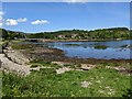
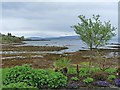
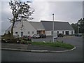
Nearby Images from Geograph Britain and Ireland:
©2023(licence)
©2011(licence)

©2021(licence)
©2012(licence)
©2008(licence)
The above images may not be of the site on this page, they are loaded from Geograph.
Please Submit an Image of this site or go out and take one for us!
Click here to see more info for this site
Nearby sites
Key: Red: member's photo, Blue: 3rd party photo, Yellow: other image, Green: no photo - please go there and take one, Grey: site destroyed
Download sites to:
KML (Google Earth)
GPX (GPS waypoints)
CSV (Garmin/Navman)
CSV (Excel)
To unlock full downloads you need to sign up as a Contributory Member. Otherwise downloads are limited to 50 sites.
Turn off the page maps and other distractions
Nearby sites listing. In the following links * = Image available
425m NNW 348° Corry cist, cairn and souterrain Cist (NG641242)
2.3km SW 216° Suardal* Chambered Cairn (NG62722203)
2.3km E 96° Achadh A'chuirn* Chambered Cairn (NG66422343)
3.0km WSW 242° Buaile Nan Aodan Standing Stones (NG61452255)
4.1km SSW 209° Kilchrist, Glebe* Stone Circle (NG61972027)
4.2km NE 46° Pabay Chapel Ancient Temple (NG67362651)
4.6km E 80° Tobar Ashik* Holy Well or Sacred Spring (NG6873324291)
6.0km SSE 168° Heaste Stone Standing Stone (Menhir) (NG6505117847)
6.2km SW 226° High Pasture Cave* Cave or Rock Shelter (NG59431971)
6.3km SW 233° Clach na h'Annait* Standing Stone (Menhir) (NG58952029)
7.7km WSW 238° Dun Mor (Torrin)* Broch or Nuraghe (NG57402015)
7.7km SSW 193° Dun Boreraig Stone* Standing Stone (Menhir) (NG61951638)
7.7km SW 236° Dun Beag (Loch Slapin)* Stone Fort or Dun (NG57511984)
7.7km SSW 213° Dun Kearstack* Hillfort (NG596175)
8.0km SSW 196° Dun Boreraig Fort* Hillfort (NG615162)
10.0km ENE 65° Sligeanach Kildonan Stone Row / Alignment (NG735275)
10.4km WSW 243° Abhainn Cille Mhaire Standing Stones (NG54611952)
10.5km SW 227° Dun Ringill* Broch or Nuraghe (NG561170)
10.6km S 190° Tobar Chaon* Holy Well or Sacred Spring (NG61711340)
10.8km S 189° Teampuill Chaon* Early Christian Sculptured Stone (NG61831321)
11.0km SW 231° Cnocan nan Gobhar* Round Cairn (NG55261735)
11.1km SW 236° Kilmarie Standing Stones (NG54591814)
11.1km SW 230° Kilmarie (Strathaird) Stone Circle (NG552172)
11.5km SW 235° Na Clachan Bhreige* Stone Circle (NG5433817681)
11.6km SW 226° Cadha nan Ingrean* Stone Fort or Dun (NG55331625)
View more nearby sites and additional images


 We would like to know more about this location. Please feel free to add a brief description and any relevant information in your own language.
 Wir möchten mehr über diese Stätte erfahren. Bitte zögern Sie nicht, eine kurze Beschreibung und relevante Informationen in Deutsch hinzuzufügen.
 Nous aimerions en savoir encore un peu sur les lieux. S'il vous plaît n'hesitez pas à ajouter une courte description et tous les renseignements pertinents dans votre propre langue.
 Quisieramos informarnos un poco más de las lugares. No dude en añadir una breve descripción y otros datos relevantes en su propio idioma.